Country:
Region:
City:
Latitude and Longitude:
Time Zone:
Postal Code:
IP information under different IP Channel
ip-api
Country
Region
City
ASN
Time Zone
ISP
Blacklist
Proxy
Latitude
Longitude
Postal
Route
Luminati
Country
ASN
Time Zone
Europe/Riga
ISP
Latvijas Mobilais Telefons SIA
Latitude
Longitude
Postal
IPinfo
Country
Region
City
ASN
Time Zone
ISP
Blacklist
Proxy
Latitude
Longitude
Postal
Route
db-ip
Country
Region
City
ASN
Time Zone
ISP
Blacklist
Proxy
Latitude
Longitude
Postal
Route
ipdata
Country
Region
City
ASN
Time Zone
ISP
Blacklist
Proxy
Latitude
Longitude
Postal
Route
Popular places and events near this IP address
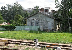
Čiekurkalns
Neighbourhood of Riga
Distance: Approx. 918 meters
Latitude and longitude: 56.98333333,24.16666667
Čiekurkalns (German: Schreienbusch) is a neighbourhood of the Northern District of Riga, the capital of Latvia. It is located on the southwestern shore of Lake Ķīšezers. In April 2014, the new building of the State Revenue Service of Latvia was unveiled at Talejas iela 1 in Čiekurkalns.

Great Cemetery
Cemetery in Riga, Latvia
Distance: Approx. 1567 meters
Latitude and longitude: 56.97055556,24.14305556
The Great Cemetery (Latvian: Lielie kapi; German: Großer Friedhof) was formerly the principal cemetery of Riga in Latvia, established in 1773. It was the main burial ground of the Baltic Germans in Latvia. Extensive damage and removal of many headstones and graves by the Soviet authorities governing the Latvian SSR after 1945 led to the suspension of burials and the eventual conversion of the burial ground to a public park.

Church of the Resurrection, Riga
Church building in Riga, Latvia
Distance: Approx. 1353 meters
Latitude and longitude: 56.97188611,24.14598889
Church of the Resurrection (Latvian: Augšāmcelšanās Evaņģēliski luteriskā baznīca) is a Lutheran church in Riga, the capital of Latvia. It is a parish church of the Evangelical Lutheran Church of Latvia. The church is situated at the address 4 Klusā Street.
Intercession of the Theotokos Church, Riga
Church in Riga, Latvia
Distance: Approx. 1844 meters
Latitude and longitude: 56.96872778,24.13944722
Intercession of the Theotokos Church (Latvian: Vissvētās Dievmātes Patvēruma pareizticīgo baznīca) is an Eastern Orthodox church in Riga, the capital of Latvia. The church is situated at the address 3 Mēness Street.
St. Sergius of Radonezh Church, Riga
Distance: Approx. 1739 meters
Latitude and longitude: 56.9636,24.1481
St. Sergius of Radonezh Church (Latvian: Svētā Radoņežas Sergija pareizticīgo baznīca) is an Eastern Orthodox church in Riga, the capital of Latvia. The church is situated at the address 126 Krišjānis Barons Street.

Holy Trinity Cathedral, Riga
Church building in Riga, Latvia
Distance: Approx. 1773 meters
Latitude and longitude: 56.96332778,24.14781944
Holy Trinity Cathedral (Latvian: Svētā Trīsvienības katedrāle) is an Eastern Orthodox cathedral in Riga, the capital of Latvia. The cathedral is situated at the address 126 Krišjānis Barons Street.
Pokrov Cemetery
Cemetery in Riga, Latvia
Distance: Approx. 1844 meters
Latitude and longitude: 56.96805556,24.14
Pokrov Cemetery (Latvian: Pokrova kapi) is a 70,669 square metres (760,670 sq ft) wide cemetery in Riga built in 1773. The current owner of the cemetery is Shelter of Our Most Holy Lady Church who are renting the land. Two Red Army burial sites are located in the cemetery – a smaller one for the summer of 1941 and a bigger one for the years 1944–1946; as well as Russian Empire army's bed of honour dating from 1917.
Brasa, Riga
Neighbourhood of Riga, Latvia
Distance: Approx. 1623 meters
Latitude and longitude: 56.97194444,24.14138889
Brasa is a neighbourhood of Riga, the capital of Latvia.
Teika, Riga
Neighborhood of Riga, Latvia
Distance: Approx. 947 meters
Latitude and longitude: 56.97,24.18
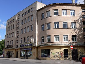
Teika is a neighbourhood in the Vidzeme Suburb of Riga, the capital of Latvia. Teika is the only neighbourhood in Riga which was planned and partly built in the 1920s and 1930s during interwar Latvia. Built up areas consists mainly from 1- to 2-storey family houses, but there are also 5-storey apartment houses, especially around Brīvības street and Zemitāns Square.
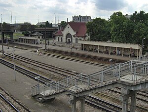
Zemitāni Station
Railway station in Riga, Latvia
Distance: Approx. 1266 meters
Latitude and longitude: 56.96550278,24.15631111
Zemitāni Station is a railway station in Riga, Latvia on the Riga–Skulte and Riga–Lugaži railway lines.
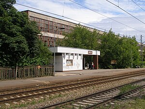
Brasa Station
Railway station in Latvia
Distance: Approx. 1298 meters
Latitude and longitude: 56.9775,24.14655556
Brasa Station is a railway stop on the Zemitāni–Skulte Railway.
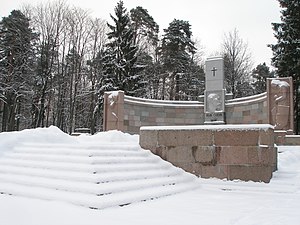
Forest Cemetery, Riga
Cemetery in Riga, Latvia
Distance: Approx. 1851 meters
Latitude and longitude: 56.98738056,24.14693611
Forest Cemetery (Latvian: Rīgas Meža kapi) is an 85 hectares (210 acres) large cemetery in the northwestern part of Riga, the capital of Latvia, between the neighbourhoods of Mežaparks and Čiekurkalns. Formally, the cemetery is divided between 1st Forest Cemetery, with entrance from Aizsaules Street, and 2nd Forest Cemetery, with entrance from Gaujas Street. In 1904, German Lutheran congregations in Riga inquired the Riga City Council for allotment of land for a cemetery in the Mežaparks neighbourhood.
Weather in this IP's area
overcast clouds
2 Celsius
-3 Celsius
2 Celsius
2 Celsius
1016 hPa
94 %
1016 hPa
1015 hPa
10000 meters
5.66 m/s
190 degree
100 %
08:02:59
16:12:50
