Country:
 France
Region:
City:
Latitude and Longitude:
Time Zone:
Postal Code:
IP information under different IP Channel
ip-api
Country
Region
City
ASN
Time Zone
ISP
Blacklist
Proxy
Latitude
Longitude
Postal
Route
IPinfo
Country
Region
City
ASN
Time Zone
ISP
Blacklist
Proxy
Latitude
Longitude
Postal
Route
MaxMind
Country
Region
City
ASN
Time Zone
ISP
Blacklist
Proxy
Latitude
Longitude
Postal
Route
Luminati
Country
 GB
GBASN
Time Zone
Europe/London
ISP
Ouiheberg Sarl
Latitude
Longitude
Postal
db-ip
Country
Region
City
ASN
Time Zone
ISP
Blacklist
Proxy
Latitude
Longitude
Postal
Route
ipdata
Country
Region
City
ASN
Time Zone
ISP
Blacklist
Proxy
Latitude
Longitude
Postal
Route
Popular places and events near this IP address

Ambrussum
Historic site in Ambrussum, Villetelle
Distance: Approx. 5106 meters
Latitude and longitude: 43.71916667,4.14805556
Ambrussum (French pronunciation: [ɑ̃bʁysɔm], [ɑ̃bʁysœm]; Latin pronunciation: [amˈbrussum]) is a Roman archaeological site in Villetelle, Occitania, Southern France. It is close to the modern town Lunel, between Nîmes and Montpellier. Ambrussum is notable for its museum, its staging post on the Via Domitia, its bridge Pont Ambroix over the Vidourle, painted by Gustave Courbet, and for its oppidum (fortified village).

Pont Ambroix
Bridge in Languedoc-Roussillon, France
Distance: Approx. 4727 meters
Latitude and longitude: 43.7172,4.1519
The Pont Ambroix or Pont d'Ambrussum (French for Ambrussum Bridge) was a 1st-century BC Roman bridge in the south of France that was part of the Via Domitia. It crossed the Vidourle at Ambrussum between today's Gallargues-le-Montueux in the Gard department and Villetelle in the Hérault department. In the High Middle Ages, a chapel devoted to St Mary was added to the structure.

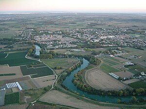
Aimargues
Commune in Occitanie, France
Distance: Approx. 1064 meters
Latitude and longitude: 43.6858,4.2092
Aimargues (French pronunciation: [ɛmaʁɡ]) is a commune in the Gard department in southern France. The town of Aimargues may have Roman origins and is situated beside the river Vidourle on the floodplain of the Rhône. Traditionally it has been an agricultural and wine-producing community but it now also has a number of new industries and employers who benefit from excellent road connections to the north of France as well as to Spain and Italy.

Codognan
Commune in Occitanie, France
Distance: Approx. 4975 meters
Latitude and longitude: 43.7325,4.2206
Codognan (French pronunciation: [kɔdɔɲɑ̃]; Occitan: Codonhan) is a commune in the Gard department in southern France.
Gallargues-le-Montueux
Commune in Occitania, France
Distance: Approx. 3971 meters
Latitude and longitude: 43.7219,4.1736
Gallargues-le-Montueux (French pronunciation: [ɡalaʁɡ lə mɔ̃tɥø]; Occitan: Galargues) is a commune in the Gard department in southern France.

Le Cailar
Commune in Occitanie, France
Distance: Approx. 3482 meters
Latitude and longitude: 43.6769,4.2367
Le Cailar (French pronunciation: [lə kɛlaʁ]; Occitan: Lo Cailar) is a commune in the Gard department in southern France. It is located at the confluence of the River Vistre and the River Rhôny. It was an important port during the Iron Age at a time when lagoons connected to the Mediterranean Sea covered the adjoining low-lying land.
Marsillargues
Commune in Occitania, France
Distance: Approx. 3278 meters
Latitude and longitude: 43.6649,4.1789
Marsillargues (French pronunciation: [maʁsijaʁɡ]; Provençal: Marsilhargues) is a commune in the Hérault department in southern France. Its inhabitants are called Marsillarguois.
Mas de Malherbes
Hotel in the south of France
Distance: Approx. 3639 meters
Latitude and longitude: 43.65883,4.20677
The Mas de Malherbes is a provençal mas and a small hotel near Aimargues, in the south of France.

Aigues-Vives tramway
Historic French narrow-gauge railway
Distance: Approx. 4151 meters
Latitude and longitude: 43.727917,4.191845
The Aigues-Vives tramway (French Chemin de Fer d'Aigues-Vives-Bourg a Aigues-Vives PLM or colloquially La Lignette) was a 2 km (1.2 mi) long narrow-gauge railway with a gauge of 600 mm (1 ft 11+5⁄8 in) in Aigues-Vives in the department Gard in Southern France. It operated from 1892 to 1901.

Gallargues station
Distance: Approx. 3536 meters
Latitude and longitude: 43.7161,4.17127
Gallargues is a railway station in Gallargues-le-Montueux, Occitanie, southern France. Within TER Occitanie, it is part of line 21 (Narbonne–Avignon).
Le Cailar station
Distance: Approx. 3082 meters
Latitude and longitude: 43.68333,4.23485
Le Cailar is a railway station in Le Cailar, Occitanie, southern France. Within TER Occitanie, it is part of line 26 (Nîmes-Le Grau-du-Roi).

Aimargues station
Distance: Approx. 1608 meters
Latitude and longitude: 43.67872,4.20875
Aimargues is a railway station in Aimargues, Occitanie, southern France. Within TER Occitanie, it is part of line 26 (Nîmes-Le Grau-du-Roi).
Weather in this IP's area
light rain
15 Celsius
15 Celsius
15 Celsius
15 Celsius
1010 hPa
85 %
1010 hPa
1010 hPa
10000 meters
2.6 m/s
3.27 m/s
24 degree
100 %
07:47:54
19:13:43