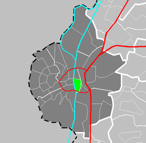
Country:
Region:
City:
Latitude and Longitude:
Time Zone:
Postal Code:
IP information under different IP Channel
ip-api
Country
Region
City
ASN
Time Zone
ISP
Blacklist
Proxy
Latitude
Longitude
Postal
Route
Luminati
Country
Region
li
City
maastricht
ASN
Time Zone
Europe/Amsterdam
ISP
Boels Verhuur B.V.
Latitude
Longitude
Postal
IPinfo
Country
Region
City
ASN
Time Zone
ISP
Blacklist
Proxy
Latitude
Longitude
Postal
Route
db-ip
Country
Region
City
ASN
Time Zone
ISP
Blacklist
Proxy
Latitude
Longitude
Postal
Route
ipdata
Country
Region
City
ASN
Time Zone
ISP
Blacklist
Proxy
Latitude
Longitude
Postal
Route
Popular places and events near this IP address
Zuid-Willemsvaart
Canal in the Netherlands
Distance: Approx. 2687 meters
Latitude and longitude: 50.86666667,5.68333333
The Zuid-Willemsvaart (Dutch: [zœytˈʋɪləmsfaːrt]; translated: South William's Canal) is a canal in the south of the Netherlands and the east of Belgium.

Meerssen
Municipality and town in Limburg, Netherlands
Distance: Approx. 2616 meters
Latitude and longitude: 50.88333333,5.75
Meerssen (Dutch: [ˈmeːrsə(n)] ; Limburgish: Meersje [ˈmeːʀʃə]) is a town and a municipality in southeastern Netherlands.

De Geusselt
Stadium in Maastricht, Netherlands
Distance: Approx. 1219 meters
Latitude and longitude: 50.8575,5.71777778
Stadion de Geusselt (Dutch pronunciation: [də ˈɣøːsəlt]) is a multi-use stadium in Maastricht, Netherlands. It is currently used mostly for football matches and is the home stadium of MVV Maastricht. The stadium is able to hold 10,000 people and was built in 1961.
Amby, Maastricht
Neighbourhood & former municipality in Netherlands, Limburg, Maastricht
Distance: Approx. 849 meters
Latitude and longitude: 50.86666667,5.73333333
A former village, Amby is now a neighborhood (part 25) of Maastricht, in the Netherlands, located about 4 km northeast of the center of the city. From January 2, 1839, to July 1, 1970, Amby existed as a separate municipality. As of 2017, it had a total population of 6,565.

Maastricht railway station
Railway station in the Netherlands
Distance: Approx. 2325 meters
Latitude and longitude: 50.85,5.70527778
Maastricht railway station (Dutch: Station Maastricht [staːˈɕɔ maːˈstrɪxt]; Limburgish: Statie Mestreech [ˈstaː˦si məˈstʀeːx]) is located in Maastricht in Limburg, Netherlands. It is the main railway station in Limburg's capital city. It is the southern terminus of the Alkmaar–Maastricht intercity service by NS. Additionally, Arriva and the Belgian NMBS serve the station with local trains.

Meerssen railway station
Railway station in the Netherlands
Distance: Approx. 2607 meters
Latitude and longitude: 50.88277778,5.75055556
Meerssen railway station is located in Meerssen, the Netherlands. The station opened on 23 October 1853 on the Maastricht–Aachen railway. The original station building was enlarged in 1900.
Maastricht Noord railway station
Railway station in the Netherlands
Distance: Approx. 393 meters
Latitude and longitude: 50.87083333,5.71777778
Maastricht Noord (lit. 'Maastricht North') is a railway station in the north of Maastricht, the Netherlands. Construction of the station started in March 2011 and after a few delays it opened on 17 November 2013 on the Maastricht–Aachen railway, which is part of the Heuvellandlijn. The station features 360 car parking spaces and park and ride facilities with connections to the centre of Maastricht.

Townhouse Designhotel Maastricht
Distance: Approx. 2262 meters
Latitude and longitude: 50.851352,5.703492
Townhouse Designhotel Maastricht is a four-star design hotel located in the Wyck district in Maastricht, Netherlands. The hotel opened in late 2009. Townhouse is part of the La Bergère Group.

Boschpoort
Neighbourhood in Maastricht, Netherlands
Distance: Approx. 2326 meters
Latitude and longitude: 50.8631,5.6894
Boschpoort (Dutch: [ˈbɔsˌpoːrt], Limburgish: [ˈbɔsˌpoːʀt˦]) is a neighbourhood of Maastricht in the Dutch province of Limburg. The suburb is situated in the North Western area of the town, on the West bank of the river Meuse. The Dörp (pronounced [ˈdœʀ˦əp]; "village") as it is colloquially known is home to approximately 1500 people.

Bethlehem Castle
Castle in Maastricht, Netherlands
Distance: Approx. 731 meters
Latitude and longitude: 50.86777778,5.71111111
Bethlehem Castle is a castle in Maastricht, in the south of the Netherlands. It was built in the 12th century. It is one of the oldest castles in the Netherlands.
Wyck, Maastricht
Neighbourhood in Maastricht, Netherlands
Distance: Approx. 2499 meters
Latitude and longitude: 50.84944444,5.70194444
Wyck (Dutch: [ʋik]; Limburgish: Wiek [wiːk˦]) is a neighbourhood in Maastricht, Netherlands, comprising the eastern bank of the Meuse (Dutch: Maas) in the city's historic centre.
Boschstraatkwartier
Neighbourhood in Netherlands, Limburg, Maastricht
Distance: Approx. 2514 meters
Latitude and longitude: 50.85515833,5.69229167
The Boschstraatkwartier (Dutch: [ˈbɔstraːtkʋɑrˌtiːr]; Limburgish: Boschstraotkerteer [ˈbɔstʀɒːtkəʀˌteːʀ]) is a neighbourhood in the old city centre of Maastricht, Limburg, Netherlands.
Weather in this IP's area
overcast clouds
8 Celsius
8 Celsius
7 Celsius
9 Celsius
1026 hPa
89 %
1026 hPa
1020 hPa
10000 meters
0.89 m/s
1.34 m/s
212 degree
100 %
07:53:28
16:50:17


