Country:
 Netherlands
Region:
City:
Latitude and Longitude:
Time Zone:
Postal Code:
IP information under different IP Channel
ip-api
Country
Region
City
ASN
Time Zone
ISP
Blacklist
Proxy
Latitude
Longitude
Postal
Route
IPinfo
Country
Region
City
ASN
Time Zone
ISP
Blacklist
Proxy
Latitude
Longitude
Postal
Route
MaxMind
Country
Region
City
ASN
Time Zone
ISP
Blacklist
Proxy
Latitude
Longitude
Postal
Route
Luminati
Country
NLRegion
nb
City
alphen
ASN
Time Zone
Europe/Amsterdam
ISP
Qonnected B.V.
Latitude
Longitude
Postal
db-ip
Country
Region
City
ASN
Time Zone
ISP
Blacklist
Proxy
Latitude
Longitude
Postal
Route
ipdata
Country
Region
City
ASN
Time Zone
ISP
Blacklist
Proxy
Latitude
Longitude
Postal
Route
Popular places and events near this IP address

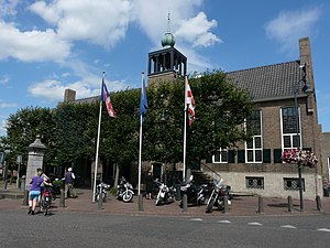
Alphen-Chaam
Municipality in North Brabant, Netherlands
Distance: Approx. 1004 meters
Latitude and longitude: 51.48333333,4.95
Alphen-Chaam (Dutch pronunciation: [ˌɑlfə(ŋ) ˈxaːm] ) is a municipality in the southern Netherlands.
Baarle-Nassau
Municipality and town in North Brabant, Netherlands
Distance: Approx. 4031 meters
Latitude and longitude: 51.45,4.93333333
Baarle-Nassau (Dutch pronunciation: [ˌbaːrlə ˈnɑsʌu] ) is a municipality and town in the southern Netherlands, located in the province of North Brabant. It had a population of 6,899 in 2019. The town is the site of a complicated borderline between Belgium and the Netherlands: it encloses 22 small exclaves of the Belgian town Baarle-Hertog, of which the two largest contain seven counter-enclaves of Baarle-Nassau, and the main body of Belgium contains another.

Baarle-Hertog
Municipality in Flemish Community, Belgium
Distance: Approx. 4031 meters
Latitude and longitude: 51.45,4.93333333
Baarle-Hertog (Dutch pronunciation: [ˌbaːrlə ˈɦɛrtɔx]; French: Baerle-Duc, pronounced [baʁl(ə)dyk]) is a Flemish municipality of Belgium, much of which consists of a number of small Belgian enclaves fully surrounded by the Netherlands. Parts of Baarle-Hertog are surrounded by the Dutch province of North Brabant, but it is part of the Belgian province of Antwerp. As of 2021, it had a population of 2,935.

Baarle
Village divided into Belgian and Dutch territories
Distance: Approx. 6217 meters
Latitude and longitude: 51.43333333,4.91666667
Baarle (Dutch pronunciation: [ˈbaːrlə] ) is a village which consists of a patchwork of Belgian and Dutch territories. The Belgian parts of the village are called Baarle-Hertog and the Dutch elements are called Baarle-Nassau. The Belgian part includes 16 exclaves within Dutch territory.

Heikant, Oordeel
Hamlet in North Brabant, Netherlands
Distance: Approx. 3614 meters
Latitude and longitude: 51.44833333,4.96388889
Heikant or Oordeel Heikant is a hamlet in the Dutch province of North Brabant. It is a part of the municipality of Baarle-Nassau, and lies about 15 km south of Tilburg. This Heikant (the name means "heath edge") should not be confused with the other hamlet of the same name lying 8 km to the west and also in Baarle-Nassau, or with any of the dozens of other Heikants in the Netherlands and Belgium.

Het Sas, North Brabant
Village in North Brabant, Netherlands
Distance: Approx. 1919 meters
Latitude and longitude: 51.46944444,4.98472222
Het Sas (Dutch pronunciation: [(ɦ)ət ˈsɑs]) is a hamlet in the municipality Alphen-Chaam in the Dutch province of North Brabant. It is located southwest of Alphen. Het Sas is not a statistical entity, and the postal authorities have placed it under Alphen.
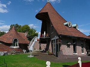
Alphen, North Brabant
Village in North Brabant, Netherlands
Distance: Approx. 540 meters
Latitude and longitude: 51.48083333,4.95611111
Alphen is a village in the municipality of Alphen-Chaam, in the Netherlands. It is located about 12 km southwest of Tilburg.

Alphen en Riel
Distance: Approx. 2526 meters
Latitude and longitude: 51.5,4.98333333
Alphen en Riel is a former municipality in the Dutch province of North Brabant. It covered the villages of Alphen and Riel. In 1997, the municipality was divided between the new municipality of Alphen-Chaam, and the municipality of Goirle.

Heikant, Alphen-Chaam
Hamlet in North Brabant, Netherlands
Distance: Approx. 7455 meters
Latitude and longitude: 51.51583333,4.87222222
Heikant is a hamlet in the Dutch province of North Brabant. It is located in the municipality of Alphen-Chaam, about 2 km northeast of Chaam. Heikant is not a statistical entity, and the postal authorities have placed it under Chaam.
't Zand, Alphen-Chaam
Hamlet in North Brabant, Netherlands
Distance: Approx. 1696 meters
Latitude and longitude: 51.49543,4.95707
't Zand (Dutch pronunciation: [(ə)t sɑnt]) is a hamlet in the Dutch province of North Brabant, in the municipality of Alphen-Chaam. It was first mentioned in 1980 and means sand. 't Zand is a villa ward and recreational site near Alphen.
Riel, Netherlands
Village in North Brabant, Netherlands
Distance: Approx. 6247 meters
Latitude and longitude: 51.52388889,5.02166667
Riel is a village (Dutch: dorp) in the municipality of Goirle, south of Tilburg in the province of North Brabant. Until 1997 it belonged to the municipality Alphen en Riel. On the east it is bordered by the stream valley of the river Donge, on the west by the deactivated railroad Turnhout- Tilburg.

Poppel (village)
Village in Flemish Region
Distance: Approx. 6557 meters
Latitude and longitude: 51.4461,5.0403
Poppel is a village in the municipality of Ravels, in the province of Antwerp, Belgium. As of 2021, it was home to 3,489 people. Poppel was a municipality until 1977.
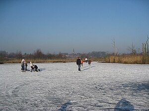
Weather in this IP's area
broken clouds
15 Celsius
16 Celsius
14 Celsius
16 Celsius
998 hPa
95 %
998 hPa
995 hPa
10000 meters
3.6 m/s
200 degree
75 %
07:52:37
19:02:18