Country:
 Netherlands
Region:
City:
Latitude and Longitude:
Time Zone:
Postal Code:
IP information under different IP Channel
ip-api
Country
Region
City
ASN
Time Zone
ISP
Blacklist
Proxy
Latitude
Longitude
Postal
Route
IPinfo
Country
Region
City
ASN
Time Zone
ISP
Blacklist
Proxy
Latitude
Longitude
Postal
Route
MaxMind
Country
Region
City
ASN
Time Zone
ISP
Blacklist
Proxy
Latitude
Longitude
Postal
Route
Luminati
Country
NLRegion
ov
City
dedemsvaart
ASN
Time Zone
Europe/Amsterdam
ISP
Qonnected B.V.
Latitude
Longitude
Postal
db-ip
Country
Region
City
ASN
Time Zone
ISP
Blacklist
Proxy
Latitude
Longitude
Postal
Route
ipdata
Country
Region
City
ASN
Time Zone
ISP
Blacklist
Proxy
Latitude
Longitude
Postal
Route
Popular places and events near this IP address

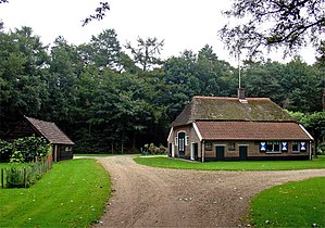
Dedemsvaart
Town in Overijssel, Netherlands
Distance: Approx. 82 meters
Latitude and longitude: 52.6,6.46666667
Dedemsvaart ("Dedem's Canal") (Dutch Low Saxon: De Voart) is a town in Overijssel, the Netherlands.

Arriërveld
Hamlet in Overijssel, Netherlands
Distance: Approx. 4801 meters
Latitude and longitude: 52.56305556,6.43166667
Arriërveld is a hamlet in the Dutch province of Overijssel. It is a part of the municipality of Ommen, and lies about 18 km (11 mi) south of Hoogeveen. It was first mentioned in 1867 as Arriën Veld, and means field near Arriën.
Stegerveld
Hamlet in Overijssel, Netherlands
Distance: Approx. 3876 meters
Latitude and longitude: 52.57194444,6.49861111
Stegerveld is a hamlet in the Dutch province of Overijssel. It is a part of the municipality of Ommen, and lies about 17 km south of Hoogeveen. A part of the hamlet is located in Hardenberg.

Witharen
Hamlet in Overijssel, Netherlands
Distance: Approx. 6513 meters
Latitude and longitude: 52.56083333,6.39583333
Witharen is a hamlet in the Dutch province of Overijssel. It is a part of the municipality of Ommen, and lies about 19 km south of Hoogeveen. It was first mentioned in 1533 as "bij Witthaeren", and means "white sandy ridge".

Ommerschans
Hamlet in Overijssel, Netherlands
Distance: Approx. 4411 meters
Latitude and longitude: 52.58583333,6.40583333
Ommerschans is a former bulwark in the Dutch province of Overijssel. It is a part of the municipality of Ommen, and lies about 16 km south of Hoogeveen.
Witman
Hamlet in Overijssel, Netherlands
Distance: Approx. 5232 meters
Latitude and longitude: 52.6294,6.5276
Witman is a hamlet in the Dutch province of Overijssel. It is located in the municipality of Hardenberg, about 2 km west of the town of Slagharen. Witman is not a statistical entity, and the postal authorities have placed it under Slagharen.
Avereest
Former municipality in Overijssel, Netherlands
Distance: Approx. 6966 meters
Latitude and longitude: 52.61666667,6.36666667
Avereest is a former municipality in the Dutch province of Overijssel. The largest town in the municipality was Dedemsvaart. In 2001, the area became a part of Hardenberg.

Nolde, Netherlands
Hamlet in Drenthe, Netherlands
Distance: Approx. 4710 meters
Latitude and longitude: 52.63305556,6.42138889
Nolde is a hamlet in the Dutch province of Drenthe. It is located in the municipality of De Wolden, about 4 km south of Zuidwolde. The postal authorities have placed it under Linde.

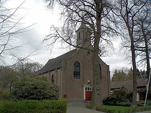
Balkbrug
Village in Overijssel, Netherlands
Distance: Approx. 5084 meters
Latitude and longitude: 52.60055556,6.39111111
Balkbrug is a village in the Dutch province of Overijssel. It is located in the municipality Hardenberg, about 5 km west of Dedemsvaart.

Gold Rush (Slagharen)
Steel roller coaster in the Netherlands
Distance: Approx. 6977 meters
Latitude and longitude: 52.624357,6.561886
Gold Rush is a steel launched roller coaster at Attractiepark Slagharen in Slagharen, Overijssel, of the Netherlands. The coaster is manufactured by Gerstlauer and replaced the aging Thunder Loop attraction, which now operates in Cyprus. Gold Rush is heavily themed to the 1849 California Gold Rush, and features the first (and currently only) triple launch system on a Dutch roller coaster.

Slagharen
Village in Overijssel, Netherlands
Distance: Approx. 6436 meters
Latitude and longitude: 52.625,6.5527
Slagharen is a village in the municipality of Hardenberg in the province of Overijssel, Netherlands. The village started as a peat excavation village. It is known for the Attractiepark Slagharen, an amusement park.
Lutten
Village in Overijssel, Netherlands
Distance: Approx. 7428 meters
Latitude and longitude: 52.6116,6.5747
Lutten (Dutch Low Saxon: Luttn) is a village in the Dutch province of Overijssel. It is located in the municipality Hardenberg, about 13 kilometres (8.1 mi) south-west of Coevorden.
Weather in this IP's area
broken clouds
11 Celsius
11 Celsius
11 Celsius
11 Celsius
1000 hPa
77 %
1000 hPa
1000 hPa
10000 meters
5.21 m/s
11.14 m/s
157 degree
73 %
07:45:59
18:57:30