Country:
Region:
City:
Latitude and Longitude:
Time Zone:
Postal Code:
IP information under different IP Channel
ip-api
Country
Region
City
ASN
Time Zone
ISP
Blacklist
Proxy
Latitude
Longitude
Postal
Route
Luminati
Country
ASN
Time Zone
Europe/Berlin
ISP
Ociris GmbH
Latitude
Longitude
Postal
IPinfo
Country
Region
City
ASN
Time Zone
ISP
Blacklist
Proxy
Latitude
Longitude
Postal
Route
db-ip
Country
Region
City
ASN
Time Zone
ISP
Blacklist
Proxy
Latitude
Longitude
Postal
Route
ipdata
Country
Region
City
ASN
Time Zone
ISP
Blacklist
Proxy
Latitude
Longitude
Postal
Route
Popular places and events near this IP address

Machtlfinger Straße station
Station of the Munich U-Bahn
Distance: Approx. 780 meters
Latitude and longitude: 48.09722222,11.51472222
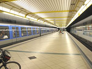
Machtlfinger Straße is an U-Bahn station in Munich on the U3.

Aidenbachstraße station
Station of the Munich U-Bahn
Distance: Approx. 224 meters
Latitude and longitude: 48.09777778,11.52555556
Aidenbachstraße is an U-Bahn station in Munich on the U3. In 2014, construction is expected to start on a 8.7 kilometres (5.4 mi) tangential extension of route 16 of the Munich tramway from its existing terminus at Romansplatz to an interchange at Aidenbachstraße station.

Obersendling station
Station of the Munich U-Bahn
Distance: Approx. 863 meters
Latitude and longitude: 48.09805556,11.53611111
Obersendling is an U-Bahn station in Munich, Germany on the U3.
Thalkirchen station
Station of the Munich U-Bahn
Distance: Approx. 1738 meters
Latitude and longitude: 48.1025,11.54611111
Thalkirchen is a Munich U-Bahn station in the Munich borough of Thalkirchen, near the Tierpark Hellabrunn (Munich Zoo).

Thalkirchen-Obersendling-Forstenried-Fürstenried-Solln
Borough of Munich, Germany
Distance: Approx. 879 meters
Latitude and longitude: 48.089,11.519
Thalkirchen-Obersendling-Forstenried-Fürstenried-Solln (Central Bavarian: Thoikircha-Obasendling-Forstnriad-Fiastnriad-Soin) is the 19th borough of Munich, Germany, comprising the extreme southern part of the city on the west bank of the river Isar. After the administrative reform, the boroughs Thalkirchen-Obersendling-Forstenried and Solln were incorporated, thus forming the new borough.

Munich-Mittersendling station
Railway station in Munich, Germany
Distance: Approx. 1580 meters
Latitude and longitude: 48.107763,11.536428
Munich-Mittersendling station is a Munich S-Bahn railway station in the borough of Mittersendling. It has an access for disabled people.
Munich Siemenswerke station
Railway station in Germany
Distance: Approx. 606 meters
Latitude and longitude: 48.095,11.53305556
Munich Siemenswerke station is a Munich S-Bahn railway station on the Bayerische Oberlandbahn main line in the borough of Obersendling. It is named after a large Siemens complex formerly located west of the station. Today, large parts of this complex have been transformed into a residential area.

Mühlbach (Isar-Werkkanal)
Stream in Germany
Distance: Approx. 1552 meters
Latitude and longitude: 48.097,11.5458
Mühlbach is a small stream in Munich-Thalkirchen, Bavaria, Germany. It is a branch of the Isar.

Sprachen & Dolmetscher Institut München
Distance: Approx. 528 meters
Latitude and longitude: 48.0966,11.532
Sprachen & Dolmetscher Institut München (Languages and translators institute) is located in Maxvorstadt, Munich, Bavaria, Germany.

New European College
Distance: Approx. 1135 meters
Latitude and longitude: 48.0933,11.5398
New European College is a private international business school in Munich, Germany, that offers state-accredited university programs in business administration and international management in English.

Wolfratshauser Straße
Road in Munich, Germany
Distance: Approx. 1321 meters
Latitude and longitude: 48.10074,11.541159
Wolfratshauser Straße is a major road in Munich. It forms part of the Bundesstraße 11 (federal highway) and is named after the city Wolfratshausen south of Munich, in whose direction it leads.

Boschetsrieder Straße
Street in Munich, Germany
Distance: Approx. 524 meters
Latitude and longitude: 48.0989,11.5197
Boschetsrieder Straße is an inner city street in the Munich districts of Thalkirchen, Obersendling and Forstenried/Am Waldfriedhof, which runs west from Bundesstraße 11 (Plinganser-/Wolfratshauser Straße) on the Isar hillside to Kreuzhof, where it continues as the Fürstenrieder Straße.
Weather in this IP's area
overcast clouds
8 Celsius
7 Celsius
6 Celsius
8 Celsius
1026 hPa
72 %
1026 hPa
960 hPa
10000 meters
1.54 m/s
60 degree
100 %
07:21:02
16:36:17

