45.137.116.110 - IP Lookup: Free IP Address Lookup, Postal Code Lookup, IP Location Lookup, IP ASN, Public IP
Country:
Region:
City:
Location:
Time Zone:
Postal Code:
IP information under different IP Channel
ip-api
Country
Region
City
ASN
Time Zone
ISP
Blacklist
Proxy
Latitude
Longitude
Postal
Route
Luminati
Country
Region
spe
City
stpetersburg
ASN
Time Zone
Europe/Moscow
ISP
aurologic GmbH
Latitude
Longitude
Postal
IPinfo
Country
Region
City
ASN
Time Zone
ISP
Blacklist
Proxy
Latitude
Longitude
Postal
Route
IP2Location
45.137.116.110Country
Region
sindh
City
karachi
Time Zone
Asia/Karachi
ISP
Language
User-Agent
Latitude
Longitude
Postal
db-ip
Country
Region
City
ASN
Time Zone
ISP
Blacklist
Proxy
Latitude
Longitude
Postal
Route
ipdata
Country
Region
City
ASN
Time Zone
ISP
Blacklist
Proxy
Latitude
Longitude
Postal
Route
Popular places and events near this IP address
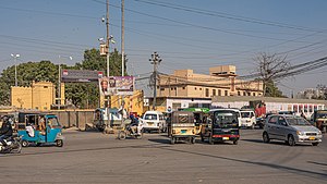
Karachi
Capital of Sindh, Pakistan
Distance: Approx. 0 meters
Latitude and longitude: 24.86,67.01
Karachi (; Urdu: کراچی [kə.ɾɑː.t͡ʃiː]; Sindhi: ڪراچي; IPA: [kəˈraːtʃi] ) is the capital city of the Pakistani province of Sindh. It is the largest city in Pakistan and 12th largest in the world, with a population of over 20 million. It is situated at the southern tip of the country along the Arabian Sea coast and formerly served as the country's capital from 1947 to 1959.

2002 Karachi bus bombing
Distance: Approx. 0 meters
Latitude and longitude: 24.86,67.01
The 2002 Karachi bus bombing was one of a series of deadly strikes against Westerners in Pakistan in 2002. The blast killed 14 people and wounded another 40. The attack took place in Karachi, Sindh.
Kara Film Festival
Annual film festival in Karachi, Pakistan
Distance: Approx. 0 meters
Latitude and longitude: 24.86,67.01
The Karachi International Film Festival, simply known as the Kara Film Festival (Urdu: کارا فلم فیسٹیول or کارا فلم) was an annual film festival held in Karachi, Pakistan from 2001 until 2009. The festival reportedly started in response to the declining state of the Pakistani film industry. The 10th Kara Film Festival was intended to be held in 2010 but has since been delayed every year due to social issues in Karachi.
City Sports Complex
Indoor sporting arena located in Islamabad, Pakistan
Distance: Approx. 0 meters
Latitude and longitude: 24.86,67.01
The City Sports Complex, previously KMC Sports Complex, is located at Kashmir Road, in Karachi, Sindh, Pakistan. Various sports are played at the Complex, including skating, swimming and basketball. The Complex has also hosted boxing and tennis matches for various countries.

Lady Dufferin Hospital
Hospital in Sindh, Pakistan
Distance: Approx. 292 meters
Latitude and longitude: 24.8583,67.0078
Lady Dufferin Hospital is a private women's hospital located in Karachi, Sindh.

Central Jail Karachi
Jail in Pakistan
Distance: Approx. 0 meters
Latitude and longitude: 24.86,67.01
Central Jail Karachi, also known as Central Prison Karachi, is a prison in the city of Karachi in Sindh, Pakistan. It houses more than 4800 prisoners including convicted terrorists that include militants who attempted to assassinate President of Pakistan Pervez Musharraf.
2009 Karachi floods
Distance: Approx. 0 meters
Latitude and longitude: 24.86,67.01
The 2009 Karachi floods (Urdu: سيلاب کراچی ) in Pakistan's financial centre, Karachi, have killed at least 26 people. The death toll is expected to rise, and more than 150 people have been injured in a series of related incidents. The floods are the result of the heaviest rains in the region in thirty years.
Notre Dame Institute of Education
Distance: Approx. 0 meters
Latitude and longitude: 24.86,67.01
The Notre Dame Institute of Education (NDIE) is a teacher education facility in Saddar Town in Karachi, Sindh, Pakistan.
2012 Pakistan factory fires
2012 industrial disasters in Karachi and Lahore, Pakistan
Distance: Approx. 0 meters
Latitude and longitude: 24.86,67.01
Factories in Pakistan's two largest cities of Karachi and Lahore caught fire on 11 September 2012. The fires occurred in a textile factory in the western part of Karachi and in a shoe factory in Lahore. The fires are considered to be the most deadly and worst industrial factory fires in Pakistan's history, killing 289 people and seriously injuring more than 600.
Murder of Shahzeb Khan
2012 murder in Karachi, Pakistan
Distance: Approx. 0 meters
Latitude and longitude: 24.86,67.01
On 25 December 2012, university student Shahzeb Khan was murdered in a targeted revenge killing in Karachi, Pakistan. The initial lack of action from police in apprehending Shahzeb Khan's killers sparked countrywide outrage and protests against the abuse of power by the wealthy in Pakistan. On 7 June 2013 Shahrukh Jatoi, son of feudal Sikandar Jatoi and Siraj Talpur, from the Talpur clan, were sentenced to death for this crime, while Sajjad Solangi and Ghulam Murtaza Lashari were sentenced to life imprisonment for aiding the two killers.
2017 Karachi stabbings
Series of attacks
Distance: Approx. 163 meters
Latitude and longitude: 24.86146111,67.00993889
The 2017 Karachi stabbings were series of attacks carried out by an anonymous person against women in Karachi, Sindh, Pakistan. The spree started on 25 September 2017 and in result 16 women were injured; none of them was robbed or killed by him.
Siege of Debal
Battle between Umayyads and Hindus of Sindh
Distance: Approx. 0 meters
Latitude and longitude: 24.86,67.01
The siege of Debal, also known as the siege of Debul, took place in the autumn of 711 AD, in which the Umayyad forces under Muhammed Ibn al-Qasim besieged Debal, a city under the Brahmin dynasty of Sindh ruled by Raja Dahir. Umayyads defeated the inhabitants of the order on the order of Governor of Iraq Al-Hajjaj and captured it. In 711, Muhammed ibn Qasim marched towards Debal with 6,000 Syrian cavalry and 3,000 camelry with a good number of Arab soldiers.
Weather in this IP's area
haze
22 Celsius
21 Celsius
22 Celsius
22 Celsius
1020 hPa
24 %
1020 hPa
1018 hPa
4000 meters
4.12 m/s
60 degree

