45.132.149.125 - IP Lookup: Free IP Address Lookup, Postal Code Lookup, IP Location Lookup, IP ASN, Public IP
Country:
Region:
City:
Location:
Time Zone:
Postal Code:
IP information under different IP Channel
ip-api
Country
Region
City
ASN
Time Zone
ISP
Blacklist
Proxy
Latitude
Longitude
Postal
Route
Luminati
Country
Region
wls
City
newport
ASN
Time Zone
Europe/London
ISP
Daisy Corporate Services Trading Ltd
Latitude
Longitude
Postal
IPinfo
Country
Region
City
ASN
Time Zone
ISP
Blacklist
Proxy
Latitude
Longitude
Postal
Route
IP2Location
45.132.149.125Country
Region
wales
City
llancayo
Time Zone
Europe/London
ISP
Language
User-Agent
Latitude
Longitude
Postal
db-ip
Country
Region
City
ASN
Time Zone
ISP
Blacklist
Proxy
Latitude
Longitude
Postal
Route
ipdata
Country
Region
City
ASN
Time Zone
ISP
Blacklist
Proxy
Latitude
Longitude
Postal
Route
Popular places and events near this IP address

Usk
Town in Monmouthshire, Wales
Distance: Approx. 2280 meters
Latitude and longitude: 51.704,-2.902
Usk (Welsh: Brynbuga) is a town and community in Monmouthshire, Wales, 10 miles (16 km) northeast of Newport. It is located on the River Usk, which is spanned by an arched stone bridge at the western entrance to the town. Usk Castle, above the town, overlooks the ancient crossing point.

Llancayo
Distance: Approx. 676 meters
Latitude and longitude: 51.71666667,-2.91666667
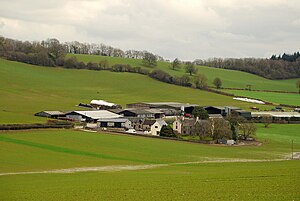
Llancayo is a village in Monmouthshire, south east Wales, United Kingdom. It is located two miles north of Usk on the B4598 road to Abergavenny, in the community of Gwehelog Fawr.

Usk Castle
Castle site in the town of Usk in south east Wales, United Kingdom
Distance: Approx. 2132 meters
Latitude and longitude: 51.7051,-2.9033
Usk Castle (Welsh: Castell Brynbuga) is a castle site in the town of Usk in central Monmouthshire, south east Wales, United Kingdom. It was listed Grade I on 16 February 1953. Within the castle, and incorporating parts of its gatehouse, stands Castle House, a Grade I listed building in its own right.
Gwehelog
Human settlement in Wales
Distance: Approx. 2317 meters
Latitude and longitude: 51.7322,-2.8856
Gwehelog is a village settlement in the community of Llanarth, in Monmouthshire, south east Wales.

Usk railway station (Great Western Railway)
Former railway station in England
Distance: Approx. 1952 meters
Latitude and longitude: 51.7063,-2.9055
Usk (GWR) railway station is a disused railway station in the town of Usk, Monmouthshire, Wales. The station is now barely recognisable with the remains of the platforms beneath undergrowth, but the trackbed, the adjacent Usk Tunnel and road and river bridges remain extant and can be walked.

Castle House, Usk
House in Usk, Monmouthshire, Wales
Distance: Approx. 2173 meters
Latitude and longitude: 51.705,-2.9022
Castle House in Usk, Monmouthshire, Wales, originally formed the gatehouse to Usk Castle. Much altered in the eighteenth and nineteenth centuries, it is now a private home and a Grade I listed building.

Trostrey
Human settlement in Wales
Distance: Approx. 1562 meters
Latitude and longitude: 51.73423,-2.9284
Trostrey (Welsh: Trostre) is a small hamlet and parish in Monmouthshire, in southeast Wales located about 2+1⁄2 miles (4.0 km) north/northwest of Usk.

Porth-y-carn, Usk
House in Usk, Monmouthshire
Distance: Approx. 2172 meters
Latitude and longitude: 51.7042,-2.9055
Porth-y-carn, Porthycarne Street, Usk, Monmouthshire is an early 19th-century Neoclassical villa. Built c. 1834 for Thomas Reece, the agent of the "iron king", Crawshay Bailey, it is a Grade II* listed building.

St David's Church, Trostrey
Church in Monmouthshire, Wales
Distance: Approx. 1601 meters
Latitude and longitude: 51.7347,-2.9283
The Church of St David, Trostrey, Monmouthshire, Wales, is a parish church with its origins in the 14th century. Its founder may have been Geoffrey Marshall, Lord of Trostrey Castle. The church was substantially rebuilt in the 16th century and restored by John Prichard in 1876–1877.

Trostrey Court
House in Trostrey Monmouthshire
Distance: Approx. 1373 meters
Latitude and longitude: 51.7347,-2.9201
Trostrey Court House, Trostrey, Monmouthshire is a late 16th century gentry house. The current building replaced an earlier medieval court. The house played a role in the English Civil War when it was seized by the forces of Thomas Fairfax during the siege of Raglan Castle.
Berthin Brook
Distance: Approx. 1404 meters
Latitude and longitude: 51.71066,-2.90944
The Berthin Brook is a minor right bank tributary of the River Usk in Monmouthshire, in south Wales. Flowing north from New Inn initially, it turns east at Little Mill to flow along a former glacial meltwater channel past the former Royal Ordnance Factory site (now BAE Systems) at Glascoed and by Rhadyr to join the major river 1 km north of the town of Usk. At the height of the last ice age (the Devensian), the Usk valley glacier reached as far down the Usk valley as Little Mill and sediment-laden meltwater created a valley sandur over which the post-glacial Berthin Brook now flows.

St David Lewis and St Francis Xavier Church, Usk
Church in Wales
Distance: Approx. 2176 meters
Latitude and longitude: 51.7044,-2.9044
St David Lewis and St Francis Xavier Church is a Roman Catholic parish church in Usk, Monmouthshire, Wales. It was built in 1847 and designed by Charles Hansom in the Gothic Revival style. The church is dedicated to two Jesuit saints, Francis Xavier and the local David Lewis, who is buried nearby.
Weather in this IP's area
broken clouds
9 Celsius
8 Celsius
9 Celsius
10 Celsius
1032 hPa
92 %
1032 hPa
1029 hPa
10000 meters
2.46 m/s
3.17 m/s
247 degree
79 %