45.131.37.88 - IP Lookup: Free IP Address Lookup, Postal Code Lookup, IP Location Lookup, IP ASN, Public IP
Country:
 Germany
Region:
City:
Location:
Time Zone:
Postal Code:
ISP:
ASN:
language:
User-Agent:
Proxy IP:
Blacklist:
IP information under different IP Channel
ip-api
Country
Region
City
ASN
Time Zone
ISP
Blacklist
Proxy
Latitude
Longitude
Postal
Route
db-ip
Country
Region
City
ASN
Time Zone
ISP
Blacklist
Proxy
Latitude
Longitude
Postal
Route
IPinfo
Country
Region
City
ASN
Time Zone
ISP
Blacklist
Proxy
Latitude
Longitude
Postal
Route
IP2Location
45.131.37.88Country
deRegion
hessen
City
aschbach
Time Zone
ISP
Language
User-Agent
Latitude
Longitude
Postal
ipdata
Country
Region
City
ASN
Time Zone
ISP
Blacklist
Proxy
Latitude
Longitude
Postal
Route
Popular places and events near this IP address
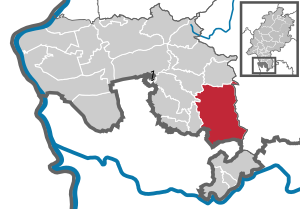
Wald-Michelbach
Municipality in Hesse, Germany
Distance: Approx. 1463 meters
Latitude and longitude: 49.56666667,8.83333333
Wald-Michelbach is a municipality in the Bergstraße district in Hesse, Germany.

Abtsteinach
Municipality in Hesse, Germany
Distance: Approx. 6639 meters
Latitude and longitude: 49.53333333,8.78333333
Abtsteinach is a municipality in the Bergstraße district in Hesse, Germany. The municipality calls itself “The Gateway to the Überwald”.

Grasellenbach
Municipality in Hesse, Germany
Distance: Approx. 6909 meters
Latitude and longitude: 49.63333333,8.88333333
Grasellenbach is a municipality in the Bergstraße district in southern Hesse, Germany.

Überwald
Distance: Approx. 2437 meters
Latitude and longitude: 49.5833,8.8166
The Überwald is a wooded area in the southeast of Bergstraße district in Hesse, Germany, between the "Anterior" and "Hinder" Odenwald, comprising the communities of Abtsteinach, Grasellenbach and Wald-Michelbach. Wald-Michelbach is the Überwald's central community. The name was likely first used by the inhabitants of the neighbouring Weschnitz valley.

Stiefelhöhe
Distance: Approx. 7427 meters
Latitude and longitude: 49.51666667,8.8
Stiefelhöhe is an Odenwald mountain of Baden-Württemberg, Germany.

Wagenberg (hill)
Mountain in Germany
Distance: Approx. 7273 meters
Latitude and longitude: 49.63805556,8.81861111
Wagenberg is a wooded mountain ridge stretching from north to south in the Bergstraße district in the Odenwald. It is 535.7 m above sea level. The steeply sloping western part lies in the Fürth district and the eastern part in the Hammelbach district.
Götzenstein
Distance: Approx. 5482 meters
Latitude and longitude: 49.55,8.78333333
The Götzenstein is a hill in the Odenwald range in Hesse, Germany.
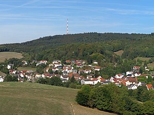
Hardberg (Odenwald)
Hill in Hesse, Germany
Distance: Approx. 5106 meters
Latitude and longitude: 49.54,8.80361111
Hardberg is a hill in the Odenwald range in Hesse, Germany. It is home to the Hardberg Transmission Tower, a 135-metre-high free-standing lattice tower on the Hardberg mountain in Germany at 49°32′28″N 8°48′17″E. The Hardberg Transmission Tower is 135 metres high, weighs 130 tons and stands on an area of 12 * 12 metres.

Spessartskopf
Mountain in Germany
Distance: Approx. 5227 meters
Latitude and longitude: 49.61666667,8.88333333
Spessartskopf is an Odenwald mountain in Hesse, Germany.

Waldskopf
Mountain in Germany
Distance: Approx. 7537 meters
Latitude and longitude: 49.53333333,8.76666667
Waldskopf is a Odenwald mountain in Hesse, Germany. It has a height of 538 metres.
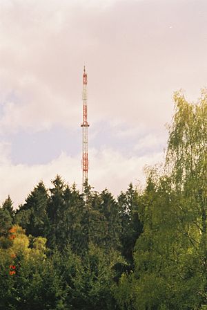
Hardberg transmitter
Distance: Approx. 5106 meters
Latitude and longitude: 49.54,8.80361111
The Hardberg transmitter is a transmission tower owned by the Hessischer Rundfunk. It is located on the 593 meters (1,945 ft) high Hardberg mountain on the south tip of Hesse. It is used for radio and formerly TV broadcasting.
Tromm (Odenwald)
Mountain in Germany
Distance: Approx. 4588 meters
Latitude and longitude: 49.60444444,8.80277778
Tromm is an Odenwald mountain in Hesse, Germany.
Weather in this IP's area
broken clouds
1 Celsius
-2 Celsius
-0 Celsius
2 Celsius
1024 hPa
81 %
1024 hPa
982 hPa
10000 meters
1.95 m/s
2.91 m/s
98 degree
80 %