45.131.148.55 - IP Lookup: Free IP Address Lookup, Postal Code Lookup, IP Location Lookup, IP ASN, Public IP
Country:
Region:
City:
Location:
Time Zone:
Postal Code:
IP information under different IP Channel
ip-api
Country
Region
City
ASN
Time Zone
ISP
Blacklist
Proxy
Latitude
Longitude
Postal
Route
Luminati
Country
Region
bk
City
ersekcsanad
ASN
Time Zone
Europe/Budapest
ISP
MVM NET Zrt.
Latitude
Longitude
Postal
IPinfo
Country
Region
City
ASN
Time Zone
ISP
Blacklist
Proxy
Latitude
Longitude
Postal
Route
IP2Location
45.131.148.55Country
Region
bacs-kiskun
City
baja
Time Zone
Europe/Budapest
ISP
Language
User-Agent
Latitude
Longitude
Postal
db-ip
Country
Region
City
ASN
Time Zone
ISP
Blacklist
Proxy
Latitude
Longitude
Postal
Route
ipdata
Country
Region
City
ASN
Time Zone
ISP
Blacklist
Proxy
Latitude
Longitude
Postal
Route
Popular places and events near this IP address

Baja, Hungary
City with county rights in Southern Great Plain, Hungary
Distance: Approx. 585 meters
Latitude and longitude: 46.17972222,18.95305556
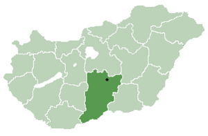
Baja (Hungarian pronunciation: [ˈbɒjɒ]) is a city with county rights in Bács-Kiskun County, southern Hungary. It is the second largest city in the county, after the county seat at Kecskemét, and is home to some 35,000 people. Baja is the seat of the Baja municipality.

Sugovica
Distance: Approx. 8663 meters
Latitude and longitude: 46.15,18.85
The Sugovica is a small river in southern Hungary, near Baja. It is also known as Kamarás-Duna. The Sugovica is an old tributary of the Danube.
Béla III High School
School in Baja, Hungary
Distance: Approx. 646 meters
Latitude and longitude: 46.1799,18.9519
Béla III High School (III. Béla Gimnázium) was founded in 1757. It is in Baja, Hungary.

Vaskút
Place in Bács-Kiskun, Hungary
Distance: Approx. 6818 meters
Latitude and longitude: 46.11666667,18.98333333
Vaskút (German: Waschkut or Eisenbrunn, Croatian: Baškut or Vaškut) is a large village in Bács-Kiskun county, in the Southern Great Plain region of southern Hungary.
Bátmonostor
Place in Bács-Kiskun, Hungary
Distance: Approx. 8536 meters
Latitude and longitude: 46.1,18.93333333
Bátmonostor (Croatian: Monoštorlija) is a village in Bács-Kiskun county, in the Southern Great Plain region of southern Hungary.
Érsekcsanád
Village in Bács-Kiskun, Hungary
Distance: Approx. 8603 meters
Latitude and longitude: 46.25,18.98333333
Érsekcsanád (Croatian: Čanad or Čenad) is a village in Bács-Kiskun county, in the Southern Great Plain region of southern Hungary. It is named after Csanád, the first head (comes) of the former Csanád County of Hungary in the first decades of the 11th century.

Franciscan Friary, Baja
Distance: Approx. 410 meters
Latitude and longitude: 46.1775,18.9525
The Franciscan Friary, Baja, is a Franciscan friary in the city of Baja in the Southern Great Plain Region of Hungary.

Szeremle
Place in Bács-Kiskun, Hungary
Distance: Approx. 6283 meters
Latitude and longitude: 46.15,18.88333333
Szeremle (Croatian: Srimljan) is a village in Bács-Kiskun county, in the Southern Great Plain region of southern Hungary.

Baja District
Districts of Hungary in Bács-Kiskun
Distance: Approx. 4739 meters
Latitude and longitude: 46.1833,19.0167
Baja (Hungarian: Bajai járás; German: Kreis Baja) is a district in south-western part of Bács-Kiskun County. Baja is also the name of the town where the district seat is found. The district is located in the Southern Great Plain Statistical Region.

Bács-Kiskun County 6th constituency
Distance: Approx. 952 meters
Latitude and longitude: 46.18333333,18.95361111
The 6th constituency of Bács-Kiskun County (Hungarian: Bács-Kiskun megyei 06. számú országgyűlési egyéni választókerület) is one of the single member constituencies of the National Assembly, the national legislature of Hungary. The constituency standard abbreviation: Bács-Kiskun 06.

Church of the Transfer of the Relics of the Holy Father Nicholas, Baja
Church in Bács-Kiskun County, Hungary
Distance: Approx. 941 meters
Latitude and longitude: 46.18215,18.94989
The Church of the Transfer of the Relics of the Holy Father Nicholas (Serbian Cyrillic: Црква преноса моштију светог оца Николаја, Hungarian: Szent Miklós Görögkeleti Plébániatemplom) is a Serbian Orthodox church in Baja in Hungary. The church is located in the central part of the old town of Baja with Serb community institutions in the nearby building. The church is the oldest out of three Serbian Orthodox churches in the town, two of which survived until today.
Weather in this IP's area
clear sky
0 Celsius
-3 Celsius
0 Celsius
0 Celsius
1031 hPa
78 %
1031 hPa
1018 hPa
10000 meters
2.97 m/s
3.95 m/s
179 degree
4 %