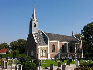
Country:
Region:
City:
Latitude and Longitude:
Time Zone:
Postal Code:
IP information under different IP Channel
ip-api
Country
Region
City
ASN
Time Zone
ISP
Blacklist
Proxy
Latitude
Longitude
Postal
Route
IPinfo
Country
Region
City
ASN
Time Zone
ISP
Blacklist
Proxy
Latitude
Longitude
Postal
Route
MaxMind
Country
Region
City
ASN
Time Zone
ISP
Blacklist
Proxy
Latitude
Longitude
Postal
Route
Luminati
Country
Region
li
City
montfort
ASN
Time Zone
Europe/Amsterdam
ISP
Qonnected B.V.
Latitude
Longitude
Postal
db-ip
Country
Region
City
ASN
Time Zone
ISP
Blacklist
Proxy
Latitude
Longitude
Postal
Route
ipdata
Country
Region
City
ASN
Time Zone
ISP
Blacklist
Proxy
Latitude
Longitude
Postal
Route
Popular places and events near this IP address

's-Gravendeel
Village in South Holland, Netherlands
Distance: Approx. 522 meters
Latitude and longitude: 51.78333333,4.61666667
's-Gravendeel (Dutch pronunciation: [ˌs xraːvə(n)ˈdeːl] ) is a village and former municipality in the western Netherlands, in the province of South Holland. 's-Gravendeel is on the eastern side of Hoeksche Waard Island on the river Dordtsche Kil. It is connected to Dordrecht by means of the Kil Tunnel.
Dordtsche Kil
River in the Netherlands
Distance: Approx. 1727 meters
Latitude and longitude: 51.76583333,4.62638889
The Dordtse Kil (pre-1947 spelling: Dordtsche Kil) is a short river in South Holland in the Netherlands. The river is tidal and forms the connection between the Oude Maas river and the Hollands Diep. The river is for most part artificial in origin, since it has been a relatively small tidal creek until the 19th century.
Puttershoek
Village in South Holland, Netherlands
Distance: Approx. 3971 meters
Latitude and longitude: 51.8,4.56666667
Puttershoek is a village and former municipality in the western Netherlands. It is located on the banks of the Oude Maas, on the island Hoeksche Waard, in the province of South Holland. On 1 January 1984, the municipality of Puttershoek was merged with several others into Binnenmaas.

Maasdam
Village in South Holland, Netherlands
Distance: Approx. 4392 meters
Latitude and longitude: 51.78333333,4.55
Maasdam is a village in the Dutch province of South Holland. It is located about 14 km south of the city of Rotterdam, in the municipality of Hoeksche Waard, on the rural Hoeksche Waard island. From the 14th Century until around 1800, Maasdam was also the name of the local administrative area, the fief and later the "ambacht".
Meerdervoort
Distance: Approx. 3792 meters
Latitude and longitude: 51.80833333,4.64166667
Meerdervoort is a former municipality in the Dutch province of South Holland. It was southwest of the town of Zwijndrecht. The municipality existed between 1817 and 1855, when it merged with Zwijndrecht.
De Mijl
Hamlet in South Holland, Netherlands
Distance: Approx. 3574 meters
Latitude and longitude: 51.80416667,4.64583333
De Mijl is a former hamlet in the Dutch province of South Holland. It was located about 2 km southwest of the city of Dordrecht, on the Oude Maas river. De Mijl was a separate municipality from 1817 to 1857, when it became part of Dubbeldam.
Wieldrecht
Place in South Holland, Netherlands
Distance: Approx. 2564 meters
Latitude and longitude: 51.78333333,4.65
Wieldrecht is a small village in the Dutch province of South Holland. It is located about 4 km southwest of the city of Dordrecht, on the Kil River. Wieldrecht was a separate municipality between 1817 and 1857, when it became part of Dubbeldam.

Dordrecht Zuid railway station
Railway station in the Netherlands
Distance: Approx. 4165 meters
Latitude and longitude: 51.78972222,4.67138889
Dordrecht Zuid is a railway station in the south of Dordrecht, Netherlands, located on the Breda–Rotterdam railway between Lage Zwaluwe and Dordrecht. Trains running between Den Haag Centraal, Roosendaal and Breda stop at this station. The current railway building was constructed in the early 1970s.
Waterschap Hollandse Delta
Place in South Holland, Netherlands
Distance: Approx. 2503 meters
Latitude and longitude: 51.8,4.6
Waterschap Hollandse Delta (WSHD) is a Dutch regional water authority covering the south of South Holland with its seat in Ridderkerk. The area it encompasses includes Rotterdam (south of the Nieuwe Maas) as well as the (former) islands Goeree-Overflakkee, Hoeksche Waard, Voorne-Putten, the Island of Dordrecht, IJsselmonde, Rozenburg and Tiengemeten. It is responsible for water management, water quality and sewage water treatment and was formed from a merger of 4 regional water authorities in January 2005.

Schenkeldijk, Binnenmaas
Hamlet in South Holland, Netherlands
Distance: Approx. 4276 meters
Latitude and longitude: 51.74111111,4.60416667
Schenkeldijk is a hamlet in the Dutch province of South Holland and is part of the municipality Hoeksche Waard. The village lies 1 km south east of the village Mookhoek and east of Strijen. Schenkeldijk was severely affected by the North Sea flood of 1953.
Drechttunnel
Tunnel in the Netherlands
Distance: Approx. 4121 meters
Latitude and longitude: 51.8094,4.6478
The Drechttunnel is an underground motorway tunnel in Netherlands. It connects Dordrecht and Zwijndrecht. The tunnel has 4 tubes including 8 lanes.

Dordrecht Sugar Factory
Distance: Approx. 4145 meters
Latitude and longitude: 51.808495,4.650348
Dordrecht Sugar Factory was an early Dutch beet sugar factory, built in 1861. It closed down in 1909 and has since been completely demolished.
Weather in this IP's area
broken clouds
22 Celsius
21 Celsius
21 Celsius
22 Celsius
1006 hPa
63 %
1006 hPa
1006 hPa
10000 meters
2.24 m/s
4.47 m/s
197 degree
52 %
07:05:36
20:13:02


