45.13.8.148 - IP Lookup: Free IP Address Lookup, Postal Code Lookup, IP Location Lookup, IP ASN, Public IP
Country:
Region:
City:
Location:
Time Zone:
Postal Code:
ISP:
ASN:
language:
User-Agent:
Proxy IP:
Blacklist:
IP information under different IP Channel
ip-api
Country
Region
City
ASN
Time Zone
ISP
Blacklist
Proxy
Latitude
Longitude
Postal
Route
db-ip
Country
Region
City
ASN
Time Zone
ISP
Blacklist
Proxy
Latitude
Longitude
Postal
Route
IPinfo
Country
Region
City
ASN
Time Zone
ISP
Blacklist
Proxy
Latitude
Longitude
Postal
Route
IP2Location
45.13.8.148Country
Region
andalucia
City
turre
Time Zone
Europe/Madrid
ISP
Language
User-Agent
Latitude
Longitude
Postal
ipdata
Country
Region
City
ASN
Time Zone
ISP
Blacklist
Proxy
Latitude
Longitude
Postal
Route
Popular places and events near this IP address

Mojácar
Municipality in Andalusia, Spain
Distance: Approx. 4091 meters
Latitude and longitude: 37.14027778,-1.85138889
Mojácar (Spanish pronunciation: [moˈxakaɾ]) is a municipality situated in the southeast of the Province of Almería (Andalucia) in southern Spain, bordering the Mediterranean Sea. It is 90 km from the capital of the province, Almería. It is an elevated mountain village displaying the traditional white colour from its earlier days.

Garrucha
Municipality in Andalusia, Spain
Distance: Approx. 7436 meters
Latitude and longitude: 37.18416667,-1.82138889
Garrucha is a municipality of Almería province, in the autonomous community of Andalusia, Spain. Garrucha is a seaport of south-eastern Spain on the Mediterranean Sea and the right bank of the river Antas. In 1998 the town had a population of 5000.
Bédar
Place in Andalusia, Spain
Distance: Approx. 7241 meters
Latitude and longitude: 37.18333333,-1.96666667
Bédar is a municipality of Almería province, in the autonomous community of Andalusia, Spain.

Los Gallardos
Place in Andalusia, Spain
Distance: Approx. 3763 meters
Latitude and longitude: 37.16666667,-1.93333333
Los Gallardos (Spanish: [los ɣaˈʎaɾðos]) is a municipality of Almería province, in the autonomous community of Andalusia, Spain.

Turre
Place in Andalusia, Spain
Distance: Approx. 1064 meters
Latitude and longitude: 37.15,-1.88333333
Turre is a municipality of Almería province, in the autonomous community of Andalusia, Spain.

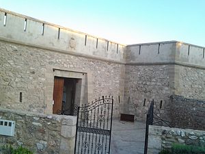
Castillo de las Escobetas
Castle in Garrucha, Andalusia, Spain
Distance: Approx. 6724 meters
Latitude and longitude: 37.1725,-1.823611
Castillo de las Escobetas ("Castle of the Nazarene") is located 3.25 miles (5.23 km) northward of Cantal Point, in the town of Garrucha, Almería province, in the autonomous community of Andalusia, Spain. The fishing village of Garrucha suffered at the hands of Berber pirates until the year 1766 when barracks were built at Escobetas, a provisional military building which cost 13,970 reais. In 1769, the castle was completed at a cost of 181,000 reais.
Weather in this IP's area
overcast clouds
19 Celsius
18 Celsius
19 Celsius
19 Celsius
1020 hPa
46 %
1020 hPa
998 hPa
10000 meters
2.49 m/s
3.41 m/s
197 degree
100 %
