Country:
Region:
City:
Latitude and Longitude:
Time Zone:
Postal Code:
IP information under different IP Channel
ip-api
Country
Region
City
ASN
Time Zone
ISP
Blacklist
Proxy
Latitude
Longitude
Postal
Route
Luminati
Country
ASN
Time Zone
Asia/Kolkata
ISP
Blue Lotus Support Services Pvt Ltd
Latitude
Longitude
Postal
IPinfo
Country
Region
City
ASN
Time Zone
ISP
Blacklist
Proxy
Latitude
Longitude
Postal
Route
db-ip
Country
Region
City
ASN
Time Zone
ISP
Blacklist
Proxy
Latitude
Longitude
Postal
Route
ipdata
Country
Region
City
ASN
Time Zone
ISP
Blacklist
Proxy
Latitude
Longitude
Postal
Route
Popular places and events near this IP address

Rajapalayam
Town in Tamil Nadu, India
Distance: Approx. 765 meters
Latitude and longitude: 9.4515,77.55430556
Rajapalayam (Tamil: [ɾaːdʑabaːɭaɪjam]) is a town in the Indian state of Tamil Nadu. It is the largest municipality in the Virudhunagar district. Rajapalayam is located on the Madurai to Quilon National Highway at a distance of 562 km south of the state capital Chennai.

Mamsapuram
Town in Tamil Nadu, India
Distance: Approx. 7008 meters
Latitude and longitude: 9.500027,77.586927
Mamsapuram is a town located in Srivilliputhur Taluk and comes under Srivilliputtur Assembly constituency & Tenkasi Lok Sabha constituency, Virudhunagar District in the Indian State of Tamil Nadu.

Maittanpatti
Village in Tamil Nadu, India
Distance: Approx. 6155 meters
Latitude and longitude: 9.4,77.57
Maittanpatti is a small village in kalligudi Taluk of Madurai district in the Indian state of Tamil Nadu.
Dhalavaipuram
Town in Tamil Nadu, India
Distance: Approx. 5640 meters
Latitude and longitude: 9.4,77.55
Dhalavaipuram or Dhalavaipuram is a town in Rajapalayam Virudhunagar district in the Indian state of Tamil Nadu. It is located 105 km southwest of Madurai in the state of Tamil Nadu. The economy is based on the manufacture of Garments, cotton sarees, lungis, Nighties, Inskirt, Brassiere and there are mills for spinning and weaving cotton.
Sundaranachiapuram
Village in Tamil Nadu, India
Distance: Approx. 293 meters
Latitude and longitude: 9.45,77.55
Sundaranachiyapuram is a village located nearby Rajapalayam, in Virudhunagar district, Tamil Nadu, India. It is a small village, with around 1300 families.
South Street Hindu Nadar Higher Secondary School
Private high school in Muhavoor, Tamil Nadu, Rajapalayam, India
Distance: Approx. 9745 meters
Latitude and longitude: 9.390063,77.483297
South Street Hindu Nadar Higher Secondary School (SSHN Higher Secondary School) is a private school located in the village of Muhavoor, at Rajapalayam Taluk, Virudhunagar District, Tamil Nadu State.

Rajapalayam Assembly constituency
One of the 234 State Legislative Assembly Constituencies in Tamil Nadu, in India
Distance: Approx. 293 meters
Latitude and longitude: 9.45,77.55
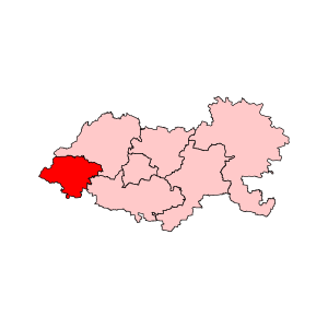
Rajapalayam is an assembly constituency located in Virudhunagar district in Tamil Nadu. It falls under Tenkasi Lok Sabha constituency. It is one of the 234 State Legislative Assembly Constituencies in Tamil Nadu, in India.
Rajapalaiyam taluk
Distance: Approx. 293 meters
Latitude and longitude: 9.45,77.55
Rajapalayam taluk is a taluk of Virudhunagar district of the Indian state of Tamil Nadu. The headquarters of the taluk is the town of Rajapalaiyam.
Sengapadai
Village in Tamil Nadu, India
Distance: Approx. 1385 meters
Latitude and longitude: 9.45,77.56
Sengapadai is a village 30 km (19 mi) southwest of Madurai city and 10 km southwest of Thirumangalam. The village was created by Koon Pandiyan, a Pandiya King, created the village as a military base on the banks of Gundar River, a distributary of River Vaigai. During an earlier period, the village was known as Sengol Padai (English: Military of Throne) which later became Sengapadai.
Rajapalayam block
Distance: Approx. 293 meters
Latitude and longitude: 9.45,77.55
Rajapalayam block is a revenue block in the Virudhunagar district of Tamil Nadu, India. It has a total of 36 panchayat villages.
Krishnapuram, Virudhunagar district
Village in Tamil Nadu, India
Distance: Approx. 5219 meters
Latitude and longitude: 9.42555556,77.50722222
Krishnapuram is a village in the Virudhunagar district in the state of Tamil Nadu, India. It is located on Kollam-Tirumangalam Road National Highways 744 and is about 7 km from Rajapalayam.

Ramco Institute of Technology
Engineering college in Tamil Nadu, India
Distance: Approx. 5102 meters
Latitude and longitude: 9.4828,77.51434
Ramco Institute of Technology (RIT), is an Engineering college in Rajapalayam, approved by AICTE and affiliated to Anna University, Chennai. Promoted by the Raja Charity Trust, the college started functioning in 2013-14.
Weather in this IP's area
scattered clouds
24 Celsius
25 Celsius
24 Celsius
24 Celsius
1011 hPa
81 %
1011 hPa
993 hPa
10000 meters
0.72 m/s
1.05 m/s
331 degree
34 %
06:10:55
17:55:59