Country:
Region:
City:
Latitude and Longitude:
Time Zone:
Postal Code:
IP information under different IP Channel
ip-api
Country
Region
City
ASN
Time Zone
ISP
Blacklist
Proxy
Latitude
Longitude
Postal
Route
Luminati
Country
ASN
Time Zone
Europe/Berlin
ISP
area-7 IT-Services GmbH
Latitude
Longitude
Postal
IPinfo
Country
Region
City
ASN
Time Zone
ISP
Blacklist
Proxy
Latitude
Longitude
Postal
Route
db-ip
Country
Region
City
ASN
Time Zone
ISP
Blacklist
Proxy
Latitude
Longitude
Postal
Route
ipdata
Country
Region
City
ASN
Time Zone
ISP
Blacklist
Proxy
Latitude
Longitude
Postal
Route
Popular places and events near this IP address

Bitz
German municipality
Distance: Approx. 576 meters
Latitude and longitude: 48.24388889,9.09083333
Bitz is a municipality in the Zollernalbkreis district of Baden-Württemberg, Germany.

Ebingen
Distance: Approx. 4657 meters
Latitude and longitude: 48.21666667,9.03333333
Ebingen is a town in the large district of Albstadt, district Zollernalbkreis, in the German state of Baden-Württemberg. It is located on the river Schmiecha, a left-hand tributary of the Danube, south of Tübingen and west of Ulm.

Albstadt
Town in Baden-Württemberg, Germany
Distance: Approx. 5532 meters
Latitude and longitude: 48.21194444,9.02388889
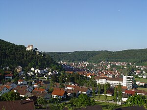
Albstadt (German pronunciation: [ˈalpʃtat] ) is the largest city in the district of Zollernalbkreis in Baden-Württemberg, Germany. It is located on the Swabian Jura mountains, about halfway between Stuttgart and Lake Constance.
Burladingen
German town
Distance: Approx. 5823 meters
Latitude and longitude: 48.29027778,9.10944444
Burladingen is a town in the Zollernalbkreis district of Baden-Württemberg, Germany.

Neufra
Municipality in Baden-Württemberg, Germany
Distance: Approx. 7292 meters
Latitude and longitude: 48.24666667,9.18277778
Neufra is a municipality in the district of Sigmaringen in Baden-Württemberg in Germany.
Straßberg, Zollernalbkreis
German municipality
Distance: Approx. 6719 meters
Latitude and longitude: 48.18027778,9.08777778
Straßberg is a municipality of the Zollernalb district of Baden-Württemberg, Germany.

Winterlingen
German municipality
Distance: Approx. 7143 meters
Latitude and longitude: 48.17972222,9.11527778
Winterlingen is a municipality in the Zollernalbkreis district of Baden-Württemberg, Germany.

Braunhardsberg
Distance: Approx. 5845 meters
Latitude and longitude: 48.24583333,9.00638889
Braunhardsberg is a mountain of Baden-Württemberg, Germany. It is located in Zollernalbkreis.

Himberg (Swabian Jura)
Distance: Approx. 8531 meters
Latitude and longitude: 48.3125,9.045
The Himberg is a mountain in Baden-Württemberg, Germany. It is located in the county of Zollernalbkreis.

Malesfelsen
Distance: Approx. 5562 meters
Latitude and longitude: 48.20277778,9.03583333
Malesfelsen is a mountain of the Swabian Jura in Germany. It is located at the edge of the Großer Heuberg plateau above the Schmiecha valley in Albstadt.
Ochsenberg (Swabian Jura)
Mountain in Baden-Württemberg, Germany
Distance: Approx. 8756 meters
Latitude and longitude: 48.23027778,8.96777778
The Ochsenberg is a mountain in Baden-Württemberg, Germany. It is located in the county of Zollernalbkreis.

Schlossfelsen
Distance: Approx. 4434 meters
Latitude and longitude: 48.21777778,9.03583333
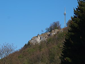
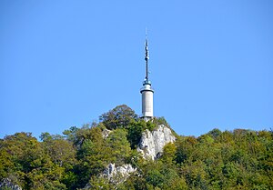
Schlossfelsen is a mountain of Baden-Württemberg, Germany. It is located in Albstadt, Zollernalbkreis. The mountain stands 958m above sea level (approximately 250m above Albstadt) and there is a 24m high observation tower Schlossfelsenturm near the summit.
Weather in this IP's area
scattered clouds
5 Celsius
5 Celsius
3 Celsius
7 Celsius
1026 hPa
95 %
1026 hPa
925 hPa
10000 meters
0.85 m/s
0.88 m/s
215 degree
26 %
07:15:43
16:58:47

