45.115.5.97 - IP Lookup: Free IP Address Lookup, Postal Code Lookup, IP Location Lookup, IP ASN, Public IP
Country:
Region:
City:
Location:
Time Zone:
Postal Code:
IP information under different IP Channel
ip-api
Country
Region
City
ASN
Time Zone
ISP
Blacklist
Proxy
Latitude
Longitude
Postal
Route
Luminati
Country
ASN
Time Zone
Asia/Kolkata
ISP
Gigantic Infotel Pvt Ltd
Latitude
Longitude
Postal
IPinfo
Country
Region
City
ASN
Time Zone
ISP
Blacklist
Proxy
Latitude
Longitude
Postal
Route
IP2Location
45.115.5.97Country
Region
delhi
City
azadpur
Time Zone
Asia/Kolkata
ISP
Language
User-Agent
Latitude
Longitude
Postal
db-ip
Country
Region
City
ASN
Time Zone
ISP
Blacklist
Proxy
Latitude
Longitude
Postal
Route
ipdata
Country
Region
City
ASN
Time Zone
ISP
Blacklist
Proxy
Latitude
Longitude
Postal
Route
Popular places and events near this IP address

Battle of Badli-ki-Serai
Distance: Approx. 1750 meters
Latitude and longitude: 28.71901308,77.16759832
The Battle of Badli-ki-Serai was fought early in the Indian Rebellion of 1857, or First War of Indian Independence as it has since been termed in Indian histories of the events. A British and Gurkha force defeated a force of sepoys who had rebelled against the British East India Company. The British victory enabled them to besiege and ultimately capture Delhi.
Model Town (Delhi)
Neighborhood of Delhi in North West Delhi, India
Distance: Approx. 1795 meters
Latitude and longitude: 28.718,77.1916
Model Town is an upscale neighbourhood situated in North Delhi, India. It was built in the early 1950s by the DLF Group, then known as Delhi Land and Finance, and is one of the first privately developed neighborhoods in Delhi. Model Town is a large area and divided into blocks and sub-colonies.
Derawal Nagar
Neighborhood of Delhi in North Delhi, India
Distance: Approx. 1477 meters
Latitude and longitude: 28.6974,77.1895
Derawal Nagar is a neighbourhood in North Delhi. It is named after people of the Derawal community. Originally native to the Derajat region (districts of Dera Ismail Khan and Dera Ghazi Khan in present-day Pakistan).

Adarsh Nagar metro station
Metro station in Delhi, India
Distance: Approx. 1362 meters
Latitude and longitude: 28.716535,77.17045194
The Adarsh Nagar metro station is located on the Yellow Line of the Delhi Metro. The metro station is a short walk (500-550 metre) from the Adarsh Nagar railway station.

Azadpur metro station
Metro station in Delhi, India
Distance: Approx. 158 meters
Latitude and longitude: 28.70730556,77.18
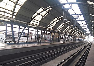
The Azadpur metro station is an interchange station of the Delhi Metro in New Delhi, India. It serves as an interchange between the Yellow Line and the Pink Line. After Phase 4 this will be the second station to have a 3 line interchange after Kashmere Gate with the extension of the Magenta Line.

Model Town metro station, Delhi
Metro station in Delhi, India
Distance: Approx. 1551 meters
Latitude and longitude: 28.70280556,77.19388889
The Model Town metro station is located on the Yellow Line of the Delhi Metro.
Chhatrasal Stadium
Sports venue in Delhi, India
Distance: Approx. 914 meters
Latitude and longitude: 28.7038,77.1874
The Chhatrasal Stadium is a sports stadium in North Delhi. The stadium is famous for its wrestlers, such as Yogeshwar Dutt, Ravi Kumar Dahiya, Sushil Kumar, Bajrang Punia, Amit Kumar Dahiya and Aman Sehrawat who have won medals at Olympics, Commonwealth Games, Asian Games and numerous world championships. The stadium also hosts athletics, basketball, archery, football and kabaddi matches.
Mata Jai Kaur Public School
Private school in Ashok Vihar, Delhi, India
Distance: Approx. 1604 meters
Latitude and longitude: 28.692231,77.179802
Mata Jai Kaur Public School is a private school in Ashok Vihar, Delhi, India. It was established in 1977 by Bhai Sahib Ditta Mal Ji in memory of his wife, Mata Jai Kaur Ji. It is managed by the Mata Jai Kaur Charitable Trust and affiliated to the Central Board of Secondary Education (CBSE).
Adarsh Nagar, Delhi Assembly constituency
Legislative assembly seat in Delhi
Distance: Approx. 1589 meters
Latitude and longitude: 28.72,77.173
Adarsh Nagar Assembly constituency is one of the seventy Delhi assembly constituencies of Delhi in northern India. Adarsh Nagar is also one of the most posh and upscale colonies in Delhi with large markets, wide roads and big bungalows. It is easily accessible by Delhi Metro, DTC or Metro Feeder Services.
Adarsh Nagar railway station
Railway station in Delhi, India
Distance: Approx. 1371 meters
Latitude and longitude: 28.7166,77.1704
Adarsh Nagar railway station is a small railway station in Adarsh Nagar, a residential and commercial neighborhood of the North West Delhi district of Delhi. Its code is ANDI. The station is part of Delhi Suburban Railway. The station consist of 4 platforms.

Shalimar Bagh metro station
Metro station in Delhi, India
Distance: Approx. 1413 meters
Latitude and longitude: 28.70181889,77.16519111
The Shalimar Bagh metro station is located on the Pink Line of the Delhi Metro.
Azadpur
Neighborhood in North Delhi, Delhi, India
Distance: Approx. 743 meters
Latitude and longitude: 28.71305556,77.17666667
Azadpur is one of the districts located in North Delhi India at Alipur Road near Delhi University pincode is 110033. It is adjoining to the Model Town, Kingsway Camp, GTB Nagar, and Shalimar Bagh. It falls under the parliamentary constituency of Adarsh Nagar.
Weather in this IP's area
mist
12 Celsius
12 Celsius
12 Celsius
12 Celsius
1015 hPa
94 %
1015 hPa
989 hPa
1400 meters