Country:
 Hungary
Region:
City:
Latitude and Longitude:
Time Zone:
Postal Code:
IP information under different IP Channel
ip-api
Country
Region
City
ASN
Time Zone
ISP
Blacklist
Proxy
Latitude
Longitude
Postal
Route
IPinfo
Country
Region
City
ASN
Time Zone
ISP
Blacklist
Proxy
Latitude
Longitude
Postal
Route
MaxMind
Country
Region
City
ASN
Time Zone
ISP
Blacklist
Proxy
Latitude
Longitude
Postal
Route
Luminati
Country
HUASN
Time Zone
Europe/Budapest
ISP
Invitech ICT Services Kft.
Latitude
Longitude
Postal
db-ip
Country
Region
City
ASN
Time Zone
ISP
Blacklist
Proxy
Latitude
Longitude
Postal
Route
ipdata
Country
Region
City
ASN
Time Zone
ISP
Blacklist
Proxy
Latitude
Longitude
Postal
Route
Popular places and events near this IP address

Devecser
Town in Central Transdanubia, Hungary
Distance: Approx. 328 meters
Latitude and longitude: 47.1061,17.4372
Devecser (Hungarian pronunciation: [ˈdɛvɛt͡ʃɛr]) is a town in Veszprém County, Hungary. In the Middle Ages there were five villages in the area of today's Devecser: Devecser, Kisdevecser, Szék, Meggyes, and Patony. These villages expanded in the 12th and 13th century.

Somló
Distance: Approx. 7086 meters
Latitude and longitude: 47.14775833,17.37118611
Somló (German: Schomlau, the corresponding adjective, meaning of Somló as in wines of Somló in Hungarian is: somlói) is an 832 hectare wine region in Veszprém county, in the North-West of Hungary. Most of the region is situated on the slopes of an extinct volcano, crowned by the ruins of an 11th-century castle, overlooking the plain. The wines of Somló, exclusively white, are made out of the grape varieties Hárslevelű, Furmint, Juhfark, Welschriesling, Traminer and Chardonnay.
Bodorfa
Place in Central Transdanubia, Hungary
Distance: Approx. 7815 meters
Latitude and longitude: 47.0764,17.3427
Bodorfa is a village in Veszprém county, Hungary.

Borszörcsök
Place in Veszprém, Hungary
Distance: Approx. 4153 meters
Latitude and longitude: 47.13305,17.40512
Borszörcsök is a village in Veszprém county, Hungary.
Kolontár
Place in Veszprém, Hungary
Distance: Approx. 3498 meters
Latitude and longitude: 47.084435,17.475021
Kolontár (Hungarian: [ˈkolontaːr]) is a village in Veszprém county, Hungary.
Nemeshany
Place in Veszprém, Hungary
Distance: Approx. 6615 meters
Latitude and longitude: 47.07032,17.36531
Nemeshany is a village in Veszprém county, Hungary.
Oroszi
Place in Veszprém, Hungary
Distance: Approx. 6097 meters
Latitude and longitude: 47.156,17.41659
Oroszi is a village in Veszprém county, Hungary.
Pusztamiske
Place in Veszprém, Hungary
Distance: Approx. 4879 meters
Latitude and longitude: 47.05995,17.44843
Pusztamiske is a village in Veszprém county, Hungary.
Somlójenő
Place in Veszprém, Hungary
Distance: Approx. 6830 meters
Latitude and longitude: 47.12512,17.3538
Somlójenő is a village in Veszprém county, Hungary.
Somlóvásárhely
Place in Veszprém, Hungary
Distance: Approx. 5079 meters
Latitude and longitude: 47.12042,17.37592
Somlóvásárhely is a village in Veszprém county, Hungary.

Ajka alumina plant accident
2010 industrial accident in Hungary
Distance: Approx. 4674 meters
Latitude and longitude: 47.08861111,17.49583333
The Ajka alumina plant accident in October 2010 was a caustic waste reservoir chain collapse at the Ajkai Timföldgyár alumina plant in Ajka, Veszprém County, in western Hungary. On 4 October 2010, at 12:25 CEST (10:25 UTC), the northwestern corner of the dam of reservoir number 10 collapsed, releasing approximately one million cubic metres (35 million cubic feet) of liquid waste from red mud lakes. The mud was released as a 1–2 m (3–7 ft) wave, flooding several nearby localities, including the village of Kolontár and the town of Devecser.
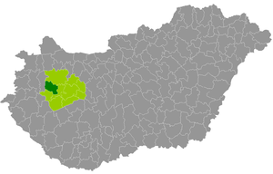
Devecser District
Districts of Hungary in Veszprém
Distance: Approx. 387 meters
Latitude and longitude: 47.1,17.44
Devecser District (Hungarian: Devecseri járás) is a district in the western part of Veszprém County. 'Devecser is also the name of the town where the district seat is found. The district is located in the Central Transdanubia Statistical Region.
Weather in this IP's area
broken clouds
17 Celsius
16 Celsius
15 Celsius
17 Celsius
1020 hPa
51 %
1020 hPa
999 hPa
10000 meters
4.08 m/s
8.89 m/s
134 degree
66 %
07:12:48
17:57:34