43.246.140.109 - IP Lookup: Free IP Address Lookup, Postal Code Lookup, IP Location Lookup, IP ASN, Public IP
Country:
Region:
City:
Location:
Time Zone:
Postal Code:
ISP:
ASN:
language:
User-Agent:
Proxy IP:
Blacklist:
IP information under different IP Channel
ip-api
Country
Region
City
ASN
Time Zone
ISP
Blacklist
Proxy
Latitude
Longitude
Postal
Route
db-ip
Country
Region
City
ASN
Time Zone
ISP
Blacklist
Proxy
Latitude
Longitude
Postal
Route
IPinfo
Country
Region
City
ASN
Time Zone
ISP
Blacklist
Proxy
Latitude
Longitude
Postal
Route
IP2Location
43.246.140.109Country
Region
himachal pradesh
City
nahan
Time Zone
Asia/Kolkata
ISP
Language
User-Agent
Latitude
Longitude
Postal
ipdata
Country
Region
City
ASN
Time Zone
ISP
Blacklist
Proxy
Latitude
Longitude
Postal
Route
Popular places and events near this IP address

Nahan
A town in Himachal Pradesh, India
Distance: Approx. 0 meters
Latitude and longitude: 30.55,77.3
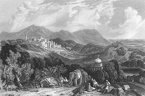
Nahan is a town in Himachal Pradesh in India and is the headquarters of the Sirmaur District. It was the capital of the former Sirmur princely state. Nahan is also known as the "town of ponds".
Suketi
Distance: Approx. 7483 meters
Latitude and longitude: 30.506,77.241
Suketi is a village in Sirmaur District, Himachal Pradesh, India. It has Asia's oldest Fossil park Shivalik Fossil Park.

Trilokpur temple
Hindu temple site in Himachal Pradesh, India
Distance: Approx. 8833 meters
Latitude and longitude: 30.54035,77.20855
Trilokpur (Hindi: त्रिलोकपुर) is a Hindu temple site in Himachal Pradesh, India. It is located on an hillock about 24 km south-west of Nahan at an elevation of about 430 m. The temple is an amalgam of Indo-Persian styles of architecture.
Roranwali
Distance: Approx. 3695 meters
Latitude and longitude: 30.56666667,77.26666667
Roranwali is a village in Hanumangarh district, Rajasthan state of western India. The town of Hanumangarh is the district headquarters. It is about 5 km (3.1 mi) north of Hanumangarh on Hanumangarh-Abohar road.

Battle of Jaithak
Battle of the Anglo-Nepalese War
Distance: Approx. 6233 meters
Latitude and longitude: 30.59593056,77.33720278
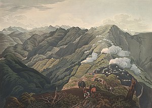
The Battle of Jaithak is the subsequent battle fought by the 53rd division of East India Company after the Battle of Nalapani against Nepalese forces. Nalapani had cost both sides dearly, but in Nahan and Jaithak, further West, they were to suffer more. Kazi Amar Singh Thapa’s son, Ranajor Singh Thapa, was in command there.
Jaitak Fort
Fort in Himachal Pradesh, India
Distance: Approx. 5634 meters
Latitude and longitude: 30.593,77.331
Jaitak Fort is situated about 15 km from district headquarters Nahan in District Sirmour in the Himachal Pradesh state of India. Situated 1479 meters above sea level, fort Jaitak is notable due to its location and affords a view of the surrounding countryside due to its strategic setting.

Nahan Assembly constituency
Legislative Assembly constituency in Himachal Pradesh State, India
Distance: Approx. 1469 meters
Latitude and longitude: 30.56,77.29
Nahan Assembly constituency is one of the 68 assembly constituencies of Himachal Pradesh a northern Indian state. Nahan is also part of Shimla Lok Sabha constituency.
Dr. Yashwant Singh Parmar Government Medical College
Medical school in Himachal Pradesh, India
Distance: Approx. 1661 meters
Latitude and longitude: 30.564,77.294
Dr. Yashwant Singh Parmar Government Medical College is a medical college located in Nahan, Sirmaur district of Himachal Pradesh. It was established in 2016 and was named after first Chief Minister of Himachal Pradesh Dr.
Weather in this IP's area
clear sky
16 Celsius
15 Celsius
16 Celsius
16 Celsius
1013 hPa
35 %
1013 hPa
938 hPa
10000 meters
2.08 m/s
1.7 m/s
9 degree