Country:
Region:
City:
Latitude and Longitude:
Time Zone:
Postal Code:
IP information under different IP Channel
ip-api
Country
Region
City
ASN
Time Zone
ISP
Blacklist
Proxy
Latitude
Longitude
Postal
Route
Luminati
Country
ASN
Time Zone
America/Chicago
ISP
AMAZON-AS
Latitude
Longitude
Postal
IPinfo
Country
Region
City
ASN
Time Zone
ISP
Blacklist
Proxy
Latitude
Longitude
Postal
Route
db-ip
Country
Region
City
ASN
Time Zone
ISP
Blacklist
Proxy
Latitude
Longitude
Postal
Route
ipdata
Country
Region
City
ASN
Time Zone
ISP
Blacklist
Proxy
Latitude
Longitude
Postal
Route
Popular places and events near this IP address

Wednesbury
Town in West Midlands, England
Distance: Approx. 1157 meters
Latitude and longitude: 52.552,-2.019
Wednesbury ( locally [ˈwɛnzbriː]) is a market town in the Sandwell district, in the county of the West Midlands, England - historically in Staffordshire. It is located near the source of the River Tame, and is part of the Black Country. Wednesbury is situated 5 miles (8km) south-east of Wolverhampton, 3 miles (4.4km) south-west of Walsall, and 7 miles (11.8km) north-west of Birmingham.

Wednesbury Parkway tram stop
West Midlands Metro tram stop
Distance: Approx. 662 meters
Latitude and longitude: 52.54968,-2.03202
Wednesbury Parkway tram stop is a tram stop in Wednesbury, Sandwell, England. It was opened on 31 May 1999 and has park and ride facilities. It is situated on West Midlands Metro Line 1.

Wednesbury Great Western Street tram stop
West Midlands Metro tram stop
Distance: Approx. 962 meters
Latitude and longitude: 52.54892,-2.02563
Wednesbury Great Western Street tram stop is a tram stop in Wednesbury, Sandwell, England. It was opened on 31 May 1999 and is situated on West Midlands Metro Line 1. The stop is next to the West Midlands Metro tram depot.
Gospel Oak School
Academy in Gospel Oak, Tipton, West Midlands, England
Distance: Approx. 1005 meters
Latitude and longitude: 52.55,-2.047222
Gospel Oak School (formerly The Royal Society of Arts (RSA) Academy and Willingsworth High School) is one of the new academies opened in England. The school's history dates back to September 1958, when Willingsworth Secondary Modern School to serve the Ocker Hill and Princes End areas of Tipton, replacing a smaller secondary modern at Ocker Hill and gaining comprehensive status in September 1969, when it became Willingsworth High. It became the RSA Academy in September 2008 and moved into its current buildings in September 2010, with the old buildings being demolished the following spring.

Wednesbury Town railway station
Former railway station in England
Distance: Approx. 1154 meters
Latitude and longitude: 52.5486,-2.0222
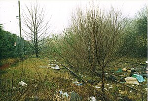
Wednesbury Town railway station was a station on the South Staffordshire Line.

Wednesbury bus station
Distance: Approx. 843 meters
Latitude and longitude: 52.552,-2.024
Wednesbury bus station is a bus interchange in the town of Wednesbury, in the West Midlands region of England.It is managed by Transport for West Midlands. Local bus services operated by various bus companies serve the bus station which has 12 departure stands. Wednesbury Great Western Street tram stop on the West Midlands Metro is a short walk away.

Wednesbury Central railway station
Former railway station in England
Distance: Approx. 874 meters
Latitude and longitude: 52.5494,-2.0267
Wednesbury Central railway station was a station on the Great Western Railway's London Paddington to Birkenhead via Birmingham Snow Hill line. It was opened as Wednesbury in 1854 and was one of two stations serving Wednesbury in the West Midlands. It was renamed to Wednesbury Central in 1950 following nationalisation.
Patent Shaft
Distance: Approx. 256 meters
Latitude and longitude: 52.553,-2.035
Patent Shaft, formerly The Patent Shaft and Axletree Company, established in 1840, was a steel=making company that operated large steelworks situated in Wednesbury, then in Staffordshire (now West Midlands), England, in a region known as the Black Country due to its industrialisation. It was in operation for 140 years, and employed hundreds of local people.

Bradley Branch
Distance: Approx. 1184 meters
Latitude and longitude: 52.5506,-2.0509
The Bradley Branch or Bradley Locks Branch was a short canal of the Birmingham Canal Navigations in the West Midlands, England. Completed in 1849, it included nine locks, and had a number of basins which enabled it to service local collieries and industrial sites. The locks were unusual, as they had a single gate at both ends, rather than double gates at the bottom end.

Wednesbury Museum and Art Gallery
Distance: Approx. 1039 meters
Latitude and longitude: 52.550552,-2.021995
Wednesbury Museum and Art Gallery is a purpose-built Victorian art gallery in Wednesbury in the West Midlands of England. It is notable for its Ruskin Pottery collection and for hosting the first public display of the Stuckism art movement.

Wednesbury Town Hall
Municipal building in Wednesbury, West Midlands, England
Distance: Approx. 1065 meters
Latitude and longitude: 52.5503,-2.0218
Wednesbury Town Hall is a municipal building in Holyhead Road in Wednesbury, West Midlands, England. The structure, which was the meeting place of Wednesbury Borough Council, now operates as an events venue.
St Bartholomew's Church, Wednesbury
Church in West Midlands, United Kingdom
Distance: Approx. 1012 meters
Latitude and longitude: 52.55583333,-2.02027778
St Bartholomew's Church is an Anglican church in Wednesbury in West Midlands, England. It is in the Diocese of Lichfield. The building, with medieval remains, was rebuilt and much modified in later centuries.
Weather in this IP's area
overcast clouds
7 Celsius
6 Celsius
7 Celsius
8 Celsius
1026 hPa
92 %
1026 hPa
1009 hPa
10000 meters
1.83 m/s
3.01 m/s
194 degree
99 %
07:21:41
16:22:37
