41.90.6.193 - IP Lookup: Free IP Address Lookup, Postal Code Lookup, IP Location Lookup, IP ASN, Public IP
Country:
Region:
City:
Location:
Time Zone:
Postal Code:
ISP:
ASN:
language:
User-Agent:
Proxy IP:
Blacklist:
IP information under different IP Channel
ip-api
Country
Region
City
ASN
Time Zone
ISP
Blacklist
Proxy
Latitude
Longitude
Postal
Route
db-ip
Country
Region
City
ASN
Time Zone
ISP
Blacklist
Proxy
Latitude
Longitude
Postal
Route
IPinfo
Country
Region
City
ASN
Time Zone
ISP
Blacklist
Proxy
Latitude
Longitude
Postal
Route
IP2Location
41.90.6.193Country
Region
nyeri
City
nyeri
Time Zone
Africa/Nairobi
ISP
Language
User-Agent
Latitude
Longitude
Postal
ipdata
Country
Region
City
ASN
Time Zone
ISP
Blacklist
Proxy
Latitude
Longitude
Postal
Route
Popular places and events near this IP address

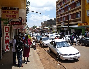
Nyeri
City in Nyeri County, Kenya
Distance: Approx. 466 meters
Latitude and longitude: -0.41666667,36.95
Nyeri is a town situated in the Central Highlands of Kenya. It is the county headquarters of Nyeri County and was the central administrative headquarters of the country's former Central Province. The town is situated about 150 km north of Kenya's capital Nairobi, in the country's densely populated and fertile Central Highlands.

Treetops Hotel
Building in Kenya
Distance: Approx. 8496 meters
Latitude and longitude: -0.36,36.90055556
Treetops Hotel is a hotel in Aberdare National Park in Kenya ten miles (16 km) from the township of Nyeri, 1,966 metres (6,450 ft) above sea level on the Aberdare Range and in sight of Mount Kenya. First opened in November 1932 by Eric Sherbrooke Walker, it was built into the tops of the trees of Aberdare National Park as a treehouse, offering the guests a close view of the local wildlife. The idea was to provide a machan (hunting platform on a tree during shikar in India) experience in relative safety and comfort.

Nyeri County
County in Kenya
Distance: Approx. 466 meters
Latitude and longitude: -0.41666667,36.95
Nyeri County is a county located in the central region of Kenya. Its capital and largest town is Nyeri. It had a population of 759,164 according to the 2019 census and an area of 2361 km2.
Tetu, Kenya
Distance: Approx. 3745 meters
Latitude and longitude: -0.43333333,36.91666667
Tetu is a sub-county in Nyeri County, Kenya. It is located west of adjacent Nyeri town, the county capital. Tetu Constituency is also the name of the local electoral constituency.

Outspan Hotel
Building in Nyeri, Kenya
Distance: Approx. 652 meters
Latitude and longitude: -0.4209,36.9418
The Outspan Hotel is in Nyeri, Kenya. It was built up from an old farm by Eric Sherbrooke Walker in the 1920s. Walker had purchased 28 hectares (69 acres) of Crown Land in Nyeri and in 1928, opened the Outspan Hotel, overlooking the gorge of a river in the Aberdare Range.

Roman Catholic Archdiocese of Nyeri
Roman Catholic archdiocese in Kenya
Distance: Approx. 901 meters
Latitude and longitude: -0.4263,36.9528
The Roman Catholic Archdiocese of Nyeri (Latin: Archidioecesis Nyeriensis) is the Metropolitan See for the ecclesiastical province of Nyeri, one of four in Kenya, Eastern Africa, yet depends on the missionary Roman Congregation for the Evangelization of Peoples. The cathedral episcopal see of the archbishop is Our Lady of Consolata Cathedral, in Nyeri.
Nyeri High School
Boys boarding school in Nyeri, Kenya
Distance: Approx. 3300 meters
Latitude and longitude: -0.407924,36.920571
Nyeri High School, also known as Nyeri High, is a boys boarding school situated in Nyeri, Kenya near Mathari Consolata Mission Hospital, which provides secondary education as stipulated by the 8-4-4 Curriculum. Despite being acknowledged as an academic giant in the region, the school has also developed a notoriety for student unrest culminating in the death of four school prefects in a fire caused by student arson and followed a few years later by a student strike that led to an official government inquiry into the running of the school. In 2006, Nyeri High School was ranked 22nd best high school in Kenya based on Kenya Certificate of Secondary Education results.

Dedan Kimathi University of Technology
University in Nyeri, Kenya
Distance: Approx. 3215 meters
Latitude and longitude: -0.3953,36.9624
Dedan Kimathi University of Technology (or DeKUT) is a public, coeducational technological university in Nyeri, Kenya. It is one of 22 public universities in Kenya, having been a constituent college of Jomo Kenyatta University of Agriculture and Technology since the year 2007 until it was chartered to become a fully fledged public university on 14 December 2012. It was the first university in Kenya to be chartered under the new universities act of 2012 and the eighth public university to be established in the country.
Ithenguri
Place in Central Province, Kenya
Distance: Approx. 6089 meters
Latitude and longitude: -0.47,36.97
Ithenguri is a settlement in Kenya's Central Province. Ithenguri is a village located in Nyeri Central District, Nyeri County near the border between Nyeri Municipality and Tetu Division, it is in Ruring'u Location formally known as Mukaro Location and in Chorong'i Sub-Location. It is an agricultural area which is about 6 km away from Nyeri town.
Nyeri Airport
Airport in Nyeri, Kenya
Distance: Approx. 6599 meters
Latitude and longitude: -0.37138889,36.98138889
Nyeri Airport (IATA: NYE, ICAO: HKNI) is an airport in Nyeri County, Kenya.
Nyeri District
A former district of Kenya
Distance: Approx. 466 meters
Latitude and longitude: -0.41666667,36.95
Nyeri District was a district in the Central Province of Kenya. Its headquarters was in Nyeri town. It had an area of 3,356 km2.
Nyeri Museum
History museum in Nyeri, Kenya
Distance: Approx. 2874 meters
Latitude and longitude: -0.43998,36.964068
The Nyeri Museum (Swahili: Makumbusho ya Nyeri) is a history museum located in Nyeri, Kenya. The museum is dedicated to the history of Kenya and the Kikuyu culture.
Weather in this IP's area
clear sky
13 Celsius
13 Celsius
13 Celsius
13 Celsius
1018 hPa
85 %
1018 hPa
824 hPa
10000 meters
1.7 m/s
1.41 m/s
240 degree
5 %