41.86.63.215 - IP Lookup: Free IP Address Lookup, Postal Code Lookup, IP Location Lookup, IP ASN, Public IP
Country:
Region:
City:
Location:
Time Zone:
Postal Code:
ISP:
ASN:
language:
User-Agent:
Proxy IP:
Blacklist:
IP information under different IP Channel
ip-api
Country
Region
City
ASN
Time Zone
ISP
Blacklist
Proxy
Latitude
Longitude
Postal
Route
db-ip
Country
Region
City
ASN
Time Zone
ISP
Blacklist
Proxy
Latitude
Longitude
Postal
Route
IPinfo
Country
Region
City
ASN
Time Zone
ISP
Blacklist
Proxy
Latitude
Longitude
Postal
Route
IP2Location
41.86.63.215Country
Region
grand anse praslin
City
anse kerlan
Time Zone
Indian/Mahe
ISP
Language
User-Agent
Latitude
Longitude
Postal
ipdata
Country
Region
City
ASN
Time Zone
ISP
Blacklist
Proxy
Latitude
Longitude
Postal
Route
Popular places and events near this IP address
Curieuse Island
Island & national park in the Seychelles
Distance: Approx. 4977 meters
Latitude and longitude: -4.28333333,55.72361111
Curieuse Island is a small granitic island 1.13 sq mi (2.9 km2) in the Seychelles close to the north coast of the island of Praslin. Curieuse is notable for its bare red earth intermingled with the unique coco de mer palms, one of the cultural icons of the Seychelles, only growing on the two neighboring islands.
Cousin Island
Island in Seychelles
Distance: Approx. 3625 meters
Latitude and longitude: -4.33,55.66333333
Cousin Island is a small (29 ha) granitic island of the Seychelles, lying 2 km (1.2 mi) west of Praslin. It is a nature reserve protected under Seychelles law as a Special Reserve. It is managed by Nature Seychelles, a national nonprofit organization and Partner of BirdLife International, by which it has been identified as an Important Bird Area.

Baie Saint Anne
District in Seychelles
Distance: Approx. 5565 meters
Latitude and longitude: -4.31667,55.7333
Baie Sainte Anne (French pronunciation: [bɛ sɛ̃t an]) is an administrative district of Seychelles located mostly on the island of Praslin, but also administers Curieuse Island and some other smaller islands.

Grand'Anse Praslin
District in Seychelles
Distance: Approx. 5085 meters
Latitude and longitude: -4.33111111,55.72222222
Grand'Anse Praslin is an administrative district of Seychelles located mostly on the island of Praslin, but also administers Cousin Island, Cousine Island, Booby Island, and Aride Island.

Vallée de Mai
Protected area
Distance: Approx. 6460 meters
Latitude and longitude: -4.32916667,55.7375
Vallée de Mai Nature Reserve ("May Valley") is a nature park and UNESCO World Heritage Site on the island of Praslin, Seychelles. It consists of a well-preserved palm forest, flagship species made up of the island endemic coco de mer, as well as five other endemic palms. The coco de mer (Lodoicea maldivica), a monocot tree in the Arecaceae (palm family), has the largest seeds (double nut seed) of any plant in the world.
Anse Lazio
Beach situated in the northwest of Praslin Island, Seychelles
Distance: Approx. 2301 meters
Latitude and longitude: -4.29361111,55.70166667
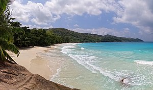
Anse Lazio is a beach situated in the northwest of Praslin Island, Seychelles, considered by Lonely Planet to be the "best beach on Praslin", and one of the "best in the archipelago".

Praslin National Park and surrounding areas Important Bird Area
National park in the Seychelles
Distance: Approx. 6260 meters
Latitude and longitude: -4.33333333,55.73333333
The Praslin National Park and surrounding areas Important Bird Area lies in the southern part of the island of Praslin in the Seychelles archipelago of the western Indian Ocean.
Booby Island (Seychelles)
Distance: Approx. 5191 meters
Latitude and longitude: -4.26,55.673
Booby is an island in Seychelles, lying north of Praslin and south of Aride Island. It has an area of 2.3& hectares. Booby Island is a high granite rock, densely covered with tropical vegetation.
Round Island, Praslin
Island in Seychelles
Distance: Approx. 3625 meters
Latitude and longitude: -4.33,55.66333333
Round is an island in Seychelles, lying less than a mile (550 m) southeast of the island of Praslin tilted a little to the southeast of Praslin's easternmost Peninsula and 48 km north-east of the island of Mahe
Revengers FC
Football club
Distance: Approx. 1875 meters
Latitude and longitude: -4.32138889,55.68916667
Revengers Football Club also known as Revengers FC is a Seychellois football club based in Praslin, Seychelles. The club competes in Seychelles' premier league, the Seychelles First Division.
Stade d'Amitié
Distance: Approx. 1902 meters
Latitude and longitude: -4.3216,55.6893
Stade d’Amitié or Amitié Stadium is a multi-purpose stadium located in Praslin, Seychelles. It is used mostly for football matches and is the home stadium of Seychellois football clubs Revengers FC and Côte d'Or FC. In 2006 and 2010, two Goal Projects by FiFA were approved at the stadium. The first one replaced the natural grass pitch with artificial turf, and the second one included the construction of terraces, dressing rooms, toilets, and lights.

Anse Georgette
Beach in Praslin island, Seychelles
Distance: Approx. 1207 meters
Latitude and longitude: -4.29495995,55.68093252
Anse Georgette is a beach situated in the northwestern coast of Praslin, Seychelles. It is ranked among the top 10 best beaches in the world for 2024.
Weather in this IP's area
overcast clouds
27 Celsius
29 Celsius
27 Celsius
27 Celsius
1011 hPa
76 %
1011 hPa
1010 hPa
10000 meters
4.39 m/s
4.6 m/s
267 degree
94 %
