Country:
Region:
City:
Latitude and Longitude:
Time Zone:
Postal Code:
IP information under different IP Channel
ip-api
Country
Region
City
ASN
Time Zone
ISP
Blacklist
Proxy
Latitude
Longitude
Postal
Route
Luminati
Country
Region
kzn
City
lamercy
ASN
Time Zone
Africa/Johannesburg
ISP
DUBETRADEPORT
Latitude
Longitude
Postal
IPinfo
Country
Region
City
ASN
Time Zone
ISP
Blacklist
Proxy
Latitude
Longitude
Postal
Route
db-ip
Country
Region
City
ASN
Time Zone
ISP
Blacklist
Proxy
Latitude
Longitude
Postal
Route
ipdata
Country
Region
City
ASN
Time Zone
ISP
Blacklist
Proxy
Latitude
Longitude
Postal
Route
Popular places and events near this IP address

EMdloti
Village in KwaZulu-Natal, South Africa
Distance: Approx. 3310 meters
Latitude and longitude: -29.66666667,31.11666667
eMdloti, alternatively rendered Umdloti and also known as Umdloti Beach, is a small resort village situated along the KwaZulu-Natal North Coast, South Africa. It lies at the mouth of the Mdloti River approximately 24 km north-east (14,9 mi) of Durban and 11 km (6.8 mi) north-east of uMhlanga and now forms part of eThekwini, the Greater Durban Metropolitan Municipality. The name Mdloti is the Zulu word for a species of wild tobacco that grows here.

Verulam, KwaZulu-Natal
Place in KwaZulu-Natal, South Africa
Distance: Approx. 8420 meters
Latitude and longitude: -29.65,31.05
Verulam () is a town 24 kilometres north of Durban in KwaZulu-Natal, South Africa and forms part of the eThekwini Metropolitan Municipality, governing the Greater Durban metropolitan area.

Ohlanga River
River in South Africa
Distance: Approx. 7559 meters
Latitude and longitude: -29.7025,31.1
The Ohlanga River is a river in KwaZulu-Natal, South Africa, which empties into the Indian Ocean just north of uMhlanga, north of Durban. The river has extensive reed beds in the estuary at its mouth, which is only 7 km southwest from the mouth of the uMdloti River. Presently, this river is part of the Mvoti to Umzimkulu Water Management Area.
Crawford College, North Coast
School in South Africa
Distance: Approx. 5894 meters
Latitude and longitude: -29.592037,31.155029
Crawford College, North Coast is an alternative, independent school in Westbrook, between oThongathi, Ballito and eMdloti on the North Coast of KwaZulu-Natal, South Africa. The school is owned by the ADvTECH Group and is run as a for-profit business enterprise. Crawford College, North Coast was founded in 1997 on the campus of uThongathi School by Graeme Crawford.

King Shaka International Airport
Airport serving Durban, South Africa
Distance: Approx. 3969 meters
Latitude and longitude: -29.61666667,31.10833333
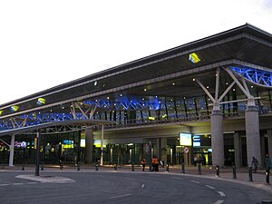
King Shaka International Airport (IATA: DUR, ICAO: FALE), abbreviated KSIA, pronounced as (Kīng Shāk(k)ā Internashonāl Ay(ir)port), is the primary international airport serving Durban, South Africa. It is located in La Mercy, KwaZulu-Natal, approximately 35 km (22 mi) north of the city centre of Durban. The airport opened its doors to passengers on May 1, 2010, 41 days before the start of the 2010 FIFA World Cup.
La Mercy
Place in KwaZulu-Natal, South Africa
Distance: Approx. 1068 meters
Latitude and longitude: -29.63333333,31.13333333
La Mercy is a suburb of the eThekwini municipality about 27 km (17 mi) north of Durban, South Africa. It is the location of Durban's King Shaka International Airport. It has four distinct areas - The airport precinct, the main residential area, a shanty town, and a beach-front strip of apartments along South Beach Road.
Mount Moreland
Place in KwaZulu-Natal, South Africa
Distance: Approx. 5254 meters
Latitude and longitude: -29.63333333,31.08333333
Mount Moreland is a small community located in the eThekwini municipality in KwaZulu-Natal, South Africa. It is located slightly inland of Umdloti, just over 30 kilometres (19 mi) north of the city of Durban, and 2.6 kilometres (1.6 mi) to the south of Durban's King Shaka International Airport. The community is known as being the location of an important roosting site for the European barn swallow and accordingly attracts visitors to the area mid October to mid April.

Umhlanga Lagoon Nature Reserve
Nature reserve in South Africa
Distance: Approx. 8329 meters
Latitude and longitude: -29.70916667,31.0975
uMhlanga Lagoon is a 26 hectares (64 acres) nature reserve on the shore of the Indian Ocean at uMhlanga Rocks, South Africa. The reserve encloses the Ohlanga River's lagoon and mouth. The forest forms a natural extension of the less accessible Hawaan Forest, of which the greater part lies inland of the busy M4 road.

Mdloti River
River in South Africa
Distance: Approx. 1266 meters
Latitude and longitude: -29.65111111,31.12805556
The Mdloti River or uMdloti River flows in the KwaZulu-Natal province, South Africa. The mouth of the Mdloti River is situated in eMdloti (part of eThekwini Metropolitan Municipality). The name Mdloti is the Zulu word for a species of wild tobacco that grows here.
UThongathi School
Distance: Approx. 5894 meters
Latitude and longitude: -29.592037,31.155029
uThongathi School was a high school near oThongathi, KwaZulu-Natal, South Africa. The school opened in January 1986. The school was the first nonracial school established by the New Era Schools Trust (NEST).
Sibaya Casino and Entertainment Kingdom
An entertainment complex near uMhlanga, South Africa
Distance: Approx. 5624 meters
Latitude and longitude: -29.6819,31.1002
Sibaya Casino and Entertainment Kingdom is an entertainment complex situated just north of uMhlanga and south-west of eMdloti on the North Coast of KwaZulu-Natal, South Africa. Sibaya, owned by resort hotel chain and casino destination, Sun International is one of the two casinos in the Greater Durban metropolitan area with the other one being Suncoast located in the city.
Westbrook, South Africa
Place in KwaZulu-Natal, South Africa
Distance: Approx. 5915 meters
Latitude and longitude: -29.59222222,31.15638889
Westbrook, also known as Westbrook Beach is a coastal village on the North Coast of the KwaZulu-Natal province of South Africa, approximately 35 kilometres (22 mi) north-east of Durban and 7 kilometres (4 mi) east of oThongathi.
Weather in this IP's area
clear sky
31 Celsius
36 Celsius
31 Celsius
31 Celsius
1007 hPa
66 %
1007 hPa
1007 hPa
10000 meters
3.09 m/s
50 degree
04:50:42
18:30:57
