Country:
Region:
City:
Latitude and Longitude:
Time Zone:
Postal Code:
IP information under different IP Channel
ip-api
Country
Region
City
ASN
Time Zone
ISP
Blacklist
Proxy
Latitude
Longitude
Postal
Route
Luminati
Country
Region
8
City
aguelhok
ASN
Time Zone
Africa/Bamako
ISP
IKATELNET
Latitude
Longitude
Postal
IPinfo
Country
Region
City
ASN
Time Zone
ISP
Blacklist
Proxy
Latitude
Longitude
Postal
Route
db-ip
Country
Region
City
ASN
Time Zone
ISP
Blacklist
Proxy
Latitude
Longitude
Postal
Route
ipdata
Country
Region
City
ASN
Time Zone
ISP
Blacklist
Proxy
Latitude
Longitude
Postal
Route
Popular places and events near this IP address
Aguelhok
Commune and town in Kidal Region, Mali
Distance: Approx. 1181 meters
Latitude and longitude: 19.465,0.856
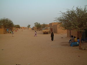
Aguelhok also known as Adjelhoc (the official name) is a rural commune and village in the Kidal Region of eastern Mali in the Tessalit Cercle. In the census of 2009 the commune had a population of 8,080.
Battle of Aguelhok (2012)
Distance: Approx. 1189 meters
Latitude and longitude: 19.465,0.855
The Battle of Aguelhok (also called the Aguelhok Massacre) occurred when rebels from the National Movement for the Liberation of Azawad (MNLA) and Islamists groups Ansar Dine and Al-Qaeda in the Islamic Maghreb attacked a Malian army garrison base in the town of Aguelhok, Kidal Region of Northern Mali on 17 January 2012, as part of the larger Tuareg rebellion to seize all government bases in the region. The attack was led by Colonel Moussa Ag, a Malian army deserter to the MNLA. The military base was overrun on 25 January, after the Malian army garrison ran out of ammunition and surrendered.
2021 Aguelhok attack
Distance: Approx. 1186 meters
Latitude and longitude: 19.465,0.8575
On April 2, 2021, insurgents from the al-Qaeda-linked group Jama'at Nasr al-Islam wal Muslimin (JNIM) attacked a contingent of Chadian troops serving in MINUSMA, the UN's peacekeeping branch throughout the Mali War. The Chadian troops effectively repelled the JNIM attack, inflicting heavy casualties.
2019 Aguelhok attack
Attack by Jama'at Nasr al-Islam wal Muslimin against the MINUSMA
Distance: Approx. 1186 meters
Latitude and longitude: 19.465,0.8575
The 2019 Aguelhok attack was an attack by Jama'at Nasr al-Islam wal Muslimin against the MINUSMA base in Aguelhok, Mali on January 20, 2019. At the time of the attack, the base was defended by Chadian and Bengali peacekeepers and was later aided by French forces as part of Operation Barkhane.
2016 Aguelhok ambush
2016 militants attack on Chadian forces in Aguelhok, Mali
Distance: Approx. 1777 meters
Latitude and longitude: 19.47,0.86
On May 18, 2016, militants from Ansar Dine ambushed Chadian forces north of Aguelhok, Mali.
2014 Aguelhok attack
Suicide bombing in Mali
Distance: Approx. 1189 meters
Latitude and longitude: 19.465,0.855
On 11 June 2014, a suicide bomber attacked the MINUSMA base in Aguelhok, Mali, killing several Chadian peacekeepers.
Weather in this IP's area
overcast clouds
25 Celsius
24 Celsius
25 Celsius
25 Celsius
1016 hPa
14 %
1016 hPa
969 hPa
10000 meters
4.67 m/s
7.46 m/s
89 degree
100 %
06:05:29
17:17:36
