41.63.110.83 - IP Lookup: Free IP Address Lookup, Postal Code Lookup, IP Location Lookup, IP ASN, Public IP
Country:
Region:
City:
Location:
Time Zone:
Postal Code:
IP information under different IP Channel
ip-api
Country
Region
City
ASN
Time Zone
ISP
Blacklist
Proxy
Latitude
Longitude
Postal
Route
Luminati
Country
Region
eng
City
hull
ASN
Time Zone
Europe/London
ISP
LLNW-SPS
Latitude
Longitude
Postal
IPinfo
Country
Region
City
ASN
Time Zone
ISP
Blacklist
Proxy
Latitude
Longitude
Postal
Route
IP2Location
41.63.110.83Country
Region
england
City
sutton on hull
Time Zone
Europe/London
ISP
Language
User-Agent
Latitude
Longitude
Postal
db-ip
Country
Region
City
ASN
Time Zone
ISP
Blacklist
Proxy
Latitude
Longitude
Postal
Route
ipdata
Country
Region
City
ASN
Time Zone
ISP
Blacklist
Proxy
Latitude
Longitude
Postal
Route
Popular places and events near this IP address

Hall Road Rangers F.C.
Association football club in England
Distance: Approx. 1526 meters
Latitude and longitude: 53.7812,-0.3281
Hall Road Rangers Football Club is a football club based in Kingston upon Hull, East Riding of Yorkshire, England.

Bransholme
Housing estate in Kingston upon Hull, England
Distance: Approx. 1328 meters
Latitude and longitude: 53.78297,-0.32451
Bransholme is an area and a housing estate on the north side of Kingston upon Hull, East Riding of Yorkshire, England. The name Bransholme comes from an old Scandinavian word meaning Brand's water meadow (brand or brandt meant 'wild boar'). The largely council owned estate is located in between Sutton-on-Hull to the east, Sutton Park to the south, and Kingswood to the west.

Malet Lambert School
Academy in Kingston upon Hull, East Riding of Yorkshire, England
Distance: Approx. 1337 meters
Latitude and longitude: 53.76803,-0.30192
Malet Lambert is a secondary school for 11- to 16-year-old pupils in Kingston upon Hull, East Riding of Yorkshire, England. The school is situated on James Reckitt Avenue in the east of the city, its front facade overlooks East Park. Malet Lambert opened in 1932 and became a grammar school in 1944 before becoming a community comprehensive in 1969.

Sutton-on-Hull railway station
Disused railway station in Sutton-on-Hull, East Riding of Yorkshire, England
Distance: Approx. 266 meters
Latitude and longitude: 53.7819,-0.3072
Sutton-on-Hull railway station was a railway station that served the village of Sutton-on-Hull in the East Riding of Yorkshire, England. It was on the Hull and Hornsea Railway. The station opened on 28 March 1864, and was originally named "Sutton", on 1 December 1874 the station became "Sutton-on-Hull".

Wilberforce College
School in Hull, East Riding of Yorkshire, England
Distance: Approx. 1840 meters
Latitude and longitude: 53.77423,-0.27873
Wilberforce College is a further education Sixth Form College in Hull, England.

East Park, Kingston upon Hull
Park in Kingston upon Hull, East Riding of Yorkshire, England
Distance: Approx. 1590 meters
Latitude and longitude: 53.76583,-0.30083
East Park is a major park of about 120 acres (49 ha) situated on the Holderness Road in Hull, East Riding of Yorkshire, England. East Park is registered a Grade II listed site by English Heritage. It is the largest public park in Hull and is often used for large open-air venues such as concerts and the annual Hull Show.

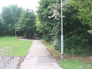
Sutton-on-Hull
Suburb of Kingston upon Hull, East Riding of Yorkshire, England
Distance: Approx. 79 meters
Latitude and longitude: 53.780585,-0.304695
Sutton-on-Hull (also known as Sutton-in-Holderness) is a suburb of the city of Kingston upon Hull, in the ceremonial county of the East Riding of Yorkshire, England. It is located 3 miles (4.8 km) north east of the city centre and has the B1237 road running through it which connects the A165 road with the A1033.

Sutton Ings
Distance: Approx. 266 meters
Latitude and longitude: 53.7819,-0.3072
Sutton Ings is a suburb of Kingston upon Hull, in the East Riding of Yorkshire, England. It was served by Sutton-on-Hull railway station. It is near the larger area of Sutton-on-Hull.

Stoneferry
Suburb of Kingston upon Hull, England
Distance: Approx. 1734 meters
Latitude and longitude: 53.768,-0.322
Stoneferry (archaic Stone-Ferry, or Stone ferry) is a suburb of Kingston upon Hull, East Riding of Yorkshire, England. It was formerly a small hamlet on the east bank of the River Hull, the site of a ferry, and, after 1905, a bridge. The area is primarily industrial, and is situated on the east bank of the river, as well as close by areas on the west bank.

Winifred Holtby Academy
Academy in Kingston upon Hull, East Riding of Yorkshire, England
Distance: Approx. 1104 meters
Latitude and longitude: 53.7841,-0.3202
Winifred Holtby Academy (previously Bransholme High School, Winifred Holtby School, Winifred Holtby Technology College) is a coeducational secondary school located in the Bransholme area of Kingston upon Hull in the East Riding of Yorkshire, England. The school is named after Winifred Holtby, a novelist and journalist who is best known for her novel South Riding. Originally known as Bransholme High School, the school was later renamed Winifred Holtby School, and some time later, Winifred Holtby Technology College.

RAF Sutton on Hull
Royal Air Force base in Yorkshire, England
Distance: Approx. 1575 meters
Latitude and longitude: 53.78952778,-0.32255556
Royal Air Force Sutton on Hull or more simply RAF Sutton on Hull is a former Royal Air Force station situated in the suburb of Sutton-on-Hull (part of Kingston upon Hull) in the East Riding of Yorkshire that operated from 1938 to 1961. During the Second World War, its primary role was to operate as No. 17 Balloon Centre of 33 Group (under RAF Balloon Command) which was headquartered in Sheffield.

Princess Royal Hospital, Kingston upon Hull
Hospital in Kingston upon Hull, East Riding of Yorkshire, England
Distance: Approx. 1713 meters
Latitude and longitude: 53.7768,-0.2795
The Princess Royal Hospital, Kingston upon Hull was an acute general hospital in Kingston upon Hull, England.
Weather in this IP's area
mist
3 Celsius
-0 Celsius
2 Celsius
3 Celsius
1038 hPa
41 %
1038 hPa
1036 hPa
6000 meters
2.57 m/s
220 degree
100 %