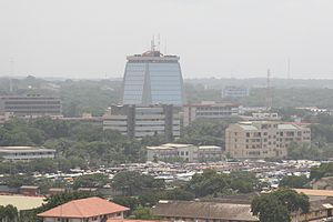
Country:
 Ghana
GhanaRegion:
City:
Latitude and Longitude:
Time Zone:
Postal Code:
IP information under different IP Channel
ip-api
Country
Region
City
ASN
Time Zone
ISP
Blacklist
Proxy
Latitude
Longitude
Postal
Route
IPinfo
Country
Region
City
ASN
Time Zone
ISP
Blacklist
Proxy
Latitude
Longitude
Postal
Route
MaxMind
Country
Region
City
ASN
Time Zone
ISP
Blacklist
Proxy
Latitude
Longitude
Postal
Route
Luminati
Country
GHASN
Time Zone
Africa/Accra
ISP
Airtel-Ghana
Latitude
Longitude
Postal
db-ip
Country
Region
City
ASN
Time Zone
ISP
Blacklist
Proxy
Latitude
Longitude
Postal
Route
ipdata
Country
Region
City
ASN
Time Zone
ISP
Blacklist
Proxy
Latitude
Longitude
Postal
Route
Popular places and events near this IP address

National Museum of Ghana
Museum in Accra, Ghana
Distance: Approx. 287 meters
Latitude and longitude: 5.56041667,-0.20641667
The National Museum, also known as the National Museum of Ghana, is a museum located in Accra, Ghana. Established in 1957, it is the largest and oldest of the six museums under the administration of the Ghana Museums and Monuments Board (GMMB). The museum closed in 2015 for restoration until eventually reopening in 2022.

Ghana Stock Exchange
Stock exchange in Ghana
Distance: Approx. 447 meters
Latitude and longitude: 5.555605,-0.202153
The Ghana Stock Exchange (GSE) is the principal stock exchange of Ghana. The exchange was incorporated in July 1989 with trading commencing in 1990. It currently lists 42 equities (from 37 companies) and 2 corporate bonds.
West Ridge, Accra
Historic site in N: Castle Road, E: Independence Avenue
Distance: Approx. 243 meters
Latitude and longitude: 5.559025,-0.20335
West Ridge is a neighbourhood of Accra, Ghana, bounded to the south by Kinbu Gardens. Barnes Road serves as the neighbourhood's western boundary, while the Independence Avenue/Liberation Avenue is the eastern boundary. Castle Road separates West Ridge from the northern neighbourhood of North Ridge.
Ministry of Food and Agriculture (Ghana)
Government of Ghana Agency for Agriculture
Distance: Approx. 97 meters
Latitude and longitude: 5.55894,-0.205196
Ghana's Ministry of Food and Agriculture (MOFA) is the government agency responsible for the development and growth of agriculture in the country. The jurisdiction does not cover the cocoa, coffee, or forestry sectors. The primary organisation and main area of the presidential administration of Ghana is the nation's Ministry of Food and Agriculture (MOFA), which is in charge of creating and carrying out policies and plans for the agricultural sector within the framework of an efficient national socio-economic development and prosperity agenda.
Ministry of Roads and Highways (Ghana)
Distance: Approx. 716 meters
Latitude and longitude: 5.553075,-0.201264
The Ministry of Roads and Highways (MRH) is an agency of the Government of Ghana responsible for formulating policies, coordinating sector performance, monitoring and evaluating road infrastructure, development, financing, road construction and road maintenance in Ghana.
African University College of Communications
Private tertiary institution in Accra, Ghana
Distance: Approx. 709 meters
Latitude and longitude: 5.558098,-0.211731
The African University College of Communications is a private tertiary institution at Adabraka, Accra, Ghana, for the study and teaching of journalism, communication studies, information technology convergence, business, African Studies, providing opportunities for advanced learning, and practical and professional training for the rapid growth and development of Africa. The university admitted the first batch of Diploma students for its Communication Studies programme in 2002, and was formally accredited as a tertiary institution by the National Accreditation Board (NAB) of Ghana in 2004.
Cedi House
Offices,Banks in Accra, Ghana
Distance: Approx. 508 meters
Latitude and longitude: 5.555605,-0.201478
Cedi House is a 14-storey building in Accra, Ghana that houses the Bank of Ghana and the Ghana Stock Exchange. Cedi House is located at Victoria Borg on the main Independence Avenue in Ridge Accra.

The Octagon, Accra
Distance: Approx. 692 meters
Latitude and longitude: 5.55212,-0.20357
The Octagon is a business and retail center in the heart of Accra, the capital of Ghana. The building complex offers ca. 75,000 m2 usable area for luxury offices and retail inclusively a five-star hotel.

Accra Technical University
Public technical university in Accra, Ghana
Distance: Approx. 452 meters
Latitude and longitude: 5.554028,-0.205556
The Accra Technical University (ATU) was established in 1949 as a Technical School in Ghana and commissioned in 1957 as Accra Technical Institute before being converted into a Polytechnic in 2007 by the Parliament of Ghana. It was later given a university status, becoming Accra Technical University (ATU) in 2016. The school is located in Accra, the capital city of Ghana.

Holy Spirit Cathedral (Accra)
Roman Catholic Church in Accra
Distance: Approx. 541 meters
Latitude and longitude: 5.56275065,-0.20668446
The Holy Spirit Cathedral in Accra, Ghana, is the main church of the Roman Catholic Archdiocese of Accra. The first proposal to build a Catholic cathedral in Accra came from Apostolic Delegate David Matthews in 1947. This was enthusiastically taken up by Adolph Noser who, in 1950, became the first Bishop of Accra.
First National Bank Ghana
Commercial bank in Ghana
Distance: Approx. 537 meters
Latitude and longitude: 5.55527778,-0.20138889
First National Bank Ghana Limited (FNBGL), commonly referred to as First National Bank Ghana, is a commercial bank in Ghana. It is licensed by the Bank of Ghana, the central bank and national banking regulator.
Development Bank Ghana
Government-owned finance institution in Ghana
Distance: Approx. 512 meters
Latitude and longitude: 5.55527778,-0.20166667
The Development Bank Ghana (DBG) is a government-owned development bank in Ghana. Owned by the government of Ghana, the institution has received grants and loans for on-lending to Ghana's commercial banks, from the African Development Bank, the World Bank Group, the European Investment Bank, and the German Development Bank. The DBG focuses on providing indirect loans to small and medium enterprises (SMEs), with less than 100 employees each.
Weather in this IP's area
few clouds
26 Celsius
26 Celsius
26 Celsius
26 Celsius
1013 hPa
89 %
1013 hPa
1009 hPa
10000 meters
3.6 m/s
260 degree
20 %
05:46:39
17:47:28