Country:
Region:
City:
Latitude and Longitude:
Time Zone:
Postal Code:
IP information under different IP Channel
ip-api
Country
Region
City
ASN
Time Zone
ISP
Blacklist
Proxy
Latitude
Longitude
Postal
Route
Luminati
Country
ASN
Time Zone
Africa/Nairobi
ISP
KE-NET2000
Latitude
Longitude
Postal
IPinfo
Country
Region
City
ASN
Time Zone
ISP
Blacklist
Proxy
Latitude
Longitude
Postal
Route
db-ip
Country
Region
City
ASN
Time Zone
ISP
Blacklist
Proxy
Latitude
Longitude
Postal
Route
ipdata
Country
Region
City
ASN
Time Zone
ISP
Blacklist
Proxy
Latitude
Longitude
Postal
Route
Popular places and events near this IP address
Solar Ice Rink
Distance: Approx. 891 meters
Latitude and longitude: -1.329034,36.855821
The Solar Ice Rink is an ice rink located in Nairobi, Kenya. The rink is located in the Panari Sky Centre, a large retail, leisure and hotel accommodation complex. Opened in 2005, the Solar Ice Rink is the largest rink in Africa, and the first rink in East Africa and Central Africa.
South C
Residential estate in Nairobi, Kenya
Distance: Approx. 2805 meters
Latitude and longitude: -1.317,36.825
South C or South Compton ( during colonial times) is a upper-class residential estate located in the southland area of Nairobi. South C lies next to Wilson Airport. It is bordered by South B to the north-east, Langata Estate to the west and the Nairobi National Park to the south.
African Airlines Association
African industry association
Distance: Approx. 1114 meters
Latitude and longitude: -1.325,36.83888889
The African Airlines Association (French: Association des Compagnies Aériennes Africaines), abbreviated AFRAA, is a trade association of African airlines. AFRAA was founded in Accra, Ghana, in 1968, and is, as of February 2021, headquartered in Nairobi, Kenya. The primary purpose of AFRAA is to establish and facilitate co-operation between African airlines.
National Oil Corporation of Kenya
State corporation of Kenya
Distance: Approx. 1892 meters
Latitude and longitude: -1.325,36.8319
The National Oil Corporation of Kenya (NOCK), is a state corporation of Kenya founded by Act of Parliament in 1981, with a mandate of participating in all aspects of the Kenyan petroleum industry. The company was incorporated in 1981 and began operations in 1984.
Highway Secondary School
School
Distance: Approx. 1578 meters
Latitude and longitude: -1.317529,36.836854
The Highway Secondary is a public boys' boarding school located in Nairobi's South B suburb, Kenya. The school is named for the Mombasa Highway that runs along the school's southern perimeter. The school is classified as an Extra County school.
South B
Distance: Approx. 2434 meters
Latitude and longitude: -1.31,36.833
South B is the name of a Division of the sub-county of Starehe in Nairobi, Kenya and the name of a "sub-location" of Mukuru Nyayo within the Division. The 2019 Kenya Census gives a population of 102,441 for South B Division and 34,216 for the sub-location. South B is about 3 kilometres (1.9 mi) south-east of Nairobi Central Business District; the Industrial Area lies to the east and the South C district to the south-west.
Gor Mahia F.C.
Kenyan football club
Distance: Approx. 3543 meters
Latitude and longitude: -1.29388889,36.84222222
Gor Mahia Football Club ( ), commonly known as K'Ogalo (Dholuo for 'descendant of Ogalo') is a professional football club based in Nairobi, Kenya. They have won the Kenyan Premier League a record 21 times, and have also won the FKF President's Cup a record 11 times. It is the first and only team from Kenya to win an African continental title to date, having won the African Cup Winners' Cup in 1987 after previously reaching the final in 1979.
Naivas Limited
Supermarket chain in Kenya
Distance: Approx. 2109 meters
Latitude and longitude: -1.32666667,36.86777778
Naivas Supermarket, often referred to simply as "Naivas", is the largest supermarket chain in Kenya, with 103 outlets as of March 2024. At that time, Naivas was the largest supermarket chain in Kenya, ahead of Quick Mart Limited with 51 outlets in the country.

Mukuru slums
Informal settlement in Nairobi City, Kenya
Distance: Approx. 2730 meters
Latitude and longitude: -1.31833333,36.8725
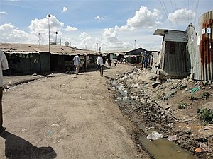
Mukuru is a collection of slums in the city of Nairobi. It is approximately 7 kilometres (4.3 mi) south of the central business district of Nairobi. It is one of the largest slums in Nairobi.
Kenya Electricity Transmission Company
Kenyan electricity transmission company
Distance: Approx. 1795 meters
Latitude and longitude: -1.32472222,36.83277778
Kenya Electricity Transmission Company Limited, commonly referred to as KETRACO, is a wholly-owned parastatal of the Government of Kenya which serves as the primary Transmission System Operator in the Republic of Kenya.
Kaloleni, Nairobi
A suburb in the city of Nairobi
Distance: Approx. 3342 meters
Latitude and longitude: -1.29527778,36.84472222
Kaloleni is a residential neighbourhood in the city of Nairobi. It is approximately 3 kilometres (1.9 mi) southeast of the central business district of Nairobi. It is one of the oldest estates in Nairobi, having been completed in the 1940s.

Safarilink Aviation Flight 053
Aviation accident in 2024
Distance: Approx. 2562 meters
Latitude and longitude: -1.34222222,36.83361111
On 5 March 2024, Safarilink Aviation Flight 053, a De Havilland Canada Dash 8, en route from Wilson Airport in Nairobi, Kenya, to Ukunda Airport, Kenya, collided soon after takeoff with a Cessna 172M training flight operated by 99 Flying School over Nairobi National Park. The Dash 8 returned to Wilson Airport and landed safely with part of the deicing boot missing, and with all 44 aboard unharmed, but the Cessna spiraled out of control and crashed in the national park, killing both occupants.
Weather in this IP's area
broken clouds
19 Celsius
19 Celsius
19 Celsius
20 Celsius
1013 hPa
72 %
1013 hPa
837 hPa
10000 meters
1.54 m/s
75 %
06:12:14
18:22:52