41.204.42.166 - IP Lookup: Free IP Address Lookup, Postal Code Lookup, IP Location Lookup, IP ASN, Public IP
Country:
Region:
City:
Location:
Time Zone:
Postal Code:
ISP:
ASN:
language:
User-Agent:
Proxy IP:
Blacklist:
IP information under different IP Channel
ip-api
Country
Region
City
ASN
Time Zone
ISP
Blacklist
Proxy
Latitude
Longitude
Postal
Route
db-ip
Country
Region
City
ASN
Time Zone
ISP
Blacklist
Proxy
Latitude
Longitude
Postal
Route
IPinfo
Country
Region
City
ASN
Time Zone
ISP
Blacklist
Proxy
Latitude
Longitude
Postal
Route
IP2Location
41.204.42.166Country
Region
western
City
axim
Time Zone
Africa/Accra
ISP
Language
User-Agent
Latitude
Longitude
Postal
ipdata
Country
Region
City
ASN
Time Zone
ISP
Blacklist
Proxy
Latitude
Longitude
Postal
Route
Popular places and events near this IP address

Axim
Town in Western Region, Ghana
Distance: Approx. 873 meters
Latitude and longitude: 4.86666667,-2.23333333
Axim is a coastal town and the capital of Nzema East Municipal district, a district in Western Region of South Ghana. Axim lies 64 kilometers west of the port city of Sekondi-Takoradi in the Western Region, west of Cape Three Points. Axim has a 2013 settlement population of 27,719 people.
Ankobra River
River in Ghana
Distance: Approx. 4685 meters
Latitude and longitude: 4.89861111,-2.27138889
The Ankobra River is situated in southwest Ghana. Starting north east of Wiawso, it flows about 190 kilometres (120 mi) south to the Gulf of Guinea, and enters the ocean about 60 km to the west of the city of Takoradi. Near its mouth are the remains of Fort Elize Carthago, a Dutch trading post abandoned in 1711.

Nzema East Municipal District
Municipal District in Western, Ghana
Distance: Approx. 300 meters
Latitude and longitude: 4.86722222,-2.24083333
Nzema East Municipal District is one of the fourteen districts in Western Region, Ghana. It was originally created as an ordinary district assembly in 1988 when it was known as Nzema East District, which was created from the former Nzema District Council, until the western part of the district was split off by a decree of then-president John Agyekum Kufuor on 29 February 2008 to create Ellembelle District; thus the remaining part has been retained as Nzema East District, which was later elevated to municipal district assembly status on the same year to become Nzema East Municipal District. The municipality is located in the southwest part of Western Region and has Axim as its capital town.
Bobowasi Island
Island in Ghana
Distance: Approx. 1113 meters
Latitude and longitude: 4.86666667,-2.25
Bobowasi Island is an island in Ghana in the Axim Bay of the Atlantic Ocean. It is located 1.8 kilometres (1.1 mi) from the town of Axim and Axim Castle, north of Watts Rock, east of Egwang Rock, and south of Mensell Hedwig Rock, at the geographic coordinates 04°52′N 02°15′W. There is a lighthouse on the island. Administratively, it is part of the Western Region of Ghana, 238 km (148 mi) west of the capital, Accra.
Domunli
Town in Western Region, Ghana
Distance: Approx. 5074 meters
Latitude and longitude: 4.83833333,-2.2075
Domunli is a town in the Western Region of Ghana. The town is south of Agufo on the Atlantic coast of Ghana. It is located 100 kilometres (62 mi) west of the regional capital, Takoradi, and is in the Jomoro District.
Ejan, Ghana
Town in Western Region, Ghana
Distance: Approx. 6099 meters
Latitude and longitude: 4.83111111,-2.20166667
Ejan, or Agyan, is a town in the Western Region of Ghana. The town is southeast of Domunli on the Atlantic coast of Ghana. It is located 100 kilometres (62 mi) west of the regional capital, Takoradi, and is in the Jomoro District.
Nsein Senior High School
Public high school in Ghana
Distance: Approx. 375 meters
Latitude and longitude: 4.86654931,-2.24087131
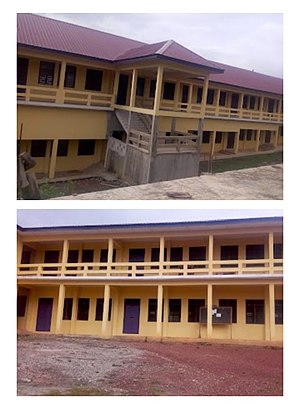
Nsein Senior High School is a senior high school located at Nsein-Axim in the Western Region of Ghana. The school was originally known as the Osagyefo Dr Kwame Nkrumah Secondary School, then as Axim Secondary School, before finally being renamed to the Nsein Secondary School.

Axim Girls Senior High School
School in the Western Region of Ghana
Distance: Approx. 416 meters
Latitude and longitude: 4.8725127,-2.2431851
Axim Girls Senior High School is an all female second cycle institution in Axim in the Western Region of Ghana.
Nsein
Town in Western Region of Ghana
Distance: Approx. 3037 meters
Latitude and longitude: 4.88333333,-2.21666667
Nsein is a town in the Western Region of Ghana. The town host the Nsein Senior High School and the operations of Ghana National Gas Corporation.
Weather in this IP's area
moderate rain
30 Celsius
34 Celsius
30 Celsius
30 Celsius
1010 hPa
64 %
1010 hPa
1008 hPa
9044 meters
2.38 m/s
2.13 m/s
196 degree
68 %
