41.203.93.193 - IP Lookup: Free IP Address Lookup, Postal Code Lookup, IP Location Lookup, IP ASN, Public IP
Country:
Region:
City:
Location:
Time Zone:
Postal Code:
ISP:
ASN:
language:
User-Agent:
Proxy IP:
Blacklist:
IP information under different IP Channel
ip-api
Country
Region
City
ASN
Time Zone
ISP
Blacklist
Proxy
Latitude
Longitude
Postal
Route
db-ip
Country
Region
City
ASN
Time Zone
ISP
Blacklist
Proxy
Latitude
Longitude
Postal
Route
IPinfo
Country
Region
City
ASN
Time Zone
ISP
Blacklist
Proxy
Latitude
Longitude
Postal
Route
IP2Location
41.203.93.193Country
Region
rivers
City
bonny
Time Zone
Africa/Lagos
ISP
Language
User-Agent
Latitude
Longitude
Postal
ipdata
Country
Region
City
ASN
Time Zone
ISP
Blacklist
Proxy
Latitude
Longitude
Postal
Route
Popular places and events near this IP address

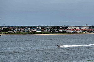
Bonny, Nigeria
City and Local Government Area in Rivers State, Nigeria
Distance: Approx. 2106 meters
Latitude and longitude: 4.43333333,7.16666667
Bonny (originally Okoloama) is a traditional, coastal town and a Local Government Area (LGA) in Rivers State in Southern Nigeria, on the Bight of Bonny. It is also the capital of the Kingdom of Bonny. The region produces a type of crude oil known as Bonny Light oil.
Bonny Island
Island in the Niger Delta region of Nigeria
Distance: Approx. 7987 meters
Latitude and longitude: 4.44916667,7.24
Bonny Island is a local government situated at the southern edge of Rivers State in the Niger Delta region of Nigeria near Port Harcourt. Ferries are the main form of transport, though recently an airstrip has been built and it’s fully functional - with flights from Lagos, Abuja and Port Harcourt respectively to and from the island. The local dialect spoken in Bonny Island are Igbo language and Ibani language.
Nigeria LNG
Liquefied natural gas plant of Nigeria
Distance: Approx. 3378 meters
Latitude and longitude: 4.4258,7.1531
Nigeria LNG Limited (NLNG) is a liquefied natural gas (LNG)-producing company and a liquefied natural gas plant on Bonny Island, Nigeria.

Finima Nature Park
Natural park in Bonny Island, Rivers State, Nigeria
Distance: Approx. 6380 meters
Latitude and longitude: 4.39548056,7.17631944
The Finima Nature Park is a natural park in Bonny Island, Rivers State, Nigeria covering an area of approximately 1000 ha (3.9 sq mi). It was established by the Nigeria Liquefied Natural Gas Limited in 1999 with the aim of conserving nature and biodiversity in the region.
Weather in this IP's area
scattered clouds
27 Celsius
30 Celsius
27 Celsius
27 Celsius
1009 hPa
83 %
1009 hPa
1009 hPa
10000 meters
3.55 m/s
6.01 m/s
238 degree
33 %