Country:
 Ghana
GhanaRegion:
City:
Latitude and Longitude:
Time Zone:
Postal Code:
IP information under different IP Channel
ip-api
Country
Region
City
ASN
Time Zone
ISP
Blacklist
Proxy
Latitude
Longitude
Postal
Route
IPinfo
Country
Region
City
ASN
Time Zone
ISP
Blacklist
Proxy
Latitude
Longitude
Postal
Route
MaxMind
Country
Region
City
ASN
Time Zone
ISP
Blacklist
Proxy
Latitude
Longitude
Postal
Route
Luminati
Country
GHASN
Time Zone
Africa/Accra
ISP
STLGHANA
Latitude
Longitude
Postal
db-ip
Country
Region
City
ASN
Time Zone
ISP
Blacklist
Proxy
Latitude
Longitude
Postal
Route
ipdata
Country
Region
City
ASN
Time Zone
ISP
Blacklist
Proxy
Latitude
Longitude
Postal
Route
Popular places and events near this IP address
Wesley College of Education, Kumasi
Teacher education college in Kumasi, Ghana
Distance: Approx. 1469 meters
Latitude and longitude: 6.7132807,-1.623867
Wesley College of Education is a teacher education college in Kumasi, Ashanti Region in Ghana. It was initially established for the training of teachers, catechists and ministers. It was founded by the Methodist Church, located between New Tafo and Old Tafo towns.

Prempeh I International Airport
International airport in Ghana
Distance: Approx. 2411 meters
Latitude and longitude: 6.71444444,-1.59055556
Prempeh I International Airport (IATA: KMS, ICAO: DGSI) is an international airport in Ghana serving Kumasi, the capital of the Ashanti Region, other regions in the middle belt of Ghana as well as the northern part of Ghana. In 2023, the airport handled over 400,000 passengers, making it the second busiest airport in Ghana after Kotoka International Airport in Accra. Prempeh I International Airport is located 6 kilometres (4 mi) from Kumasi.

Kejetia Market
Marketplace in Ashanti Region, Ghana
Distance: Approx. 2402 meters
Latitude and longitude: 6.698635,-1.61914
The Kumasi Central Market, also known as Kejetia Market, is an open-air marketplace in Kumasi, a city in the Ashanti Region of Ghana. The market has over 8,000 stores and stalls, making it the largest single market in West Africa. About 50,000 people visit the market daily, while there are 20,000 vendors operating in it.

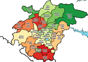
Afigya Kwabre District
Former District in Ashanti, Ghana
Distance: Approx. 1684 meters
Latitude and longitude: 6.73333333,-1.61666667
Afigya Kwabre District is a former district that was located in Ashanti Region, Ghana. It was created from the western portion of Afigya-Sekyere District (now currently known as Sekyere South District) and the western portion of Kwabre District (now currently known as Kwabre East Municipal District) on 1 November 2007 (effectively 29 February 2008). However on 15 March 2018, it was split off into two new districts: Afigya Kwabre South District (capital: Kodie) and Afigya Kwabre North District (capital: Boamang).
Asokore Mampong
Municipal in Ashanti Region, Ghana
Distance: Approx. 2487 meters
Latitude and longitude: 6.7,-1.6
Asokore Mampong is the capital of the Asokore Mampong Municipal Assembly, a district in the Ashanti Region of Ghana. Popularly known for Kumasi Academy a senior high school and the SSNIT affordable housing projects. The chief of Asokore Mampong is Nana Boakye-Ansah Debrah.

Manhyia Palace
Palace in Kumasi, Ashanti Region, Ghana
Distance: Approx. 1765 meters
Latitude and longitude: 6.70361111,-1.61583333
The Manhyia Palace (Akan: Oman hyia, English: Gathering of the people) is the seat of the Asantehene, as well as his official residence. It is located in Menshyia, Kumasi, the capital of the Ashanti Region of Ghana. The first palace is now a museum.
Tafo
Town in Ashanti Region, Ghana
Distance: Approx. 1924 meters
Latitude and longitude: 6.73583333,-1.60805556
Tafo is a town in Kumasi Metropolitan District in the Ashanti Region of Ghana near the regional capital Kumasi. Tafo is the thirtieth most populous settlement in Ghana, in terms of population, with a population of 60,919 people. Because of the town's population and housing development in recent years, it is debatable whether Tafo is still regarded as a separate town, or already a suburb of Kumasi, the capital of the Ashanti region.
Kodie, Ghana
District Capital in Ashanti Region, Ghana
Distance: Approx. 1684 meters
Latitude and longitude: 6.73333333,-1.61666667
Kodie is a small town and is the capital of Afigya-Kwabre South district, a district in the Ashanti Region of Ghana.
Serwaa Nyarko Girls' Senior High School
All girls school in Kumasi, Ghana
Distance: Approx. 1088 meters
Latitude and longitude: 6.70944738,-1.60966337
Serwaa Nyarko Senior High School is an all female secondary education institution in Kumasi in the Ashanti Region of Ghana.
Kumasi City Mall
Shopping centre in Ghana
Distance: Approx. 1854 meters
Latitude and longitude: 6.70977778,-1.62586111
The Kumasi City Mall (KCM) is a shopping mall located in Kumasi, Ghana. It is the first of its kind in the city. The Kumasi City Mall cost $95 million and took 24 months to complete.
Old Tafo Municipal District
Municipal District in Ashanti, Ghana
Distance: Approx. 1924 meters
Latitude and longitude: 6.73583333,-1.60805556
Old Tafo Municipal District is one of the forty-three districts in Ashanti Region, Ghana. Originally it was a sub-metropolitan district council within the Kumasi Metropolitan Assembly until 15 March 2018, when it was elevated to municipal district assembly status to become Old Tafo Municipal District. The municipality is located in the central part of Ashanti Region and has Tafo as its capital town.
Afigya Kwabre South District
District in Ashanti, Ghana
Distance: Approx. 1684 meters
Latitude and longitude: 6.73333333,-1.61666667
Afigya Kwabre South District is one of the forty-three districts in Ashanti Region, Ghana. Originally it was formerly part of the then-larger Afigya Kwabre District on 29 February 2008, until the northern part of the district was split off to create Afigya Kwabre North District on 15 March 2018; thus the remaining part has been renamed as Afigya Kwabre South District. The district assembly is located in the northern part of Ashanti Region and has Kodie as its capital town.
Weather in this IP's area
broken clouds
22 Celsius
22 Celsius
22 Celsius
22 Celsius
1013 hPa
99 %
1013 hPa
980 hPa
9285 meters
1.43 m/s
5.01 m/s
230 degree
81 %
05:52:54
17:52:28