Country:
Region:
City:
Latitude and Longitude:
Time Zone:
Postal Code:
IP information under different IP Channel
ip-api
Country
Region
City
ASN
Time Zone
ISP
Blacklist
Proxy
Latitude
Longitude
Postal
Route
Luminati
Country
ASN
Time Zone
Africa/Djibouti
ISP
DJIBOUTI TELECOM
Latitude
Longitude
Postal
IPinfo
Country
Region
City
ASN
Time Zone
ISP
Blacklist
Proxy
Latitude
Longitude
Postal
Route
db-ip
Country
Region
City
ASN
Time Zone
ISP
Blacklist
Proxy
Latitude
Longitude
Postal
Route
ipdata
Country
Region
City
ASN
Time Zone
ISP
Blacklist
Proxy
Latitude
Longitude
Postal
Route
Popular places and events near this IP address

Airolaf
Town in Tadjoura, Djibouti
Distance: Approx. 9200 meters
Latitude and longitude: 11.76666667,42.65
Airolaf (Arabic: إيرولاف) is a town in the Tadjoura Region in northwestern Djibouti and in the centre of the Tadjoura Region. It is located some 115 kilometres northwest of the national capital, Djibouti City. Airolaf is known for its temperate, cool climate – the coolest area in Djibouti.

Bankouale
Town in Tadjoura, Djibouti
Distance: Approx. 8374 meters
Latitude and longitude: 11.81666667,42.66666667
Bankouale (Arabic: بنكوالي) is a town in Tadjoura region of Djibouti. One of the distinctive features of Bankouale countryside is the widespread growing of vegetables. In the meantime there are also first approaches to establish gentle tourism.

Randa, Djibouti
Town in Tadjoura, Djibouti
Distance: Approx. 8032 meters
Latitude and longitude: 11.84694444,42.66055556
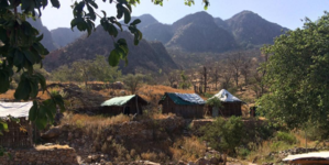
Randa (Arabic: راندا) is a town in central Djibouti located in Tadjoura. It is the capital of the Randa District. The settlement lies in a small valley, north of the Day Forest National Park in the Goda Mountains.

Itki
Town in Tadjoura, Djibouti
Distance: Approx. 9023 meters
Latitude and longitude: 11.74611111,42.60888889
Itki is a town in the Tadjoura Region in northwestern Djibouti. The surrounding district is rich in both livestock and fledgeling agriculture. Itki has one of the mildest climates in Djibouti.
Weather in this IP's area
broken clouds
19 Celsius
19 Celsius
19 Celsius
19 Celsius
1015 hPa
55 %
1015 hPa
874 hPa
10000 meters
5.31 m/s
7.34 m/s
115 degree
56 %
06:06:55
17:41:51