38.97.236.192 - IP Lookup: Free IP Address Lookup, Postal Code Lookup, IP Location Lookup, IP ASN, Public IP
Country:
 USA
USARegion:
City:
Location:
Time Zone:
Postal Code:
ISP:
ASN:
language:
User-Agent:
Proxy IP:
Blacklist:
IP information under different IP Channel
ip-api
Country
Region
City
ASN
Time Zone
ISP
Blacklist
Proxy
Latitude
Longitude
Postal
Route
db-ip
Country
Region
City
ASN
Time Zone
ISP
Blacklist
Proxy
Latitude
Longitude
Postal
Route
IPinfo
Country
Region
City
ASN
Time Zone
ISP
Blacklist
Proxy
Latitude
Longitude
Postal
Route
IP2Location
38.97.236.192Country
usRegion
colorado
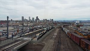
City
denver
Time Zone
America/Denver
ISP
Language
User-Agent
Latitude
Longitude
Postal
ipdata
Country
Region
City
ASN
Time Zone
ISP
Blacklist
Proxy
Latitude
Longitude
Postal
Route
Popular places and events near this IP address

Denver Coliseum
Indoor arena in Denver, Colorado
Distance: Approx. 662 meters
Latitude and longitude: 39.7791279,-104.9707305
Denver Coliseum is an indoor arena, owned by the City and County of Denver, operated by its Denver Arts & Venues and located in Denver, Colorado. The arena has a capacity of 10,200 people and was built from 1949 to 1951. The coliseum is located in Denver's Elyria-Swansea neighborhood.

National Western Stock Show
Annual livestock showing
Distance: Approx. 436 meters
Latitude and longitude: 39.78249,-104.96918
The National Western Stock Show is an annual livestock show and festival held every January, at the National Western Complex in Denver, Colorado, since 1906. The show's original purpose was to demonstrate better breeding and feeding techniques to area stockmen; however, it was largely the main showings as a means to attract patrons to the surrounding vendors. The founders included Elias M. Ammons, president of the Colorado Cattle and Horse Growers Association and later governor of Colorado; George Ballentine, general manager of the Denver Union Stock Yard Company; and Fred P. Johnson, publisher of the Record Stockman.

Riverside Cemetery (Denver, Colorado)
United States historic place
Distance: Approx. 1397 meters
Latitude and longitude: 39.79416667,-104.95916667
Riverside Cemetery, established in 1876, is Denver, Colorado's oldest operating cemetery. More than 67,000 people are buried there, including 1,000 veterans.

Globeville, Denver
Neighborhood of Denver, Colorado
Distance: Approx. 1642 meters
Latitude and longitude: 39.7843,-104.9831
Globeville is a neighborhood of Denver, Colorado. Globeville is located in the area traditionally called North Denver.

Elyria-Swansea, Denver
Neighborhood of Denver, Colorado
Distance: Approx. 856 meters
Latitude and longitude: 39.786,-104.9554
Elyria-Swansea is a neighborhood of Denver, Colorado. It is located in East Denver, on the northeast side of the city. In 2007, the neighborhood had 7,218 residents and 1,787 households.

Cole, Denver
Neighborhood of Denver, Colorado, US
Distance: Approx. 1700 meters
Latitude and longitude: 39.767,-104.966
Cole is a neighborhood of Denver, Colorado. It is in the area commonly known as North Denver. According to the Piton Foundation in 2007 the population of the neighborhood was 6,041, and there were 1,794 housing units.

Bruce Randolph School
Public school in Denver, Colorado, United States
Distance: Approx. 1610 meters
Latitude and longitude: 39.77197,-104.950799
Bruce Randolph School is a public school in Denver, Colorado, United States. It serves grades six through twelve. Part of Denver Public Schools, Bruce Randolph began to operate autonomously in 2007 in a bid to turn around its dismal graduation rates, which was successful.
St. Joseph's Polish Roman Catholic Church
Historic church in Colorado, United States
Distance: Approx. 1518 meters
Latitude and longitude: 39.78027778,-104.98166667
The St. Joseph's Polish Roman Catholic Church is a historic church at 517 E. 46th Avenue in Denver, Colorado. It was built in 1902 and was added to the National Register of Historic Places in 1983.
38th & Blake station
Commuter rail station in Denver, Colorado
Distance: Approx. 1525 meters
Latitude and longitude: 39.77069444,-104.97377778
38th & Blake station (sometimes stylized as 38th•Blake) is a Regional Transportation District (RTD) commuter rail station on the A Line in the Five Points neighborhood of Denver, Colorado. The station is the first station eastbound from Union Station in Downtown Denver and sixth westbound from Denver International Airport. Travel times are about four minutes from Union Station and 33 minutes from Denver Airport.
National Western Complex shootout
2016 Civil conflict in Colorado
Distance: Approx. 394 meters
Latitude and longitude: 39.7824,-104.9687
On January 30, 2016, a brawl involving gunfire and knives broke out between rival motorcycle clubs at the National Western Complex, in Denver, Colorado. One person was killed and seven others were injured.

48th & Brighton/National Western Center station
Commuter rail station in Denver, Colorado
Distance: Approx. 614 meters
Latitude and longitude: 39.78288889,-104.97122222
48th & Brighton / National Western Center station (sometimes stylized and abbrivated as 48th & Brighton•Nat'l Western Cntr) is a station on the N Line of the Denver RTD commuter rail system in Denver, Colorado. It is the first station northbound from Union Station and is located on the edge of the Elyria-Swansea neighborhood. The station opened on September 21, 2020.

Mission Ballroom
Concert venue in Denver, Colorado
Distance: Approx. 841 meters
Latitude and longitude: 39.775902,-104.969521
The Mission Ballroom is a concert venue located in the RiNo neighborhood of Denver, Colorado. The building opened in August 2019 with a capacity of nearly 4,000 patrons. Operated by AEG Presents Rocky Mountain, the venue is viewed as a competitor to the Live Nation operated Fillmore Auditorium.
Weather in this IP's area
broken clouds
6 Celsius
6 Celsius
2 Celsius
8 Celsius
1010 hPa
39 %
1010 hPa
833 hPa
10000 meters
0.21 m/s
0.55 m/s
331 degree
78 %