Country:
 USA
USARegion:
City:
Latitude and Longitude:
Time Zone:
Postal Code:
IP information under different IP Channel
ip-api
Country
Region
City
ASN
Time Zone
ISP
Blacklist
Proxy
Latitude
Longitude
Postal
Route
IPinfo
Country
Region
City
ASN
Time Zone
ISP
Blacklist
Proxy
Latitude
Longitude
Postal
Route
MaxMind
Country
Region
City
ASN
Time Zone
ISP
Blacklist
Proxy
Latitude
Longitude
Postal
Route
Luminati
Country
USRegion
md
City
centreville
ASN
Time Zone
America/New_York
ISP
TALKIE-COMMUNICATIONS
Latitude
Longitude
Postal
db-ip
Country
Region
City
ASN
Time Zone
ISP
Blacklist
Proxy
Latitude
Longitude
Postal
Route
ipdata
Country
Region
City
ASN
Time Zone
ISP
Blacklist
Proxy
Latitude
Longitude
Postal
Route
Popular places and events near this IP address

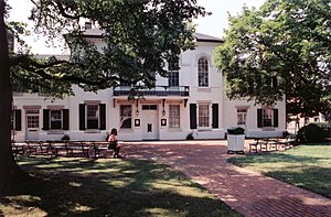
Centreville, Maryland
Incorporated town in Queen Anne's County, Maryland, United States
Distance: Approx. 2078 meters
Latitude and longitude: 39.04611111,-76.06444444
Centreville is an incorporated town in Queen Anne's County, Maryland, United States on the Delmarva Peninsula. Incorporated in 1794, it is the county seat of Queen Anne's County. The population was 4,285 at the 2010 census.

Queen Anne's County High School
Public high school in Centreville, MD, Maryland, United States
Distance: Approx. 2441 meters
Latitude and longitude: 39.0377,-76.0507
Queen Anne's County High School (QACHS) is a four-year public high school in Centreville, Queen Anne's County, Maryland, United States. It is one of two public high schools in Queen Anne's County along with Kent Island High School.

Queen Anne's County Courthouse
Building in Centreville, United States of America
Distance: Approx. 2211 meters
Latitude and longitude: 39.04527778,-76.06555556
The Queen Anne's County Courthouse is the oldest courthouse still in use in the state of Maryland. The building houses the judge for the Queen Anne's County Circuit Court, the judge's chambers, a courtroom, a jurors' assembly room, clerks offices and a small detention lock-up.

Captain's Houses
Historic house in Maryland, United States
Distance: Approx. 2551 meters
Latitude and longitude: 39.05194444,-76.07555556
The Captain's Houses are a row of four nearly identical houses built along Corsica Creek in Centreville, Maryland after the Civil War. The houses are built on raised brick foundations into a small bluff along the creek, allowing access to the main level from the top of the bluff. The upper levels of the houses are framed construction.

Centreville Armory
United States historic place
Distance: Approx. 2653 meters
Latitude and longitude: 39.04166667,-76.06805556
The Centreville Armory in Centreville, Maryland, is part of a series of Maryland National Guard armories built in the 1920s in principal towns in Maryland. The armories followed a standard design with a castle-like front housing offices and meeting spaces, backed by a large drill hall. The armory was listed on the National Register of Historic Places in 1985.

Female Seminary (Centreville, Maryland)
Historic house in Maryland, United States
Distance: Approx. 2502 meters
Latitude and longitude: 39.04233889,-76.06638889
The Female Seminary in Centreville, Maryland was built c. 1876 as a public schoolhouse intended exclusively for women. The pressed-brick building was built in a restrained Victorian style, with two classrooms on each of two floors with a side passage.

Keating House (Centreville, Maryland)
Historic house in Maryland, United States
Distance: Approx. 2540 meters
Latitude and longitude: 39.04298333,-76.06796389
The Keating House at 208 South Liberty Street in Centreville, Maryland is a Federal style house built c. 1806-1809 by Ebenezer Covington. The interior is particularly well-preserved.

Jackson Collins House
Historic house in Maryland, United States
Distance: Approx. 2442 meters
Latitude and longitude: 39.04284722,-76.06609444
The Jackson Collins House (aka "The Red Brick House" to those who have lived there) in Centreville, Maryland was built in 1887 of pressed brick. The plan and roof forms are unusually complex. The house's style is a mixture of Queen Anne and Italianate style, unusually expressed in brick.

Content (Centreville, Maryland)
Historic house in Maryland, United States
Distance: Approx. 3019 meters
Latitude and longitude: 39.04166667,-76.02138889
Content, also known as C.C. Harper Farm, is a historic home located near Centreville, Queen Anne's County, Maryland, United States. It is of brick construction, two stories high, five bays wide and one room deep, with a single flush brick chimney. The house was constructed about 1775.

Lexon
Historic house in Centreville, Queen Anne's County, Maryland, United States
Distance: Approx. 3486 meters
Latitude and longitude: 39.05444444,-76.0875
Lexon, also known as the Burris-Brockmeyer Farm, is a historic home located at Centreville, Queen Anne's County, Maryland. It was constructed in the third quarter of the 18th century. It is a two-story brick house with a pitched gable roof, center passage single pile plan.

Capt. John H. Ozmon Store
United States historic place
Distance: Approx. 2412 meters
Latitude and longitude: 39.05333333,-76.07444444
The Capt. John H. Ozmon Store is a historic general store located at Centreville, Queen Anne's County, Maryland. It is a two-story brick building constructed about 1880 into the side of a steep bank, with the store occupying the lower story and a dwelling on the second floor.
Centreville Historic District (Centreville, Maryland)
Historic district in Maryland, United States
Distance: Approx. 2272 meters
Latitude and longitude: 39.04583333,-76.06722222
Centreville Historic District is a national historic district at Centreville, Queen Anne's County, Maryland, United States. It contains an exceptional collection of 18th, 19th, and 20th century buildings chronicling the architectural development of an Eastern Shore of Maryland community. Among Centreville's residential, commercial, and ecclesiastical buildings are representative examples of the various architectural types and styles which characterized towns in the region during the period.
Weather in this IP's area
clear sky
17 Celsius
16 Celsius
16 Celsius
18 Celsius
1031 hPa
43 %
1031 hPa
1030 hPa
10000 meters
1.79 m/s
1.79 m/s
104 degree
07:17:05
18:21:04