Country:
 USA
USARegion:
City:
Latitude and Longitude:
Time Zone:
Postal Code:
IP information under different IP Channel
ip-api
Country
Region
City
ASN
Time Zone
ISP
Blacklist
Proxy
Latitude
Longitude
Postal
Route
IPinfo
Country
Region
City
ASN
Time Zone
ISP
Blacklist
Proxy
Latitude
Longitude
Postal
Route
MaxMind
Country
Region
City
ASN
Time Zone
ISP
Blacklist
Proxy
Latitude
Longitude
Postal
Route
Luminati
Country
USRegion
md
City
centreville
ASN
Time Zone
America/New_York
ISP
TALKIE-COMMUNICATIONS
Latitude
Longitude
Postal
db-ip
Country
Region
City
ASN
Time Zone
ISP
Blacklist
Proxy
Latitude
Longitude
Postal
Route
ipdata
Country
Region
City
ASN
Time Zone
ISP
Blacklist
Proxy
Latitude
Longitude
Postal
Route
Popular places and events near this IP address
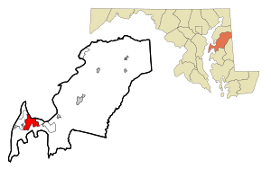
Chester, Maryland
CDP in Maryland, United States
Distance: Approx. 1549 meters
Latitude and longitude: 38.97194444,-76.28805556
Chester is a census-designated place on Kent Island in Queen Anne's County, Maryland, United States. The population was 3,723 at the 2000 census.

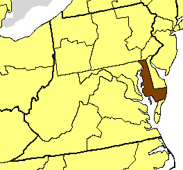
Kent Island (Maryland)
Largest Island and historic place in the Chesapeake Bay, United States
Distance: Approx. 2985 meters
Latitude and longitude: 38.94861111,-76.315
Kent Island is the largest island in the Chesapeake Bay and a historic place in Maryland. To the east, a narrow channel known as the Kent Narrows barely separates the island from the Delmarva Peninsula, and on the other side, the island is separated from Sandy Point, an area near Annapolis, by roughly four miles (6.4 km) of water. At only four miles wide, the main waterway of the bay is at its narrowest at this point and is spanned here by the Chesapeake Bay Bridge.
Kent Narrows
Distance: Approx. 3435 meters
Latitude and longitude: 38.97194444,-76.24722222
The Kent Narrows, also known as Kent Island Narrows and to local residents simply as the Narrows, is a waterway that connects the Chester River with the Eastern Bay and also separates Kent Island from the Delmarva Peninsula. It runs through the community of Kent Narrows, Maryland. The Kent Narrows was originally shallow and surrounded by marsh.
Episcopal Diocese of Easton
Diocese of the Episcopal Church in the United States
Distance: Approx. 3658 meters
Latitude and longitude: 38.98055556,-76.31444444
The Episcopal Diocese of Easton is a diocese of the Episcopal Church in the United States of America that comprises the nine counties that make up the Eastern Shore of Maryland. It is in Province III (the Middle Atlantic region) and was created as a split from the Diocese of Maryland in 1868. The diocese consists of the Eastern Shore of Maryland (the nine counties of Caroline, Cecil, Dorchester, Kent, Queen Anne's, Somerset, Talbot, Wicomico, and Worcester), and has a total membership of about 9,750 people, out of a total population of 420,792, according to a 2004 census estimate.
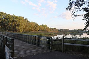
Cross Island Trail
Distance: Approx. 2666 meters
Latitude and longitude: 38.98106389,-76.29366667
The Cross Island Trail is a rail trail in Queen Anne's County, Maryland occupying a section of the abandoned Queen Anne's Railroad corridor that traverses the width of Kent Island. It was completed in 2001 and is part of the American Discovery Trail.

Christ Church (Stevensville, Maryland)
Historic church in Maryland, United States
Distance: Approx. 3658 meters
Latitude and longitude: 38.98055556,-76.31444444
Christ Church refers to both an Episcopal parish currently located in Matapeake, Maryland and the historic church building located in the Stevensville Historic District in Stevensville, Maryland, which the parish occupied from 1880 to 1995, and that is now a Lutheran church. Christ Church Parish was one of the original 30 Anglican parishes in the Province of Maryland.
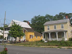
Stevensville Historic District
Historic district in Maryland, United States
Distance: Approx. 3668 meters
Latitude and longitude: 38.98138889,-76.31361111
The Stevensville Historic District, also known as Historic Stevensville, is a national historic district in downtown Stevensville, Queen Anne's County, Maryland. It contains roughly 100 historic structures, and is listed on the National Register of Historic Places. It is located primarily along East Main Street, a portion of Love Point Road, and a former section of Cockey Lane.

Stevensville Bank
United States historic place
Distance: Approx. 3780 meters
Latitude and longitude: 38.98194444,-76.31472222
The Stevensville Bank is a historic bank building located near the center of Stevensville, Maryland, United States, and is in the Stevensville Historic District. The building's name is a reference to Stevensville Savings Bank which once occupied the building. The classically detailed bank is now used as a law office.
Dominion, Maryland
Unincorporated community in Maryland, United States
Distance: Approx. 1308 meters
Latitude and longitude: 38.94694444,-76.28111111
Dominion is an unincorporated community located in Kent Island (the largest island in the Chesapeake Bay) which is in Queen Anne's County, Maryland, United States. Dominion is located along Maryland Route 552, 2 miles (3.2 km) south of Chester.
Kent Island Research Facility
Distance: Approx. 655 meters
Latitude and longitude: 38.964,-76.286
The Kent Island Research Facility is a U.S. National Security Agency facility located on Kent Island, Maryland, near the town of Chester. The facility was established in 1961 to conduct research on very high frequency and microwave antenna systems—specifically, on problems associated with anomalous propagation in communications interception. According to James Bamford in 1983, the location consists of the NSA Propagation Research Laboratory, a single-story, white, windowless building that houses automatically operating, unattended equipment, as well as a small, white cinder-block "control" building surrounded in a barbed-wire fence.

Stoopley Gibson Manor
Manor house in Kent Island, Maryland
Distance: Approx. 2567 meters
Latitude and longitude: 38.98097222,-76.27580556
The historic Stoopley-Gibson Manor is a stately three-story, 18th-century Georgian brick manor home along the Chester River on the north shore of Kent Island in Maryland. The original 150 acres (61 ha) land patent was first issued to Henry Stoupe and John Gibson in 1656. According to the local tax assessment, the property had increased to 176 acres (71 ha) by 1798 with the initial reference to the building structure.
Kirwan House (Maryland)
Living museum on Kent Island, Maryland
Distance: Approx. 567 meters
Latitude and longitude: 38.959675,-76.27659722
The James E. Kirwan House and Store is a living museum located south of the village of Chester on Kent Island, Queen Anne's County, Maryland. It served as a general store, lumber mill, cooper's mill, and blacksmith shop between 1889 and 1955 and facilitated local trade as a port on Kirwan Creek. The estate was donated to the Kent Island Heritage Society in 1998 to be run as a museum.
Weather in this IP's area
overcast clouds
24 Celsius
24 Celsius
23 Celsius
25 Celsius
1022 hPa
74 %
1022 hPa
1022 hPa
10000 meters
3.6 m/s
100 degree
100 %
06:47:53
19:11:56