38.79.76.221 - IP Lookup: Free IP Address Lookup, Postal Code Lookup, IP Location Lookup, IP ASN, Public IP
Country:
Region:
City:
Location:
Time Zone:
Postal Code:
ISP:
ASN:
language:
User-Agent:
Proxy IP:
Blacklist:
IP information under different IP Channel
ip-api
Country
Region
City
ASN
Time Zone
ISP
Blacklist
Proxy
Latitude
Longitude
Postal
Route
db-ip
Country
Region
City
ASN
Time Zone
ISP
Blacklist
Proxy
Latitude
Longitude
Postal
Route
IPinfo
Country
Region
City
ASN
Time Zone
ISP
Blacklist
Proxy
Latitude
Longitude
Postal
Route
IP2Location
38.79.76.221Country
Region
california
City
anaheim
Time Zone
America/Los_Angeles
ISP
Language
User-Agent
Latitude
Longitude
Postal
ipdata
Country
Region
City
ASN
Time Zone
ISP
Blacklist
Proxy
Latitude
Longitude
Postal
Route
Popular places and events near this IP address

Anaheim Union High School District
School district in California
Distance: Approx. 787 meters
Latitude and longitude: 33.83896389,-117.94889722
The Anaheim Union High School District (AUHSD) is a public school district serving portions of the Orange County cities of Anaheim, Buena Park, Cypress, La Palma, and Stanton. It oversees eight junior high schools (7-8), eight high schools (9-12), and one non-magnet, secondary selective school, Oxford Academy (7-12). Its superintendent, Dr.
Servite High School
Private, all-boys school in Anaheim, Orange County, California, United States
Distance: Approx. 346 meters
Latitude and longitude: 33.84638889,-117.94944444
Servite High School is a private, Catholic, all-boys college preparatory high school in Anaheim, California founded in 1958. As of 2023, it enrolled 751 students and had nearly 10,000 alumni. While located within the Diocese of Orange, it is not a diocesan school; it is operated independently by the Order of Servants of Mary (OSM), also known as the Servite Order, after whom the school is named.
Fairmont Preparatory Academy
Private school
Distance: Approx. 662 meters
Latitude and longitude: 33.84391788,-117.95989319
Fairmont Preparatory Academy is a private college preparatory high school located in Anaheim, California. It is one of the campuses of the Fairmont Private Schools system. It has been an IB World School since August 1995.
Little Arabia
Ethnic enclave in California, United States
Distance: Approx. 2315 meters
Latitude and longitude: 33.82502203,-117.95894577
Little Arabia is an ethnic enclave in western Anaheim, California, the center for Orange County's Arab Americans, who number more than 24,000 (As of 2000). It has been referred to as "Little Gaza" which was a riff on the nearby Garza Island neighborhoods. Little Arabia grew significantly in the 1990s with the arrival of immigrants from the Middle East, and is the home to thousands of Arab Americans predominantly hailing from Egypt, Syria, Palestine, and Yemen.
Cornelia Connelly High School
Private, all-female school in Anaheim, , California, United States
Distance: Approx. 2040 meters
Latitude and longitude: 33.82944444,-117.96416667
Cornelia Connelly School of the Holy Child Jesus (Connelly), was a Catholic college-preparatory high school for girls in Anaheim, California, the only such independent school in the Roman Catholic Diocese of Orange. It operated from 1961 to 2020. At the time of its closure, Connelly enrolled 124 girls, and was accredited to the Western Association of Schools and Colleges and Western Catholic Educational Association among others.

Savanna High School
Public high school in Anaheim, California, United States
Distance: Approx. 1804 meters
Latitude and longitude: 33.835,-117.96805556
Savanna High School (SHS) is a public high school in the Anaheim Union High School District (AUHSD), located in the city of Anaheim, California in the United States. Savanna was established in 1961 and is one of eight comprehensive high schools within the district. The school currently services the Northwest Anaheim region and southeast Buena Park.
TGR Learning Lab
American educational institution
Distance: Approx. 1443 meters
Latitude and longitude: 33.838938,-117.966568
The Tiger Woods Learning Center or TGR Learning Lab is an educational facility established in 2006 by the golfer Tiger Woods in Anaheim, California. A second TGR Learning Lab is set to open at Philadelphia’s Cobbs Creek Golf Course in 2024. The Anaheim learning center is used by several thousand students, with a day program for grades 4-6 and an after schools program for grades 7-12.

Phillip Ackley Stanton House
Historic house in California, United States
Distance: Approx. 597 meters
Latitude and longitude: 33.84388889,-117.95916667
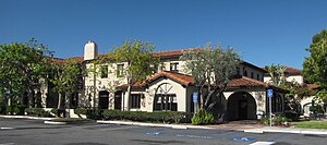
Philip Ackley Stanton House is a Mission Revival—Spanish Colonial Revival style house in Anaheim, California. It is now within the Fairmont Preparatory Academy. The Spanish Colonial hacienda-style house built in 1929 by Col.
West Anaheim
Distance: Approx. 1712 meters
Latitude and longitude: 33.8322,-117.943
West Anaheim is a district in Anaheim, California which extends from Euclid Street on the East to the city limits at Cypress on the West. West Anaheim is where most of the residential development occurred during the 1950s and the 1960s, after Disneyland opened in 1955.
Anaheim Regional Medical Center
Hospital in California, United States
Distance: Approx. 1741 meters
Latitude and longitude: 33.848202,-117.934418
Anaheim Regional Medical Center, formerly known as Anaheim Memorial Medical Center, is a 228-bed, acute care hospital in North Anaheim, California. It opened in 1958 and serves the greater North Anaheim, South Fullerton, La Habra and La Mirada areas. It was named one of the top 100 hospitals in the country for quality in the areas of heart attack care, heart failure care and pneumonia care.
Sarang Community Church of Southern California
Church in California, United States
Distance: Approx. 811 meters
Latitude and longitude: 33.848,-117.961
Sarang Community Church of Southern California is a Presbyterian Church in America (PCA) Korean-American church located in Anaheim, California. Sarang has more than 10,000 church attenders. Some statistics estimate about 11,000 members.

Bethesda University
Private Christian university in Anaheim, California, United States
Distance: Approx. 1103 meters
Latitude and longitude: 33.842341,-117.941476
Bethesda University is a private Christian university in Anaheim, California. It was founded in 1976 by David Yonggi Cho. The university is accredited by the Association for Biblical Higher Education and the Transnational Association of Christian Colleges and Schools and it is approved by the Bureau for Private Postsecondary Education of the State of California.
Weather in this IP's area
light intensity drizzle
10 Celsius
9 Celsius
9 Celsius
10 Celsius
1017 hPa
88 %
1017 hPa
1019 hPa
10000 meters
2.06 m/s
50 degree
100 %
