38.77.51.2 - IP Lookup: Free IP Address Lookup, Postal Code Lookup, IP Location Lookup, IP ASN, Public IP
Country:
Region:
City:
Location:
Time Zone:
Postal Code:
ISP:
ASN:
language:
User-Agent:
Proxy IP:
Blacklist:
IP information under different IP Channel
ip-api
Country
Region
City
ASN
Time Zone
ISP
Blacklist
Proxy
Latitude
Longitude
Postal
Route
db-ip
Country
Region
City
ASN
Time Zone
ISP
Blacklist
Proxy
Latitude
Longitude
Postal
Route
IPinfo
Country
Region
City
ASN
Time Zone
ISP
Blacklist
Proxy
Latitude
Longitude
Postal
Route
IP2Location
38.77.51.2Country
Region
new york
City
syracuse
Time Zone
America/New_York
ISP
Language
User-Agent
Latitude
Longitude
Postal
ipdata
Country
Region
City
ASN
Time Zone
ISP
Blacklist
Proxy
Latitude
Longitude
Postal
Route
Popular places and events near this IP address

Cathedral of the Immaculate Conception (Syracuse, New York)
Church in New York , United States
Distance: Approx. 261 meters
Latitude and longitude: 43.04681944,-76.14983333
The Cathedral of the Immaculate Conception in Syracuse, New York is the mother church of the Roman Catholic Diocese of Syracuse. It is the seat of the Bishop of Syracuse, currently Douglas Lucia.

Roman Catholic Diocese of Syracuse
Latin Catholic ecclesiastical jurisdiction in New York, US
Distance: Approx. 195 meters
Latitude and longitude: 43.04602778,-76.14963889
The Diocese of Syracuse (Latin: Diœcesis Syracusensis) is a Latin Church ecclesiastical territory, or diocese, of the Catholic Church in Upstate New York in the United States. Its episcopal see is located in Syracuse. It is a suffragan diocese in the ecclesiastical province of the metropolitan Archdiocese of New York.

Upstate Medical University Arena
Arena in Syracuse, New York
Distance: Approx. 233 meters
Latitude and longitude: 43.04472222,-76.14833333
The Upstate Medical University Arena (originally known as Onondaga County War Memorial and later as the Oncenter War Memorial Arena) is a multi-purpose arena located in Syracuse, New York. It is part of the Oncenter Complex. Designed by Edgarton and Edgarton and built from 1949 through 1951, the structure is significant as an example of a World War I, World War II and Aroostook War commemorative and as "an early and sophisticated example of single-span thin-shell concrete roof construction." It was listed on the National Register of Historic Places in 1988.

Columbus Circle, Syracuse
Historic site in New York, US
Distance: Approx. 293 meters
Latitude and longitude: 43.04683333,-76.14908333
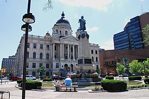
Columbus Circle is a neighborhood and plaza in the downtown section of Syracuse, New York, United States. At the center of the circle is a large fountain and the Columbus Monument, designed by the Syracuse-born architect Dwight James Baum and dedicated in 1934. Columbus Circle is home to Syracuse's two cathedrals, the Episcopalian St.

Oncenter
Distance: Approx. 273 meters
Latitude and longitude: 43.043594,-76.148199
The Oncenter is a three-building convention and entertainment complex in Downtown Syracuse, New York, United States. It is composed of a convention center, sporting arena, and theaters.

Landmark Theatre (Syracuse, New York)
Theater in Syracuse, New York
Distance: Approx. 322 meters
Latitude and longitude: 43.04740833,-76.1526
The Landmark Theatre, originally known as Loew's State Theater, is a historic theater from the era of movie palaces, located on South Salina Street in Syracuse, New York, United States. Designed by Thomas W. Lamb, it is the city's only surviving example of the opulent theatrical venues of the 1920s. The Landmark is on the National Register of Historic Places.

Central Technical High School
United States historic place
Distance: Approx. 281 meters
Latitude and longitude: 43.04222222,-76.15055556
Central Technical High School, also known as Central Tech, is located on South Warren Street in Syracuse, New York. It was designed by Archimedes Russell, and built in 1900. At that time, it represented the latest in educational building design.

Marriott Syracuse Downtown
United States historic place
Distance: Approx. 1 meters
Latitude and longitude: 43.04469444,-76.15119444
The Marriott Syracuse Downtown is a historic hotel located at 100 E. Onondaga St., Syracuse, New York. It was built in 1924 as the Hotel Syracuse and was completely restored in 2016, when it joined the Marriott chain.

Plymouth Congregational Church (Syracuse, New York)
Historic church in New York, United States
Distance: Approx. 145 meters
Latitude and longitude: 43.04566667,-76.15000833
Plymouth Congregational Church is located on East Onondaga Street in Syracuse, New York. It was designed in 1858 by Horatio Nelson White in the Romanesque Revival style. The founding congregation was closely associated with the abolitionist movement in Syracuse.

Montgomery Street–Columbus Circle Historic District
Historic district in New York, United States
Distance: Approx. 305 meters
Latitude and longitude: 43.04722222,-76.14972222
The Montgomery Street–Columbus Circle Historic District is located in Syracuse, New York. It was added to the National Register of Historic Places in 1980, with a boundary revision in 2024.

Axa Towers
Commercial office buildings in Syracuse, New York
Distance: Approx. 120 meters
Latitude and longitude: 43.04512,-76.14984
The Equitable Towers, formerly Axa Towers, are two commercial office buildings in Syracuse, New York. The towers were originally named the MONY Towers when they were built by Carrier Corporation, and renamed when Axa acquired the MONY group in 2004. They were renamed Equitable Towers in 2020, after Axa was no longer the majority owner of Equitable.

Carnegie Building (Syracuse, New York)
Former Carnegie library building in New York, United States
Distance: Approx. 341 meters
Latitude and longitude: 43.04735,-76.14909
The Carnegie Building in Syracuse, New York, previously known as the Syracuse Public Library, is a historic Carnegie library on Montgomery Street at Jefferson Circle in downtown Syracuse. It was built by the City of Syracuse in 1905-06, and came into County of Onondaga ownership in 1976. The building served as a library for 83 years and was the main library of the Syracuse Public Library system, which merged with Onondaga County's library system in 1976 to become the Onondaga County Public Library System.
Weather in this IP's area
broken clouds
-4 Celsius
-9 Celsius
-4 Celsius
-3 Celsius
1018 hPa
79 %
1018 hPa
990 hPa
10000 meters
4.91 m/s
12.34 m/s
222 degree
71 %