Country:
Region:
City:
Latitude and Longitude:
Time Zone:
Postal Code:
IP information under different IP Channel
ip-api
Country
Region
City
ASN
Time Zone
ISP
Blacklist
Proxy
Latitude
Longitude
Postal
Route
Luminati
Country
Region
on
City
toronto
ASN
Time Zone
America/Toronto
ISP
COGENT-174
Latitude
Longitude
Postal
IPinfo
Country
Region
City
ASN
Time Zone
ISP
Blacklist
Proxy
Latitude
Longitude
Postal
Route
db-ip
Country
Region
City
ASN
Time Zone
ISP
Blacklist
Proxy
Latitude
Longitude
Postal
Route
ipdata
Country
Region
City
ASN
Time Zone
ISP
Blacklist
Proxy
Latitude
Longitude
Postal
Route
Popular places and events near this IP address

St. Paul's Basilica
Church in Ontario, Canada
Distance: Approx. 103 meters
Latitude and longitude: 43.65555556,-79.36277778
St. Paul's Basilica is the oldest Roman Catholic congregation in Toronto, Ontario, Canada. It is located at 83 Power Street in the Corktown neighbourhood, just east of downtown, near the intersection of Queen and Parliament streets.

Little Trinity Anglican Church
Church in Toronto, Ontario
Distance: Approx. 170 meters
Latitude and longitude: 43.65319444,-79.36194444
Little Trinity Anglican Church (officially Trinity East) is a parish church of the Anglican Church of Canada. It is located at 425 King Street East in the Corktown neighbourhood, just east of downtown Toronto, Ontario, Canada. An Ontario Heritage Trust plaque at the site notes that the 1844 church is the oldest surviving church in the city.

Moss Park
Neighbourhood in Toronto, Ontario, Canada
Distance: Approx. 419 meters
Latitude and longitude: 43.655709,-79.367316
Moss Park is a residential neighbourhood located in downtown Toronto, Ontario, Canada. The area known as Moss Park is typically considered to be between Jarvis Street and Parliament Street, south of Dundas Street, an area dominated by public housing projects. According to one set of boundaries of the City of Toronto, it is roughly L-shaped, bounded on the north by Carlton Street to Parliament Street, on the east by Parliament Street to Queen Street East and the Don River, on the south by Eastern Avenue and Front Street, and on the west by Jarvis Street.

Inglenook Community High School
High school in Toronto, Ontario, Canada
Distance: Approx. 250 meters
Latitude and longitude: 43.6539,-79.3594
Inglenook Community High School is a Toronto public high school in Toronto, Ontario, Canada which offers grade 10, 11, and 12 level courses. It is housed in an historical building designed by William George Storm in the Corktown neighbourhood of downtown Toronto. The school has, on average, one hundred students and six teachers.

Alumnae Theatre
Theater in downtown Toronto
Distance: Approx. 301 meters
Latitude and longitude: 43.652765,-79.364902
The Alumnae Theatre, known most often as The Alum, is the oldest theatre society in Toronto, Ontario, Canada still in operation. It was founded in 1918 by female graduates of the University of Toronto who wanted to continue to participate in semi-professional theatre after graduation. Originally all performers in all roles were female, but in the 1920s the society began to invite male guest performers to join the performances.

Enoch Turner School
Ontario Heritage Trust historic site and museum in Ontario, Canada
Distance: Approx. 210 meters
Latitude and longitude: 43.6529,-79.3615
Enoch Turner Schoolhouse is a historic site and museum in Toronto, Ontario, Canada. It is a former school owned by the Ontario Heritage Trust. The school was built in 1848 when it was known as the Ward School.

Trefann Court
Neighbourhood in Canada, Ontario, Toronto
Distance: Approx. 207 meters
Latitude and longitude: 43.656548,-79.36201
Trefann Court is a small neighbourhood in the eastern part of downtown Toronto, Ontario, Canada. It is located on the north side of Queen Street between Parliament Street and River Street. It extends north only a short distance to Shuter St.
Parliament Interpretive Centre
Distance: Approx. 413 meters
Latitude and longitude: 43.65111111,-79.36361111
The Parliament Interpretive Centre was an Ontario Heritage Trust museum in Toronto, Ontario, Canada. It was located at the site of the Upper Canada parliament buildings at Front Street and Berkeley Street. The museum opened in February 2012.
Dominion Hotel, Toronto
Restaurant and former hotel
Distance: Approx. 355 meters
Latitude and longitude: 43.65694444,-79.35916667
The Dominion Hotel is a restaurant and former hotel in Toronto, Ontario, Canada. Constructed in the late nineteenth century in the Corktown neighbourhood, it is a heritage hotel structure that has not been torn down and replaced with a modern structure. The structure is a designated heritage property.

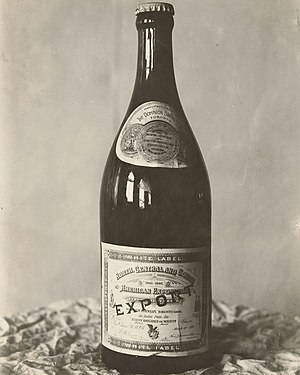
Dominion Brewery
Distance: Approx. 350 meters
Latitude and longitude: 43.65694,-79.35925
The Dominion Brewery was a brewery in Toronto, Ontario, Canada. It operated from 1878 until 1936. The brewery was founded by Robert T. Davies in 1877.

Berkeley House, York, Upper Canada
Distance: Approx. 397 meters
Latitude and longitude: 43.65149,-79.36444
Berkeley House was a prominent house in York, Upper Canada. It was the home of two Clerks of Upper Canada's Privy Council – John Small, and his son Charles Coxwell Small. Upper Canada's first small Parliament buildings were built next door to Berkeley House.

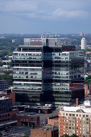
Globe and Mail Centre
Building
Distance: Approx. 397 meters
Latitude and longitude: 43.65149,-79.36444
The Globe and Mail Centre is a 17-storey building, on King Street East, in Toronto, Ontario, Canada, that houses the offices of The Globe and Mail newspaper, and other tenants. The building is adjacent to the former offices of rival newspaper the Toronto Sun, towering over it. Archeologists were allowed to excavate the foundations of Berkeley House, which were uncovered while removing a parking lot in preparation for digging foundations for the new building.
Weather in this IP's area
light rain
13 Celsius
12 Celsius
12 Celsius
14 Celsius
1017 hPa
75 %
1017 hPa
1007 hPa
10000 meters
3.09 m/s
90 degree
100 %
06:57:45
17:04:16
