Country:
 USA
USARegion:
City:
Latitude and Longitude:
Time Zone:
Postal Code:
IP information under different IP Channel
ip-api
Country
Region
City
ASN
Time Zone
ISP
Blacklist
Proxy
Latitude
Longitude
Postal
Route
IPinfo
Country
Region
City
ASN
Time Zone
ISP
Blacklist
Proxy
Latitude
Longitude
Postal
Route
MaxMind
Country
Region
City
ASN
Time Zone
ISP
Blacklist
Proxy
Latitude
Longitude
Postal
Route
Luminati
Country
USRegion
ne
City
blair
ASN
Time Zone
America/Chicago
ISP
GREAT-PLAINS-COMMUNICATIONS
Latitude
Longitude
Postal
db-ip
Country
Region
City
ASN
Time Zone
ISP
Blacklist
Proxy
Latitude
Longitude
Postal
Route
ipdata
Country
Region
City
ASN
Time Zone
ISP
Blacklist
Proxy
Latitude
Longitude
Postal
Route
Popular places and events near this IP address

Washington County, Nebraska
County in Nebraska, United States
Distance: Approx. 5420 meters
Latitude and longitude: 41.53,-96.22
Washington County is a county in the U.S. state of Nebraska. As of the 2020 United States Census, the population was 20,865. Its county seat is Blair.

Blair, Nebraska
City in and county seat of Washington County, Nebraska, United States
Distance: Approx. 3816 meters
Latitude and longitude: 41.54583333,-96.11333333
Blair is a city in and the county seat of Washington County, Nebraska, United States. The population was 7,990 at the 2010 census. Blair is a part of the Omaha-Council Bluffs Metropolitan Statistical Area.

Kennard, Nebraska
Village in Washington County, Nebraska, United States
Distance: Approx. 8870 meters
Latitude and longitude: 41.47472222,-96.20361111
Kennard is a village in Washington County, Nebraska, United States. The population was 361 at the 2010 census.
Dana College
Private college in Blair, Nebraska, US (1884–2010)
Distance: Approx. 433 meters
Latitude and longitude: 41.55027778,-96.15611111
Dana College was a private college in Blair, Nebraska. Its rural 150-acre (607,000 m2) campus is approximately 26 miles (40 km) northwest of Omaha and overlooks a portion of the Missouri River Valley. It closed in 2010.

Fort Calhoun Nuclear Generating Station
Distance: Approx. 7448 meters
Latitude and longitude: 41.52027778,-96.07722222
The Fort Calhoun Nuclear Generating Station is a shut-down nuclear power plant located on 660 acres (2.7 km2) between Fort Calhoun, and Blair, Nebraska adjacent to the Missouri River between mile markers 645.6 and 646.0. The utility has an easement for another 580 acres (2.3 km2) which is maintained in a natural state. The power plant is owned by the Omaha Public Power District of Omaha, Nebraska.
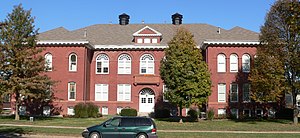
Blair High School (Blair, Nebraska)
Public school in Nebraska
Distance: Approx. 2029 meters
Latitude and longitude: 41.54,-96.13666667
Blair High School is a public high school in Blair, Nebraska, United States. It is a part of Blair Community Schools. The 140,000-square-foot (13,000 m2) building was built in 1970 at a cost of $2.2 million.
Township 2, Washington County, Nebraska
Distance: Approx. 8077 meters
Latitude and longitude: 41.48805556,-96.10277778
Township 2 is one of five townships in Washington County, Nebraska, United States. The population was 2,338 at the 2000 census. A 2006 estimate placed the township's population at 2,473.
KDCV-FM
Radio station in Blair, Nebraska (1972–2010)
Distance: Approx. 615 meters
Latitude and longitude: 41.55194444,-96.15555556
KDCV-FM (91.1 FM) was a radio station broadcasting a Variety format. Formerly licensed to Blair, Nebraska, United States, the station was owned by Dana College.

Blair Congregational Church
Historic church in Nebraska, United States
Distance: Approx. 2009 meters
Latitude and longitude: 41.541,-96.1364
The Blair Congregational Church in Blair, Nebraska is a Carpenter Gothic church that has been listed on the National Register of Historic Places since 1979. It is affiliated with the United Church of Christ. The church was founded in 1870.

Washington County Courthouse (Nebraska)
United States historic place
Distance: Approx. 2158 meters
Latitude and longitude: 41.54,-96.135
The Washington County Courthouse in Blair, Nebraska was built during 1889–91. It was listed on the National Register of Historic Places in 1990. It was designed by Lincoln, Nebraska, architect O.H. Placey.

Abraham Castetter House
United States historic place
Distance: Approx. 1767 meters
Latitude and longitude: 41.54166667,-96.13916667
The Abraham Castetter House is a historic house in Blair, Nebraska. It was built in 1876 for Abraham Castetter, who served as Washington County's county clerk and later founded The Banking House of A. Castetter. The house was designed in the Second Empire and Eclectic architectural styles.

C.C. Crowell Jr. House
United States historic place
Distance: Approx. 1281 meters
Latitude and longitude: 41.54361111,-96.14444444
The C.C. Crowell Jr. House is a historic house in Blair, Nebraska. It was built in 1901 for C.C. Crowell Jr.
Weather in this IP's area
clear sky
13 Celsius
12 Celsius
10 Celsius
13 Celsius
1022 hPa
77 %
1022 hPa
980 hPa
10000 meters
2.06 m/s
160 degree
06:58:30
19:46:07