Country:
Region:
City:
Latitude and Longitude:
Time Zone:
Postal Code:
IP information under different IP Channel
ip-api
Country
Region
City
ASN
Time Zone
ISP
Blacklist
Proxy
Latitude
Longitude
Postal
Route
Luminati
Country
Region
hid
City
ixmiquilpan
ASN
Time Zone
America/Mexico_City
ISP
IENTC S DE RL DE CV
Latitude
Longitude
Postal
IPinfo
Country
Region
City
ASN
Time Zone
ISP
Blacklist
Proxy
Latitude
Longitude
Postal
Route
db-ip
Country
Region
City
ASN
Time Zone
ISP
Blacklist
Proxy
Latitude
Longitude
Postal
Route
ipdata
Country
Region
City
ASN
Time Zone
ISP
Blacklist
Proxy
Latitude
Longitude
Postal
Route
Popular places and events near this IP address

Ixmiquilpan
Town and Municipality in Hidalgo, Mexico
Distance: Approx. 5496 meters
Latitude and longitude: 20.48194444,-99.21805556
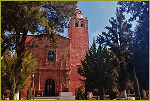
Ixmiquilpan (Otomi: Ntsʼu̱tkʼani) is a city and one of the 84 municipalities of Hidalgo, in central-eastern Mexico. It is located on the Mexico City/Nuevo Laredo Highway at km 170 in the central west part of the state of Hidalgo. The town of Ixmiquilpan is noted for its parish church, Church of San Miguel Arcángel, which contains a large series of murals done in the 16th century by native artists depicting Eagle and Jaguar warriors in battle, along with other pre-Hispanic imagery.

Mezquital Valley
Distance: Approx. 9494 meters
Latitude and longitude: 20.45275,-99.24911389
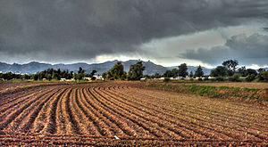
The Mezquital Valley (Mezquital Otomi: B’ot’ähi) is a series of small valleys and flat areas located in Central Mexico, about 60 kilometres (37 mi) north of Mexico City, located in the western part of the state of Hidalgo. It is part of the Trans-Mexican Volcanic Belt, with altitudes between 1,700 metres (5,600 ft) and 2,100 metres (6,900 ft) above sea level. It is one of Mexico's main semi-arid/area regions, whose native vegetation is dominated by cactus species, mesquite trees, and maguey with pine and oak trees in the highest elevations.

Church of San Miguel Arcángel
Church in Mexico
Distance: Approx. 5538 meters
Latitude and longitude: 20.48262,-99.21853
The Church of San Miguel Arcángel is a Roman Catholic church located in the town of Ixmiquilpan, Hidalgo, Mexico. Built in the 16th century, the church is renowned for its intricate murals depicting religious and secular themes, as well as its fusion of European and Indigenous architectural styles. This church and its artwork are a foundational example of the cultural and religious syncretism present in Indigenous society post-conquest with it providing insight in the post-colonial identity of Indigenous peoples.

El Mandho
Municipality and town in Hidalgo, Mexico
Distance: Approx. 7496 meters
Latitude and longitude: 20.50222222,-99.23555556
El Mandho is a town in Mexico located in the municipality of Ixmiquilpan in the state of Hidalgo.

Second federal electoral district of Hidalgo
Federal electoral district of Mexico
Distance: Approx. 5527 meters
Latitude and longitude: 20.5,-99.21666667
The second federal electoral district of Hidalgo (Distrito electoral federal 02 de Hidalgo) is one of the 300 electoral districts into which Mexico is divided for elections to the federal Chamber of Deputies and one of the seven currently operational districts in the state of Hidalgo. It elects one deputy to the lower house of Congress for each three-year legislative period by means of the first-past-the-post system. As of 2024, votes cast in the district also count towards the calculation of proportional representation ("plurinominal") deputies elected from the fourth electoral region.
Weather in this IP's area
few clouds
18 Celsius
18 Celsius
18 Celsius
18 Celsius
1010 hPa
82 %
1010 hPa
824 hPa
10000 meters
0.9 m/s
0.9 m/s
184 degree
20 %
06:47:56
17:55:51