Country:
 Canada
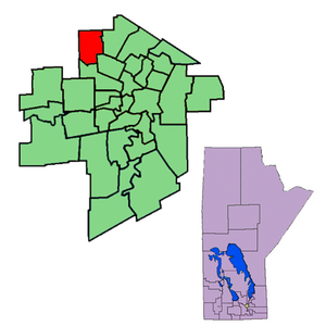
Region:
City:
Latitude and Longitude:
Time Zone:
Postal Code:
IP information under different IP Channel
ip-api
Country
Region
City
ASN
Time Zone
ISP
Blacklist
Proxy
Latitude
Longitude
Postal
Route
IPinfo
Country
Region
City
ASN
Time Zone
ISP
Blacklist
Proxy
Latitude
Longitude
Postal
Route
MaxMind
Country
Region
City
ASN
Time Zone
ISP
Blacklist
Proxy
Latitude
Longitude
Postal
Route
Luminati
Country
CARegion
mb
City
winnipeg
ASN
Time Zone
America/Winnipeg
ISP
OXIO-ASN-01
Latitude
Longitude
Postal
db-ip
Country
Region
City
ASN
Time Zone
ISP
Blacklist
Proxy
Latitude
Longitude
Postal
Route
ipdata
Country
Region
City
ASN
Time Zone
ISP
Blacklist
Proxy
Latitude
Longitude
Postal
Route
Popular places and events near this IP address
Inkster (electoral district)
Defunct provincial electoral district in Manitoba, Canada
Distance: Approx. 7414 meters
Latitude and longitude: 49.945,-97.197
Inkster was a provincial electoral division in the Canadian province of Manitoba. It was located in the northwestern corner of the city of Winnipeg. Officially created by redistribution in 1957, it has existed since the provincial election of 1958.

The Maples (electoral district)
Provincial electoral district in Manitoba, Canada
Distance: Approx. 7267 meters
Latitude and longitude: 49.956,-97.165
The Maples is a provincial electoral division in the Canadian province of Manitoba. The riding was created by redistribution in 1989, has been represented in the Legislative Assembly of Manitoba since the provincial election of 1990. It is located in the north end of Winnipeg.

Prairie Dog Central Railway
Heritage railway in Manitoba, Canada
Distance: Approx. 7267 meters
Latitude and longitude: 49.9513,-97.2697
The Prairie Dog Central Railway is a heritage railway just outside Winnipeg, Manitoba, Canada. Regular trips are every Saturday, Sunday and Holiday Monday from May through September, and last almost four hours with one stop in the rural community of Grosse Isle. Special dinner excursions occur during the season, as well as the Howlin' Halloween Express Trains in October.

Rural Municipality of West St. Paul
Rural municipality in Manitoba
Distance: Approx. 7760 meters
Latitude and longitude: 50.01194444,-97.115
West St. Paul is a rural municipality (RM) in Manitoba, Canada. It lies adjacent to the north side of Winnipeg, and directly west of the Red River.
Old Kildonan
Suburb of Winnipeg, Canada
Distance: Approx. 8012 meters
Latitude and longitude: 49.96666667,-97.13333333
Old Kildonan is the northernmost city ward of Winnipeg, Manitoba. Before the City of Winnipeg Act of 1972, it was an independent unincorporated municipality called the Municipality of Old Kildonan; prior to that, from 1914, it was a subdivision of the Rural Municipality of Kildonan. It is bounded by the north limit of the City of Winnipeg on the north; by the CP Winnipeg Beach railway, slightly past McPhillips Street, on the east; Brookside Boulevard (Winnipeg Route 90) on the west; and by Inkster Boulevard (Route 23) on the south.

Stony Mountain, Manitoba
Unincorporated Community in Manitoba, Canada
Distance: Approx. 8791 meters
Latitude and longitude: 50.08833333,-97.21944444
Stony Mountain is a small community in Manitoba, Canada approximately 11 kilometres (6.8 mi) north of Winnipeg on Provincial Highway 7. The town is in the Rural Municipality of Rockwood and is the location of Stony Mountain Ski Area. The Stony Mountain Institution and Rockwood Institution prisons are in Stony Mountain.
Maples Collegiate
Public school in Winnipeg, Manitoba, Canada
Distance: Approx. 7132 meters
Latitude and longitude: 49.9541,-97.1731
Maples Collegiate is a public high school in Winnipeg, Manitoba which goes from grades 9 to 12. It is a part of the Seven Oaks School Division. The Maples Met High School is located in the same building as the regular high school.
Garden City Shopping Centre (Winnipeg)
Regional shopping centre in West Kildonan (Winnipeg), Manitoba
Distance: Approx. 8610 meters
Latitude and longitude: 49.9508,-97.1449
Garden City Shopping Centre is a single-level shopping centre in Winnipeg, Manitoba, Canada, located at the intersection of McPhillips Street and Leila Avenue. Built in 1970, it was opened on August 12 that year. With an area of 379,681 sq ft (35,273.5 m2), the mall consists of 70 stores and 10 restaurants on a single level.
Seven Oaks General Hospital
Hospital in Manitoba, Canada
Distance: Approx. 8083 meters
Latitude and longitude: 49.955,-97.14861111
Seven Oaks General Hospital (SOGH) is a community hospital in Winnipeg, Manitoba, Canada. It was founded in 1981 by community leaders and approved by the province of Manitoba to serve the needs of the northern part of Winnipeg and surrounding area. Seven Oaks is also a hub for kidney health services, a centre for general surgery and orthopedic surgery, and has a large commitment to family medicine, both in terms of in-patient medical care, but also as a centre for the training of medical residents and the home of a new private medical clinic.
Stony Mountain Institution
Prison in Manitoba, Canada
Distance: Approx. 8083 meters
Latitude and longitude: 50.082,-97.225
Stony Mountain Institution is a federal multi-security complex located in the Rural Municipality of Rockwood immediately adjacent to the community of Stony Mountain, Manitoba, about 24 km (15 mi) from Winnipeg. The Institution (medium-security) began operations in 1877, making it the oldest running federal prison in Canada following the closure of Ontario's Kingston Penitentiary on 30 September 2013. Immediately adjacent to Stony Mountain Institution is the Rockwood Institution, a minimum-security facility established in 1962.

Tyndall Park (electoral district)
Provincial electoral district in Manitoba, Canada
Distance: Approx. 8135 meters
Latitude and longitude: 49.937,-97.208
Tyndall Park is a provincial electoral division in the Canadian province of Manitoba. It was created by redistribution in 2008 from parts of Inkster, Wellington, and St. James electoral districts.
Rockwood Institution
Prison in Stony Mountain, Canada
Distance: Approx. 8083 meters
Latitude and longitude: 50.082,-97.225
Rockwood Institution is a federal minimum-security facility located in the community of Stony Mountain, Rural Municipality of Rockwood, Manitoba, about 11 mi (18 km) from Winnipeg. It opened in 1962 and can accommodate up to 167 inmates.
Weather in this IP's area
broken clouds
24 Celsius
24 Celsius
22 Celsius
24 Celsius
1001 hPa
78 %
1001 hPa
974 hPa
10000 meters
6.17 m/s
130 degree
75 %
07:10:07
19:35:42