Country:
 Canada
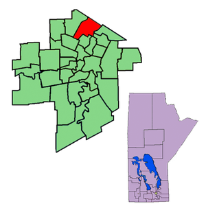
Region:
City:
Latitude and Longitude:
Time Zone:
Postal Code:
IP information under different IP Channel
ip-api
Country
Region
City
ASN
Time Zone
ISP
Blacklist
Proxy
Latitude
Longitude
Postal
Route
IPinfo
Country
Region
City
ASN
Time Zone
ISP
Blacklist
Proxy
Latitude
Longitude
Postal
Route
MaxMind
Country
Region
City
ASN
Time Zone
ISP
Blacklist
Proxy
Latitude
Longitude
Postal
Route
Luminati
Country
CARegion
mb
City
winnipeg
ASN
Time Zone
America/Winnipeg
ISP
OXIO-ASN-01
Latitude
Longitude
Postal
db-ip
Country
Region
City
ASN
Time Zone
ISP
Blacklist
Proxy
Latitude
Longitude
Postal
Route
ipdata
Country
Region
City
ASN
Time Zone
ISP
Blacklist
Proxy
Latitude
Longitude
Postal
Route
Popular places and events near this IP address
Kildonan (electoral district)
Defunct provincial electoral district in Manitoba, Canada
Distance: Approx. 3808 meters
Latitude and longitude: 49.955,-97.105
Kildonan was a provincial electoral division in the Canadian province of Manitoba. The boundaries for the riding maintained their location through the 2008 redistribution.

The Maples (electoral district)
Provincial electoral district in Manitoba, Canada
Distance: Approx. 1988 meters
Latitude and longitude: 49.956,-97.165
The Maples is a provincial electoral division in the Canadian province of Manitoba. The riding was created by redistribution in 1989, has been represented in the Legislative Assembly of Manitoba since the provincial election of 1990. It is located in the north end of Winnipeg.
Old Kildonan
Suburb of Winnipeg, Canada
Distance: Approx. 1412 meters
Latitude and longitude: 49.96666667,-97.13333333
Old Kildonan is the northernmost city ward of Winnipeg, Manitoba. Before the City of Winnipeg Act of 1972, it was an independent unincorporated municipality called the Municipality of Old Kildonan; prior to that, from 1914, it was a subdivision of the Rural Municipality of Kildonan. It is bounded by the north limit of the City of Winnipeg on the north; by the CP Winnipeg Beach railway, slightly past McPhillips Street, on the east; Brookside Boulevard (Winnipeg Route 90) on the west; and by Inkster Boulevard (Route 23) on the south.
St. Volodymyr Museum
Museum in Winnipeg, Canada
Distance: Approx. 4393 meters
Latitude and longitude: 49.9524,-97.0979
The St. Volodymyr Museum is a museum in Winnipeg, Manitoba, Canada. It was started in Canada's centennial year by the Ukrainian Catholic Women's League of Canada.
Seven Oaks School Division
School division in Manitoba, Canada
Distance: Approx. 3023 meters
Latitude and longitude: 49.945,-97.143
Seven Oaks School Division (SOSD, or colloquially 7 Oaks) is a school division in the north-west area of Winnipeg, Manitoba in Canada. Established in July 1959, it takes in the Winnipeg neighbourhoods of West Kildonan, Garden City, the Maples, Riverbend, and Amber Trails, as well as the Rural Municipality of West St. Paul.
Garden City, Winnipeg
Neighbourhood of West Kildonan (Winnipeg)
Distance: Approx. 3245 meters
Latitude and longitude: 49.94277778,-97.14472222
Garden City is a suburban neighbourhood in Winnipeg, Manitoba. The area features large homes and residential lots, numerous parks and schools, and includes Garden City Shopping Centre, a regional mall. It has a land area of 2.3-square-kilometre (570-acre), with the population growing to 6,475 as of 2021.
Garden City Collegiate
Public high school in Winnipeg, Manitoba, Canada
Distance: Approx. 3312 meters
Latitude and longitude: 49.94222222,-97.14416667
Garden City Collegiate (GCC or GC) is a high school in Winnipeg, Manitoba. It is part of the Seven Oaks School Division, and houses grades 9–12. The Garden City motto is "Participation and Excellence." Garden City Collegiate offers two programs: the English Diploma and the French Immersion Diploma.
Maples Collegiate
Public school in Winnipeg, Manitoba, Canada
Distance: Approx. 2487 meters
Latitude and longitude: 49.9541,-97.1731
Maples Collegiate is a public high school in Winnipeg, Manitoba which goes from grades 9 to 12. It is a part of the Seven Oaks School Division. The Maples Met High School is located in the same building as the regular high school.
Garden City Shopping Centre (Winnipeg)
Regional shopping centre in West Kildonan (Winnipeg), Manitoba
Distance: Approx. 2363 meters
Latitude and longitude: 49.9508,-97.1449
Garden City Shopping Centre is a single-level shopping centre in Winnipeg, Manitoba, Canada, located at the intersection of McPhillips Street and Leila Avenue. Built in 1970, it was opened on August 12 that year. With an area of 379,681 sq ft (35,273.5 m2), the mall consists of 70 stores and 10 restaurants on a single level.
Seven Oaks General Hospital
Hospital in Manitoba, Canada
Distance: Approx. 1859 meters
Latitude and longitude: 49.955,-97.14861111
Seven Oaks General Hospital (SOGH) is a community hospital in Winnipeg, Manitoba, Canada. It was founded in 1981 by community leaders and approved by the province of Manitoba to serve the needs of the northern part of Winnipeg and surrounding area. Seven Oaks is also a hub for kidney health services, a centre for general surgery and orthopedic surgery, and has a large commitment to family medicine, both in terms of in-patient medical care, but also as a centre for the training of medical residents and the home of a new private medical clinic.
Seven Oaks Sportsplex
Distance: Approx. 2854 meters
Latitude and longitude: 49.9473,-97.1388
The Seven Oaks Sportsplex is an indoor ice hockey and soccer complex in Winnipeg, Manitoba, Canada. The complex consists of the Seven Oaks Arena and the Seven Oaks Soccer Complex (formerly Garden City Soccer Complex). It is located on the grounds of the Garden City Community Centre, immediately east of the Garden City Shopping Centre, in the Garden City area.
Shaarey Zedek Cemetery (Winnipeg)
Jewish cemetery in Manitoba, Canada
Distance: Approx. 3904 meters
Latitude and longitude: 49.94555556,-97.115
Shaarey Zedek Cemetery is a Conservative Jewish burial ground in the North End of Winnipeg, Manitoba, Canada. Operated by the Shaarey Zedek Synagogue, it is the largest Jewish cemetery in the Canadian Prairies, with more than 8,000 graves as of 1996. In 2012, a Jewish interfaith burial ground was installed in a fenced-off section with a separate entrance to accommodate interment of Jews alongside their non-Jewish spouses.
Weather in this IP's area
broken clouds
24 Celsius
24 Celsius
22 Celsius
24 Celsius
1001 hPa
80 %
1001 hPa
974 hPa
10000 meters
6.17 m/s
130 degree
75 %
07:09:50
19:35:24