Country:
 Canada
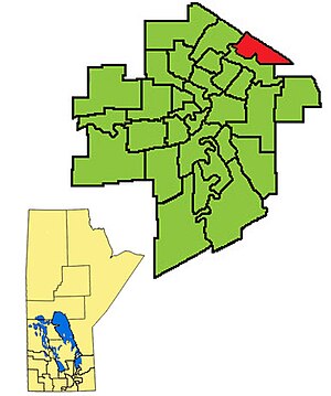
Region:
City:
Latitude and Longitude:
Time Zone:
Postal Code:
IP information under different IP Channel
ip-api
Country
Region
City
ASN
Time Zone
ISP
Blacklist
Proxy
Latitude
Longitude
Postal
Route
IPinfo
Country
Region
City
ASN
Time Zone
ISP
Blacklist
Proxy
Latitude
Longitude
Postal
Route
MaxMind
Country
Region
City
ASN
Time Zone
ISP
Blacklist
Proxy
Latitude
Longitude
Postal
Route
Luminati
Country
CARegion
mb
City
winnipeg
ASN
Time Zone
America/Winnipeg
ISP
OXIO-ASN-01
Latitude
Longitude
Postal
db-ip
Country
Region
City
ASN
Time Zone
ISP
Blacklist
Proxy
Latitude
Longitude
Postal
Route
ipdata
Country
Region
City
ASN
Time Zone
ISP
Blacklist
Proxy
Latitude
Longitude
Postal
Route
Popular places and events near this IP address

Rossmere
Provincial electoral district in Manitoba, Canada
Distance: Approx. 1954 meters
Latitude and longitude: 49.933,-97.082
Rossmere is a provincial electoral division in the Canadian province of Manitoba. It was created by redistribution in 1968, and has formally existed since the provincial election of 1969. The riding is located in the northeastern section of the City of Winnipeg.
River East
Defunct provincial electoral district in Manitoba, Canada
Distance: Approx. 708 meters
Latitude and longitude: 49.944,-97.049
River East was a provincial electoral division in the Canadian province of Manitoba. It was officially created by redistribution in 1979, and formally existed since the provincial election of 1981 until 2019. The riding was located on the northeast corner of the City of Winnipeg, bordered by the Red River to the west, the city limit, by Springfield to the north and east, and by the riding of Rossmere to the south.

Elmwood—Transcona
Federal electoral district in Manitoba, Canada
Distance: Approx. 3143 meters
Latitude and longitude: 49.9186,-97.0313
Elmwood—Transcona (formerly Winnipeg—Transcona) is a federal electoral district in Manitoba, Canada, that has been represented in the House of Commons of Canada since 1988. Its population in 2021 was 101,691.
North Kildonan
Suburb of Winnipeg, Canada
Distance: Approx. 2208 meters
Latitude and longitude: 49.94083333,-97.08861111
North Kildonan is a city ward in northern Winnipeg, and a former municipality in Manitoba, Canada. Its population as of 2016 was 44,664.

Kildonan Park
Regional park in West Kildonan (Winnipeg), Canada
Distance: Approx. 3234 meters
Latitude and longitude: 49.94361111,-97.10277778
Kildonan Park is a park in the West Kildonan area of northern Winnipeg, Manitoba, Canada. Established in 1909 as a 73-acre (30 ha) park, it features the Peguis Pavilion, Rainbow Stage, the Witch's Hut, an Olympic-sized outdoor swimming pool, duck pond, and soccer field as well as picnic tables and barbecue pits. The Park was originally designed by George Champion who was the park's Superintendent.

Rainbow Stage
Distance: Approx. 3065 meters
Latitude and longitude: 49.94194444,-97.10055556
Rainbow Stage is a not-for-profit musical theatre company and outdoor theatre operator, located in Kildonan Park in north Winnipeg, Manitoba. The covered amphitheatre seats up to 2,600 people and operates from May to September.
St. Volodymyr Museum
Museum in Winnipeg, Canada
Distance: Approx. 3136 meters
Latitude and longitude: 49.9524,-97.0979
The St. Volodymyr Museum is a museum in Winnipeg, Manitoba, Canada. It was started in Canada's centennial year by the Ukrainian Catholic Women's League of Canada.
West Kildonan Collegiate
Public high school in Winnipeg, Manitoba, Canada
Distance: Approx. 2932 meters
Latitude and longitude: 49.9541,-97.0934
West Kildonan Collegiate (WKC) is a high school in Winnipeg, Manitoba which hosts students from grades 9-12. It is part of the Seven Oaks School Division, and houses about 850 students. The school decided in June 2007 to change the school's name from "West Kildonan Collegiate Institute" to simply "West Kildonan Collegiate".

River East Collegiate
Public high school in Winnipeg, Manitoba, Canada
Distance: Approx. 1670 meters
Latitude and longitude: 49.9431,-97.0809
River East Collegiate is a public high school located in Winnipeg, Manitoba, that belongs to the River East Transcona School Division. River East has a school population of approximately 1,250 students. The school colours are blue and white and the school mascot is the Kodiak bear (Kody).

Concordia Hospital
Hospital in Winnipeg, Manitoba
Distance: Approx. 3144 meters
Latitude and longitude: 49.9132,-97.0646
Concordia Hospital is a regional hospital in Winnipeg, Manitoba that was founded in 1928, and has a primary service area with a population exceeding 150,000. The hospital's name originates from a poem entitled "Song of the Church Bell" by German poet and philosopher Friedrich Schiller. The inspirational line reads, "Concordia shall be her name; to harmony, to hearty fellowship, it summons the cherished community." Concordia Hospital is Winnipeg's leading hip and knee surgery hospital, conducting 1,508 hip and knee surgeries during the 2011 fiscal year, more than any other Winnipeg facility.
Manitoba Pioneer Camp
Distance: Approx. 2494 meters
Latitude and longitude: 49.9381,-97.0923
Pioneer Camp Manitoba (PCM) is a summer camp, one of several Pioneer Camps owned and operated by Inter-Varsity Christian Fellowship (IVCF) of Canada. It operates on two islands on Shoal Lake, near Lake of the Woods. It is located just on the Ontarian side of the Manitoba-Ontario border, and is accredited by the Manitoba Camping Association.

Kildonan-East Collegiate
Secondary school in Winnipeg, Manitoba, Canada
Distance: Approx. 2961 meters
Latitude and longitude: 49.9171,-97.0756
Kildonan East Collegiate is a grade 9 to 12 Public high school in Winnipeg, Manitoba, Canada with an enrolment of 1300 students. It is a part of the River East Transcona School Division. Built in 1971, Kildonan East Collegiate is a vocational school with various courses from grades 9 to 12.
Weather in this IP's area
broken clouds
24 Celsius
24 Celsius
23 Celsius
24 Celsius
1001 hPa
80 %
1001 hPa
975 hPa
10000 meters
6.17 m/s
130 degree
75 %
07:09:28
19:35:01