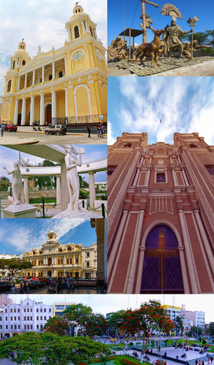
Country:
Region:
City:
Latitude and Longitude:
Time Zone:
Postal Code:
IP information under different IP Channel
ip-api
Country
Region
City
ASN
Time Zone
ISP
Blacklist
Proxy
Latitude
Longitude
Postal
Route
Luminati
Country
Region
lam
City
chiclayo
ASN
Time Zone
America/Lima
ISP
CALA SERVICIOS INTEGRALES E.I.R.L.
Latitude
Longitude
Postal
IPinfo
Country
Region
City
ASN
Time Zone
ISP
Blacklist
Proxy
Latitude
Longitude
Postal
Route
db-ip
Country
Region
City
ASN
Time Zone
ISP
Blacklist
Proxy
Latitude
Longitude
Postal
Route
ipdata
Country
Region
City
ASN
Time Zone
ISP
Blacklist
Proxy
Latitude
Longitude
Postal
Route
Popular places and events near this IP address

Chiclayo
Place in Lambayeque, Peru
Distance: Approx. 1155 meters
Latitude and longitude: -6.76296111,-79.83661389
Chiclayo (Spanish pronunciation: [tʃiˈklaʝo]; Mochica: Cɥiclaiæp) is the principal city and capital of the Lambayeque region and Chiclayo Province in northern Peru. It is located 13 kilometers (8.1 mi) from the Pacific coast, 208 kilometers from the city of Trujillo and 770 kilometers (480 m) from the country's capital, Lima. It was founded under the name of "Santa María de los Valles de Chiclayo".
FAP Captain José Abelardo Quiñones González International Airport
Airport in Peru
Distance: Approx. 2490 meters
Latitude and longitude: -6.7875,-79.82777778
Capitán FAP José A. Quiñones González International Airport (IATA: CIX, ICAO: SPHI) is an airport serving Chiclayo, Peru and the surrounding metropolitan area. It is run by ADP, a private airport operator that operates various airports in northern Peru. It is the main airport of the Lambayeque Region, one of the most populous regions of Peru.

Estadio Elías Aguirre
Distance: Approx. 1984 meters
Latitude and longitude: -6.76833333,-79.86083333
Estadio Capitán Remigio Elías Aguirre Romero is a multi-purpose stadium administrated by the governmental Instituto Peruano del Deporte in Chiclayo, Peru. It was built in 1970 named after the 19th century Peruvian sailor Elías Aguirre Romero. Its current spectator capacity is 23,000 (can be limited to 20,000 for safety reasons) after the renovations performed for the 2004 Copa América, and had artificial turf installed for the 2005 FIFA U-17 World Championship.

Chiclayo Province
Province in Lambayeque, Peru
Distance: Approx. 1014 meters
Latitude and longitude: -6.76388889,-79.8375
The Chiclayo Province is one of three provinces of the Lambayeque Region in Peru.
Roman Catholic Diocese of Chiclayo
Roman Catholic diocese in Peru
Distance: Approx. 590 meters
Latitude and longitude: -6.7717,-79.8378
The Roman Catholic Diocese of Chiclayo (Latin: Chiclayen(sis)) is a Latin Catholic suffragan diocese in the ecclesiastical province of Piura in Peru's northwestern Lambayeque region. Its cathedral episcopal see is Catedral Santa María in the city of Chiclayo.
Chiclayo District
District in Lambayeque, Peru
Distance: Approx. 427 meters
Latitude and longitude: -6.7718,-79.8393
Chiclayo District is one of twenty districts of the Chiclayo province in Peru. The district is home to the principal city of Chiclayo.
José Leonardo Ortiz District
District in Lambayeque, Peru
Distance: Approx. 2840 meters
Latitude and longitude: -6.7457,-79.8455
José Leonardo Ortiz District is one of twenty districts of the province Chiclayo in Peru.
La Victoria District, Chiclayo
District in Lambayeque, Peru
Distance: Approx. 2941 meters
Latitude and longitude: -6.7975,-79.8441
La Victoria District is one of twenty districts of the province Chiclayo in Peru.

Pomalca District
District in Lambayeque, Peru
Distance: Approx. 5707 meters
Latitude and longitude: -6.7695,-79.7915
Pomalca District is one of twenty districts of the province Chiclayo in Peru. It limits by the North with the District of Picsi; by the East with the district of Tumán; to the south with the districts of Reque and Monsefú; and to the west with the districts of Chiclayo and José Leonardo Ortiz.
Empresa Agroindustrial Pomalca
Distance: Approx. 7701 meters
Latitude and longitude: -6.769312,-79.77346
Empresa Agroindustrial Pomalca is a leading agribusiness company based in Chiclayo, Peru. It is one of the country's major sugar producers. The company has more than 15,000 hectares (37,000 acres) in sugar cane for production of sugar, molasses, and bagasse, in addition to other agricultural exports from its factory in coastal Lambayeque Region, Peru.

St. Mary's Cathedral, Chiclayo
Church in Chiclayo, Peru
Distance: Approx. 612 meters
Latitude and longitude: -6.7717,-79.8376
Chiclayo Cathedral, officially the Cathedral of Saint Mary (Spanish: Catedral de Santa María) in Chiclayo, Peru is the seat of the Roman Catholic Diocese of Chiclayo. The cathedral church was built in the neo-classical style starting in 1869 according to designs and plans commissioned from Gustave Eiffel, nicknamed "Rose Meridionale". Construction was interrupted in 1871 due to lack of funds, and resumed only after the Congress of the Republic lent support a half-century later.

Royal Tombs of Sipán Museum
Archaeological museum in Lambayeque, Peru
Distance: Approx. 9638 meters
Latitude and longitude: -6.705,-79.8994
The Royal Tombs of Sipán Museum (Spanish: Museo Tumbas Reales de Sipán) is a museum in Lambayeque, Peru. It contains most of the important artifacts (ceremonial vessels, necklaces and jewelry) found at Huaca Rajada by archeologist Walter Alva in 1987, including the Lord of Sipán and his entourage. The museum was inaugurated in 2002.
Weather in this IP's area
clear sky
19 Celsius
19 Celsius
19 Celsius
19 Celsius
1014 hPa
77 %
1014 hPa
1010 hPa
10000 meters
5.14 m/s
170 degree
05:51:24
18:16:16

