Country:
Region:
City:
Latitude and Longitude:
Time Zone:
Postal Code:
IP information under different IP Channel
ip-api
Country
Region
City
ASN
Time Zone
ISP
Blacklist
Proxy
Latitude
Longitude
Postal
Route
Luminati
Country
ASN
Time Zone
America/Caracas
ISP
THUNDERNET, C.A.
Latitude
Longitude
Postal
IPinfo
Country
Region
City
ASN
Time Zone
ISP
Blacklist
Proxy
Latitude
Longitude
Postal
Route
db-ip
Country
Region
City
ASN
Time Zone
ISP
Blacklist
Proxy
Latitude
Longitude
Postal
Route
ipdata
Country
Region
City
ASN
Time Zone
ISP
Blacklist
Proxy
Latitude
Longitude
Postal
Route
Popular places and events near this IP address

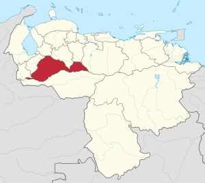
Barinas (state)
State of Venezuela
Distance: Approx. 4238 meters
Latitude and longitude: 8.63333333,-70.2
Barinas State (Spanish: Estado Barinas, IPA: [esˈtaðo βaˈɾinas]) is one of the 23 states of Venezuela. The state capital is Barinas. Barinas State covers a total surface area of 35,200 km2 (13,600 sq mi) and had an estimated population of 970,689 in 2015.
Estadio Agustín Tovar
Distance: Approx. 3272 meters
Latitude and longitude: 8.62443,-70.207401
Estadio Agustín Tovar, also known as Estadio La Carolina, is a multi-purpose stadium in Barinas, Venezuela. It is currently used mostly for football matches and it is the home stadium of Zamora FC. The stadium holds 24,234 people and was completed in 2007. This stadium was re-built to increase its capacity from 12,000 people up to 30,000.

Roman Catholic Diocese of Barinas
Roman Catholic diocese in Venezuela
Distance: Approx. 3152 meters
Latitude and longitude: 8.6317,-70.2098
The Roman Catholic Diocese of Barinas (Latin: Dioecesis Barinensis) is a suffragan Latin diocese, in the ecclesiastical province of Mérida, in western Venezuela's land-locked Barinas state. Its cathedral episcopal see is the Marian catedral de Nuestra Señora del Pilar, dedicated to Our Lady of the Pillar, located in the eponymous state capital Barinas.

Apure Department
Department in Distrito del Norte, Gran Colombia
Distance: Approx. 4238 meters
Latitude and longitude: 8.63333333,-70.2
Apure Department was one of the departments of Gran Colombia. It was split from the Venezuela Department. It encompassed 2 provinces - Barinas Province in the north and Achaguas Province in the south.
Unellez Botanical Garden
Distance: Approx. 1894 meters
Latitude and longitude: 8.63527778,-70.24916667
The Unellez Botanical Garden (Spanish: Jardín Botánico de la Unellez) Is a botanical garden and a zoo of 14 ha of extension, located inside the facilities of the National Experimental University of the Llanos Ezequiel Zamora in Barinas, Venezuela. It is a member of the BGCI, being its international identification code as a botanical institution as well as s It is located to the northwest of the city of Barinas, at the foot of the Mountain range of the $ andes; To a height of 200 msnm and presenting an average annual temperature of 28 °C. It was created in 1979, This garden also includes a zoo with an area of 14 hectares of which 4 ha correspond to a lagoon The collections of plants of the botanical garden, are grouped like: Arboretum (34 spp.) Plants of economic interest (50 spp.) Plants of medicinal interest Fodder plants Palmetum (13 spp.) Ornamental plants (100 spp.) There is a germplasm bank with a mean conservation capacity that contains 84 accessions, representing 73 species (1994 figures).
Weather in this IP's area
light rain
23 Celsius
24 Celsius
23 Celsius
23 Celsius
1007 hPa
95 %
1007 hPa
985 hPa
10000 meters
2.29 m/s
4.6 m/s
293 degree
98 %
06:33:35
18:17:33
