Country:
Region:
City:
Latitude and Longitude:
Time Zone:
Postal Code:
IP information under different IP Channel
ip-api
Country
Region
City
ASN
Time Zone
ISP
Blacklist
Proxy
Latitude
Longitude
Postal
Route
Luminati
Country
Region
que
City
cadereyta
ASN
Time Zone
America/Mexico_City
ISP
IENTC S DE RL DE CV
Latitude
Longitude
Postal
IPinfo
Country
Region
City
ASN
Time Zone
ISP
Blacklist
Proxy
Latitude
Longitude
Postal
Route
db-ip
Country
Region
City
ASN
Time Zone
ISP
Blacklist
Proxy
Latitude
Longitude
Postal
Route
ipdata
Country
Region
City
ASN
Time Zone
ISP
Blacklist
Proxy
Latitude
Longitude
Postal
Route
Popular places and events near this IP address
Estadio Sergio León Chávez
Sports venue in Irapuato, Mexico
Distance: Approx. 1190 meters
Latitude and longitude: 20.6845,-101.3563
Estadio Sergio León Chávez is a Multi-purpose stadium in the city of Irapuato. It is currently used mostly for football matches. The stadium holds 25,000 people.
Instituto Tecnológico Superior de Irapuato
Mexican university
Distance: Approx. 9217 meters
Latitude and longitude: 20.75333333,-101.33305556
The Higher Technological Institute of Irapuato (In Spanish: Instituto Tecnológico Superior de Irapuato), popularly known as ITESI, is a public, coeducational university located in the city of Irapuato, Guanajuato, Mexico. The ITESI offers 17 bachelor's degrees and 4 masters programs in the areas of management and social sciences and engineering. By October 20, 1995, the state government of Guanajuato decreed the creation of ITESI; and the latter began its academic activities on August 18, 1996.
Roman Catholic Diocese of Irapuato
Roman Catholic diocese in Mexico
Distance: Approx. 1510 meters
Latitude and longitude: 20.6746,-101.3466
The Roman Catholic Diocese of Irapuato (Latin: Dioecesis Irapuatensis) is a Latin suffragan diocese in the ecclesiastical province of the Metropolitan Archdiocese of León in southern Mexico. Its cathedral Episcopal see is Catedral de Nuestra Señora de la Soledad, at Irapuato, Guanajuato.

Irapuato
City and municipality in Guanajuato, Mexico
Distance: Approx. 1468 meters
Latitude and longitude: 20.66666667,-101.35
Irapuato is a Mexican city and municipality located at the foot of the Arandas Hill (in Spanish: Cerro de Arandas), in the central region of the state of Guanajuato. It lies between the Silao River and the Guanajuato River, a tributary of the Lerma River, at 1,724 m (5,656 ft) above sea level. It is located at 20°40′N 101°21′W. The city is the second-largest in the state (only behind León), with a population of 342,561 according to the 2005 census, while its municipality has a population of 529,440.
Inforum (Irapuato)
Distance: Approx. 5414 meters
Latitude and longitude: 20.7177,-101.3366
The Inforum is a convention center located in Irapuato, Guanajuato, Mexico. It is the site of the annual ExpoFresas, which is held every December.
Irapuato Cathedral
Church in Irapuato, Mexico
Distance: Approx. 1500 meters
Latitude and longitude: 20.675,-101.3467
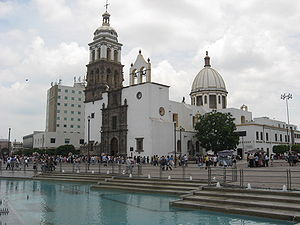
Our Lady of Solitude Cathedral (also called Irapuato Cathedral; Spanish: Catedral de Nuestra Señora de la Soledad) is the main Roman Catholic church in Irapuato, Mexico. It is located in front of the Plaza Monumental Miguel Hidalgo. It is the mother church of the Diocese of Irapuato, which is the seat of the bishopric.
Colegio Marcelino Champagnat
Catholic school in La Pintana, Chile
Distance: Approx. 1190 meters
Latitude and longitude: 20.66751,-101.36946
Colegio Marcelino Champagnat in La Pintana, Chile, opened in 1983, and since 1988 has been run by the Marist Brothers. It currently offers basic and professional technical education, and is subsidized by the state.
Weather in this IP's area
scattered clouds
13 Celsius
13 Celsius
13 Celsius
13 Celsius
1012 hPa
86 %
1012 hPa
827 hPa
10000 meters
0.38 m/s
0.5 m/s
235 degree
30 %
06:57:38
18:04:10
