Country:
Region:
City:
Latitude and Longitude:
Time Zone:
Postal Code:
IP information under different IP Channel
ip-api
Country
Region
City
ASN
Time Zone
ISP
Blacklist
Proxy
Latitude
Longitude
Postal
Route
Luminati
Country
Region
hid
City
mineraldelareforma
ASN
Time Zone
America/Mexico_City
ISP
IENTC S DE RL DE CV
Latitude
Longitude
Postal
IPinfo
Country
Region
City
ASN
Time Zone
ISP
Blacklist
Proxy
Latitude
Longitude
Postal
Route
db-ip
Country
Region
City
ASN
Time Zone
ISP
Blacklist
Proxy
Latitude
Longitude
Postal
Route
ipdata
Country
Region
City
ASN
Time Zone
ISP
Blacklist
Proxy
Latitude
Longitude
Postal
Route
Popular places and events near this IP address

Pachuca
Capital and largest city of Hidalgo, Mexico
Distance: Approx. 6090 meters
Latitude and longitude: 20.1,-98.75
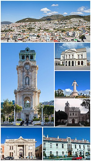
Pachuca (Spanish pronunciation: [paˈtʃuka] ; Mezquital Otomi: Nju̱nthe), formally known as Pachuca de Soto, is the capital and largest city of the east-central Mexican state of Hidalgo, located in the south-central part of the state. Pachuca de Soto is also the name of the municipality for which the city serves as municipal seat. Pachuca is located about 90 kilometres (56 mi) north of Mexico City via Mexican Federal Highway 85.

Estadio Hidalgo
Football stadium in Pachuca, Hidalgo, Mexico
Distance: Approx. 6453 meters
Latitude and longitude: 20.10527778,-98.75611111
The Estadio Hidalgo is a football stadium named after Miguel Hidalgo y Costilla. It is located in Pachuca in the Mexican state of Hidalgo. This sport facility is one of Mexico's mid-sized football stadiums, with a capacity of 30,000.

Mineral del Monte
Municipality and town in Hidalgo, Mexico
Distance: Approx. 3406 meters
Latitude and longitude: 20.13333333,-98.66666667
Mineral del Monte, commonly called Real del Monte (Spanish: [reˈal del ˈmonte] ) or El Real, is a small mining town, and one of the 84 municipalities of Hidalgo, in the State of Hidalgo in east-central Mexico. It is located at an altitude of 2,700 metres (8,900 ft) on a mountain pass, it is the highest town in Hidalgo. As of 2005, the municipality had a total population of 11,944 — with Mauricio Rodriguez Téllez as head of the municipal council.
Galerias Pachuca
Shopping Mall in Pachuca, Mexico
Distance: Approx. 7885 meters
Latitude and longitude: 20.09819356,-98.76792457
Plaza Galerias Pachuca is a two-story shopping mall in the city of Pachuca, capital of the state of Hidalgo, Mexico.

Pachuca Municipality
Municipality in Hidalgo, Mexico
Distance: Approx. 3810 meters
Latitude and longitude: 20.11666667,-98.73333333
The Municipality of Pachuca de Soto, or Municipality of Pachuca, is one of the Municipalities of the state of Hidalgo, located in east-central Mexico. The municipal seat is the City of Pachuca de Soto (Ciudad de Pachuca de Soto). The Municipality of Pachuca is increasingly co-extensive with the metropolitan area of Pachuca, as development has grown to cover over 60% of the geographic open space.

Omitlán de Juárez
Municipality and town in Hidalgo, Mexico
Distance: Approx. 7273 meters
Latitude and longitude: 20.16972222,-98.64777778
Omitlán de Juárez is a town and one of the 84 municipalities of Hidalgo, in central-eastern Mexico. The municipality covers an area of 110.5 km². As of 2005, the municipality had a total population of 7,529.

Universidad Autónoma del Estado de Hidalgo
Distance: Approx. 3853 meters
Latitude and longitude: 20.12805556,-98.73444444
The Autonomous University of the State of Hidalgo (Universidad Autónoma del Estado de Hidalgo or UAEH) is a public university located in Pachuca, the capital of the State of Hidalgo in east-central Mexico, with campuses statewide. The university was initially founded in 1869. It is the oldest, largest, and most respected research university in the state and a member of the Consortium of Mexican Universities (CUMEX).

Monumental Clock of Pachuca
Distance: Approx. 3587 meters
Latitude and longitude: 20.1275,-98.73194444
The Pachuca's Monumental Clock is a clock tower 40 m high, located in Plaza Independencia of the Historic centre of the city of Pachuca, in Hidalgo State, Mexico. Which was built between 1904 and 1910 to commemorate the Centennial of the Independence of Mexico. Its machinery was made by the Dent enterprise in London.
Pachuquilla
Distance: Approx. 5861 meters
Latitude and longitude: 20.07166667,-98.69638889
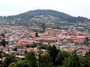
Pachuquilla is a Mexican town in the State of Hidalgo, 2,420 meters (7,940 feet) above sea level. In 1958, it became the municipal seat of Mineral de la Reforma. The name Pachuquilla was adopted from the nearby city of Pachuca de Soto and means Little Pachuca in English.
International Pasty Festival
Distance: Approx. 3005 meters
Latitude and longitude: 20.138216,-98.673163
The International Pasty Festival (Spanish: Festival Internacional del Paste) is an annual festival celebrating the pasty that has been held in Real del Monte, Hidalgo, Mexico since 2009. Pasties (known locally as pastes), were introduced to the region by Cornish miners in the 19th century and are still made by their descendants. Traditional recipes may be followed, but often the ingredients today reflect local preferences.

Estadio Revolución Mexicana
Multi-use stadium in Mexico
Distance: Approx. 4690 meters
Latitude and longitude: 20.11,-98.74
The Estadio Revolución Mexicana is a multi-use stadium in Pachuca, Hidalgo, Mexico. It is currently used mostly for football matches and is the home stadium for Atlético Pachuca. The stadium has a capacity of 3,500 people.

Sixth federal electoral district of Hidalgo
Federal electoral district of Mexico
Distance: Approx. 6090 meters
Latitude and longitude: 20.1,-98.75
The sixth federal electoral district of Hidalgo (Distrito electoral federal 06 de Hidalgo) is one of the 300 electoral districts into which Mexico is divided for elections to the federal Chamber of Deputies and one of the seven currently operational districts in the state of Hidalgo. It elects one deputy to the lower house of Congress for each three-year legislative period by means of the first-past-the-post system. As of 2024, votes cast in the district also count towards the calculation of proportional representation ("plurinominal") deputies elected from the fourth electoral region.
Weather in this IP's area
scattered clouds
13 Celsius
12 Celsius
13 Celsius
13 Celsius
1013 hPa
63 %
1013 hPa
750 hPa
10000 meters
2.03 m/s
2.35 m/s
170 degree
31 %
06:45:30
17:54:33
