Country:
Region:
City:
Latitude and Longitude:
Time Zone:
Postal Code:
IP information under different IP Channel
ip-api
Country
Region
City
ASN
Time Zone
ISP
Blacklist
Proxy
Latitude
Longitude
Postal
Route
Luminati
Country
Region
v
City
cabimas
ASN
Time Zone
America/Caracas
ISP
COLNETWORK C.A.
Latitude
Longitude
Postal
IPinfo
Country
Region
City
ASN
Time Zone
ISP
Blacklist
Proxy
Latitude
Longitude
Postal
Route
db-ip
Country
Region
City
ASN
Time Zone
ISP
Blacklist
Proxy
Latitude
Longitude
Postal
Route
ipdata
Country
Region
City
ASN
Time Zone
ISP
Blacklist
Proxy
Latitude
Longitude
Postal
Route
Popular places and events near this IP address

Caracas
Capital and largest city of Venezuela
Distance: Approx. 1871 meters
Latitude and longitude: 10.48055556,-66.90361111
Caracas ( kə-RA(H)K-əs, Spanish: [kaˈɾakas]), officially Santiago de León de Caracas (CCS), is the capital and largest city of Venezuela, and the center of the Metropolitan Region of Caracas (or Greater Caracas). Caracas is located along the Guaire River in the northern part of the country, within the Caracas Valley of the Venezuelan coastal mountain range (Cordillera de la Costa). The valley is close to the Caribbean Sea, separated from the coast by a steep 2,200-meter-high (7,200 ft) mountain range, Cerro El Ávila; to the south there are more hills and mountains.
Southern General Cemetery
Cemetery in Caracas, Venezuela
Distance: Approx. 2251 meters
Latitude and longitude: 10.479,-66.921
The Southern General Cemetery is the largest cemetery in Caracas. It was founded in 1876, by order of President Antonio Guzmán Blanco. It is located at the end of El Cementerio and El Degredo streets, in the parish of Santa Rosalia, west of Libertador Municipality.

Attack on Richard Nixon's motorcade
1958 attack on the motorcade of US Vice President
Distance: Approx. 1871 meters
Latitude and longitude: 10.48055556,-66.90361111
On May 13, 1958, US Vice President Richard Nixon's motorcade was attacked by a mob in Caracas, Venezuela, during Nixon's goodwill tour of South America. The event was described at the time as the "most violent attack ever perpetrated on a high American official while on foreign soil." Close to being killed while a couple of his aides were injured in the melee, Nixon ended up unharmed and his entourage managed to reach the U.S. embassy. The visit took place only months after the overthrow in January of Venezuelan dictator Marcos Pérez Jiménez, who in 1954 had been awarded the Legion of Merit and was later granted asylum by the United States, and the incident may have been orchestrated by the Communist Party of Venezuela.

El Valle Parish
Parish in Distrito Capital, Venezuela
Distance: Approx. 348 meters
Latitude and longitude: 10.46722222,-66.90722222
El Valle is one of the 22 parishes located in the Libertador Bolivarian Municipality and one of 32 of Caracas, Venezuela.

Paseo Los Próceres
Monument in Caracas, Venezuela
Distance: Approx. 417 meters
Latitude and longitude: 10.4638,-66.9033
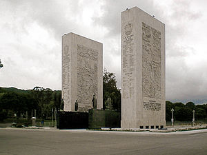
The Paseo Los Próceres (translatable into English as Walkway of the Heroes) is a monument located in the Venezuelan city of Caracas, near Fort Tiuna and the Military Academy of the Bolivarian Army. On the promenade there are statues of the heroes of the War of Independence, as well as fountains, stairs, squares, roads and walls. Since 1993, the Paseo Los Próceres and the entire annex system was declared a National Historic Landmark.
Fort Tiuna
Military fortification in Caracas, Venezuela
Distance: Approx. 2599 meters
Latitude and longitude: 10.44083611,-66.90905556
Fuerte Tiuna or Fort Tiuna (more formally the Military Complex of Fort Tiuna) is the name of an important military installation in Caracas, Venezuela.

Embassy of Indonesia, Caracas
Diplomatic mission
Distance: Approx. 2378 meters
Latitude and longitude: 10.453402,-66.888295
The Embassy of the Republic of Indonesia in Caracas (Indonesian: Kedutaan Besar Republik Indonesia di Caracas; Spanish: Embajada de la República de Indonesia en Caracas) is the diplomatic mission of the Republic of Indonesia to the Bolivarian Republic of Venezuela. The embassy is concurrently accredited to five other surrounding countries: Dominica Grenada Saint Lucia Saint Vincent and the Grenadines Trinidad and Tobago Diplomatic relations between Indonesia and Venezuela were established on 10 October 1959. In 1977, the Indonesian government opened the embassy in Caracas with Ferdy Salim as the first Indonesian ambassador to Venezuela.
Los Símbolos station
Caracas metro station
Distance: Approx. 2389 meters
Latitude and longitude: 10.48275,-66.89630556
Los Símbolos is a Caracas Metro station on Line 3. It was opened on 18 December 1994 as part of the inaugural section of Line 3 from Plaza Venezuela to El Valle. The station is between Ciudad Universitaria and La Bandera.

La Bandera station
Caracas metro station
Distance: Approx. 1736 meters
Latitude and longitude: 10.47869444,-66.9015
La Bandera is a Caracas Metro station on Line 3. It was opened on 18 December 1994 as part of the inaugural section of Line 3 from Plaza Venezuela to El Valle. The station is between Los Símbolos and El Valle.

El Valle station
Caracas metro station
Distance: Approx. 581 meters
Latitude and longitude: 10.46869444,-66.90458333
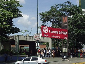
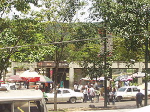
El Valle is a Caracas Metro station on Line 3. It was opened on 18 December 1994 as the southern terminus of the inaugural section of Line 3 from Plaza Venezuela to El Valle. The station is between La Bandera and Los Jardines.
Coche station
Caracas metro station
Distance: Approx. 2600 meters
Latitude and longitude: 10.44761111,-66.92391667
Coche is a Caracas Metro station on Line 3. It was opened on 9 January 2010 on the section of the line between El Valle and La Rinconada, which was opened earlier without intermediate stations. The station is located between Los Jardines and Mercado.

Los Jardines station (Caracas)
Metro station in Caracas, Venezuela
Distance: Approx. 1169 meters
Latitude and longitude: 10.45927778,-66.91658333
Los Jardines is a Caracas Metro station on Line 3. It was opened on 9 January 2010 on the section of the line between El Valle and La Rinconada, which was opened earlier without intermediate stations. The station is located between El Valle and Coche.
Weather in this IP's area
light rain
23 Celsius
23 Celsius
23 Celsius
23 Celsius
1011 hPa
69 %
1011 hPa
913 hPa
10000 meters
1.54 m/s
290 degree
84 %
06:22:46
18:01:44


