Country:
Region:
City:
Latitude and Longitude:
Time Zone:
Postal Code:
IP information under different IP Channel
ip-api
Country
Region
City
ASN
Time Zone
ISP
Blacklist
Proxy
Latitude
Longitude
Postal
Route
Luminati
Country
ASN
Time Zone
America/Chicago
ISP
TELCOM MIKROTIK PERU S.A.C.
Latitude
Longitude
Postal
IPinfo
Country
Region
City
ASN
Time Zone
ISP
Blacklist
Proxy
Latitude
Longitude
Postal
Route
db-ip
Country
Region
City
ASN
Time Zone
ISP
Blacklist
Proxy
Latitude
Longitude
Postal
Route
ipdata
Country
Region
City
ASN
Time Zone
ISP
Blacklist
Proxy
Latitude
Longitude
Postal
Route
Popular places and events near this IP address

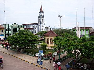
Yurimaguas
Town in Loreto, Peru
Distance: Approx. 4319 meters
Latitude and longitude: -5.9,-76.08333333
Yurimaguas is a port town in the Loreto Region of the northeastern Peruvian Amazon. Historically associated with the Mainas missions, the culturally diverse town is affectionately known as the "Pearl of the Huallaga" (Perla del Huallaga). Yurimaguas is located at the confluence of the majestic Huallaga and Paranapura Rivers in the steamy rainforests of northeastern Peru.
Alto Amazonas Province
Province in Loreto, Peru
Distance: Approx. 4319 meters
Latitude and longitude: -5.9,-76.08333333
The Alto Amazonas Province is one of the eight provinces in the Loreto Region of Peru. Located in the northeastern Peruvian Amazon, the culturally and biodiverse Province of Alto Amazonas is divided into six districts. Per August 1, 2005 (law Nº 8593), the following five districts were reallocated to the newly created province Datem del Marañón: Barranca, Cahuapanas, Manseriche, Morona, Pastaza.
Yurimaguas District
District in Loreto, Peru
Distance: Approx. 1519 meters
Latitude and longitude: -5.8952,-76.1343
Yurimaguas District is one of six districts of the province of Alto Amazonas in Peru.
Weather in this IP's area
overcast clouds
23 Celsius
24 Celsius
23 Celsius
23 Celsius
1008 hPa
99 %
1008 hPa
992 hPa
10000 meters
0.82 m/s
2.19 m/s
327 degree
100 %
05:37:47
18:00:49
