Country:
Region:
City:
Latitude and Longitude:
Time Zone:
Postal Code:
IP information under different IP Channel
ip-api
Country
Region
City
ASN
Time Zone
ISP
Blacklist
Proxy
Latitude
Longitude
Postal
Route
Luminati
Country
Region
qc
City
montreal
ASN
Time Zone
America/Toronto
ISP
OXIO-ASN-01
Latitude
Longitude
Postal
IPinfo
Country
Region
City
ASN
Time Zone
ISP
Blacklist
Proxy
Latitude
Longitude
Postal
Route
db-ip
Country
Region
City
ASN
Time Zone
ISP
Blacklist
Proxy
Latitude
Longitude
Postal
Route
ipdata
Country
Region
City
ASN
Time Zone
ISP
Blacklist
Proxy
Latitude
Longitude
Postal
Route
Popular places and events near this IP address

Joliette Regional County Municipality
Regional county municipality in Quebec, Canada
Distance: Approx. 3547 meters
Latitude and longitude: 46.01666667,-73.45
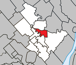
Joliette is a regional county municipality in the Lanaudière region of Quebec, Canada. Its seat is Joliette. The municipality has a land area of 417.41 km2.

Joliette
City in Quebec, Canada
Distance: Approx. 3547 meters
Latitude and longitude: 46.01666667,-73.45
Joliette is a city in southwest Quebec, Canada. It is approximately 50 kilometres (31 mi) northeast of Montreal, on the L'Assomption River and is the seat of the Regional County Municipality of Joliette. It is considered to be a part of the North Shore of Greater Montreal.

Joliette Airport
Airport in Joliette, Quebec, Canada
Distance: Approx. 5270 meters
Latitude and longitude: 46.04472222,-73.50166667
Joliette Airport (TC LID: CSG3) is located 2.2 nautical miles (4.1 km; 2.5 mi) northwest of Joliette, Quebec, Canada.

Quebec Route 131
Highway in Quebec
Distance: Approx. 2753 meters
Latitude and longitude: 46.0292,-73.4079
Route 131 is a Quebec highway running from Lavaltrie (junction of Route 138) to Saint-Michel-des-Saints in Lanaudière. This route, combined with Autoroute 31, provides the key route to Joliette, and then continues northward through Saint-Félix-de-Valois, Saint-Jean-de-Matha and Saint-Zénon for a distance of approximately 125 kilometres (78 mi).

Joliette station (Via Rail)
Railway station in Quebec, Canada
Distance: Approx. 2069 meters
Latitude and longitude: 46.0293,-73.444
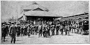
Joliette railway station is a Heritage Railway Station located at 380 Champlain Street in Joliette, Quebec, Canada. It is operated by Via Rail on two routes running from Montreal, Quebec.
Roman Catholic Diocese of Joliette
Catholic ecclesiastical territory
Distance: Approx. 2195 meters
Latitude and longitude: 46.0269,-73.4377
The Roman Catholic Diocese of Joliette (Latin: Dioecesis Ioliettensis) (erected 27 January 1904) is a suffragan in Joliette of the Archdiocese of Montréal.

Saint-Charles-Borromée
City in Quebec, Canada
Distance: Approx. 2594 meters
Latitude and longitude: 46.05,-73.46666667
Saint-Charles-Borromée, Quebec (2021 Population 15,285) is a city in southwest-central Quebec, Canada, on the l'Assomption River. In Joliette Regional County Municipality, Saint-Charles-Borromée has the Maison Antoine-Lacombe, a heritage home that hosts many exhibits throughout the year. The town is also home to the Centre Saint-Jean-Bosco, which annually hosts the Mémoires et Racines Festival of folk music from various countries and Quebec.

Saint-Pierre, Quebec
Village municipality in Quebec, Canada
Distance: Approx. 4186 meters
Latitude and longitude: 46.01666667,-73.46666667
Saint-Pierre (French pronunciation: [sɛ̃ pjɛʁ] ) is a village municipality in Joliette Regional County Municipality in the Lanaudière region of Quebec, Canada.

Notre-Dame-des-Prairies
City in Quebec, Canada
Distance: Approx. 401 meters
Latitude and longitude: 46.05,-73.43333333
Notre-Dame-des-Prairies is a town in the Lanaudière region of Quebec, Canada, part of the Joliette Regional County Municipality. It is a suburb of Joliette, located along the eastern shores of the L'Assomption River.

St. Charles Borromeo Cathedral (Joliette)
Church in Quebec, Canada
Distance: Approx. 2160 meters
Latitude and longitude: 46.0271,-73.4364
The St. Charles Borromeo Cathedral (French: Cathédrale Saint-Charles-Borromée de Joliette) is the name given to a religious building belonging to the Catholic Church and is located in Joliette, a town in the administrative region of Lanaudière in the southern part of the province of Quebec (Eastern Canada). The headquarters of the diocese of Joliette was built between 1887 and 1892 according to plans by the architects Maurice Perrault and Albert Mesnard.
Joliette Institution for Women
Prison in Quebec, Canada
Distance: Approx. 2107 meters
Latitude and longitude: 46.0325,-73.415
Joliette Institution for Women (French: Établissement Joliette pour femmes) is a prison for women in Joliette, Quebec, northeast of Montreal, Quebec, Canada. It is operated by the Correctional Service of Canada (CSC) and has a capacity of 132 prisoners. Built in 1997, it originally had a capacity for 80 prisoners; it is one of several prisons that replaced the Kingston Prison for Women.
Joliette High School
Public secondary school in Joliette, Quebec, Canada
Distance: Approx. 3872 meters
Latitude and longitude: 46.0141,-73.4521
Joliette High School (JHS, French: École secondaire Joliette) is a public anglophone secondary school in Joliette, Quebec. Operated by the Sir Wilfrid Laurier School Board, it is the sole anglophone high school in Lanaudière. As of 2017 it has about 265 students.
Weather in this IP's area
moderate rain
4 Celsius
2 Celsius
4 Celsius
6 Celsius
1024 hPa
90 %
1024 hPa
1017 hPa
9454 meters
2.33 m/s
4.3 m/s
90 degree
100 %
06:39:17
16:35:18