Country:
 Canada
Region:
City:
Latitude and Longitude:
Time Zone:
Postal Code:
IP information under different IP Channel
ip-api
Country
Region
City
ASN
Time Zone
ISP
Blacklist
Proxy
Latitude
Longitude
Postal
Route
IPinfo
Country
Region
City
ASN
Time Zone
ISP
Blacklist
Proxy
Latitude
Longitude
Postal
Route
MaxMind
Country
Region
City
ASN
Time Zone
ISP
Blacklist
Proxy
Latitude
Longitude
Postal
Route
Luminati
Country
CARegion
qc
City
mcmasterville
ASN
Time Zone
America/Toronto
ISP
OXIO-ASN-01
Latitude
Longitude
Postal
db-ip
Country
Region
City
ASN
Time Zone
ISP
Blacklist
Proxy
Latitude
Longitude
Postal
Route
ipdata
Country
Region
City
ASN
Time Zone
ISP
Blacklist
Proxy
Latitude
Longitude
Postal
Route
Popular places and events near this IP address
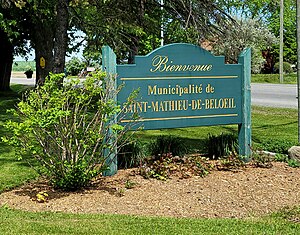
Saint-Mathieu-de-Beloeil
Municipality in Quebec, Canada
Distance: Approx. 5163 meters
Latitude and longitude: 45.56666667,-73.2
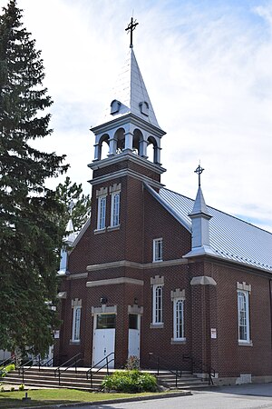
Saint-Mathieu-de-Beloeil is a municipality in southwestern Quebec, Canada, east of Montreal in the Regional County Municipality of La Vallée-du-Richelieu. The population as of the 2021 Canadian Census was 2,952.
Mont Saint-Bruno
Mountain in Montérégie, Quebec, Canada
Distance: Approx. 3712 meters
Latitude and longitude: 45.555094,-73.309944
Mont Saint-Bruno is part of the Monteregian Hills in southern Quebec, Canada. Its summit stands 218 m (715 ft) high and lies 23 km (14 mi) east of downtown Montreal. This mountain has a ski resort, a natural area, and an apple orchard.
Saint-Mathieu-de-Beloeil Aerodrome
Airport in Saint-Mathieu-de-Beloeil, Quebec
Distance: Approx. 4721 meters
Latitude and longitude: 45.59027778,-73.23805556
Saint-Mathieu-de-Beloeil (Gilles Beaudet) Aerodrome, Gilles-Beaudet Airport or Aéroport Gilles-Beaudet, (TC LID: CSB3) and is located 1.5 nautical miles (2.8 km; 1.7 mi) northwest of Saint-Mathieu-de-Beloeil, Quebec, Canada.

Otterburn Park
City in Quebec, Canada
Distance: Approx. 4113 meters
Latitude and longitude: 45.53333333,-73.21666667
Otterburn Park is a small town located 40 kilometres (25 mi) east of Montreal, Quebec, Canada. The population as of the Canada 2021 Census was 8,479. The town lies south of Mont-Saint-Hilaire on the Richelieu River and is one of the few officially bilingual towns in Quebec.

Saint-Basile-le-Grand
City in Quebec, Canada
Distance: Approx. 2589 meters
Latitude and longitude: 45.53333333,-73.28333333
Saint-Basile-le-Grand is a city located in La Vallée-du-Richelieu Regional County Municipality in southwestern Quebec, Canada. The population as of the 2021 Canadian Census was 17,053.
McMasterville
City in Quebec, Canada
Distance: Approx. 2288 meters
Latitude and longitude: 45.55,-73.23333333
McMasterville is a city in southwestern Quebec, Canada on the Richelieu River in La Vallée-du-Richelieu Regional County Municipality. The population as of the 2021 Canadian Census was 5,936. It is within the Administrative Region of Montérégie.

Saint-Basile-le-Grand station
Railway station in Quebec, Canada
Distance: Approx. 4604 meters
Latitude and longitude: 45.52333333,-73.30583333
Saint-Basile-le-Grand station is a commuter rail station operated by Exo in Saint-Basile-le-Grand, Quebec, Canada. It is served by the Mont-Saint-Hilaire line.

McMasterville station
Railway station in Quebec, Canada
Distance: Approx. 2577 meters
Latitude and longitude: 45.54583333,-73.23055556
McMasterville station is a commuter rail station operated by Exo in McMasterville, Quebec, Canada. It is served by the Mont-Saint-Hilaire line.

Beloeil train disaster
1864 train crash in Quebec, Canada
Distance: Approx. 4118 meters
Latitude and longitude: 45.54805556,-73.21
The Beloeil train disaster occurred on June 29, 1864, at the present-day town of Beloeil, Quebec. A passenger train fell through an open swing bridge into the Richelieu River after the crew failed to obey a stop signal. The widely accepted death toll is 99 people.
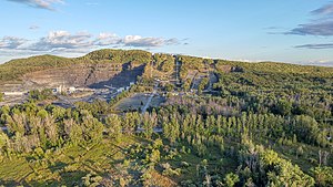
Mont-Saint-Bruno National Park
National park of Quebec, Canada
Distance: Approx. 4218 meters
Latitude and longitude: 45.55,-73.31666667
Mont-Saint-Bruno Provincial Park (French: Parc Provincial du Mont-Saint-Bruno) is a small national park of Quebec located near the municipality of Saint-Bruno-de-Montarville, 15 kilometres (9.3 mi) to the east of Montréal on the south shore of the Saint Lawrence River. The park, with an area of 8.84 square kilometres (3.41 sq mi), notably includes Mont Saint-Bruno, one of the Monteregian Hills which peaks at 218 metres (715 ft). The mountain is shared with the Ski Mont Saint-Bruno ski resort, a quarry and a small Canadian Forces (5th GSS) training camp.
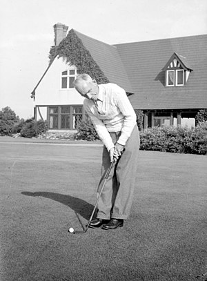
Mount Bruno Golf Club
Distance: Approx. 4674 meters
Latitude and longitude: 45.5299,-73.314
Mount Bruno Golf Club is a private club located in Saint-Bruno-de-Montarville, Quebec, Canada. It is reputed to be one of the most exclusive golf clubs in Canada, and it has hosted the Canadian Open twice: in 1922, when it was won by Al Watrous, and in 1924, won by Leo Diegel. The course was originally designed by Willie Park Jr., later renovated by Stanley Thompson and Tom McBroom.
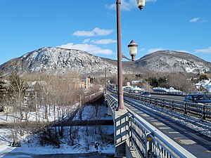
Jordi-Bonet Bridge
Bridge on Richelieu River, Quebec, Canada
Distance: Approx. 5029 meters
Latitude and longitude: 45.56388889,-73.20055556
The Jordi-Bonet Bridge (French: pont Jordi-Bonet) is a road bridge linking Beloeil and Mont-Saint-Hilaire and spanning the Richelieu River, in La Vallée-du-Richelieu Regional County Municipality, in Montérégie, Québec, Canada. This bridge mainly serves residents of the Beloeil-Mont-Saint-Hilaire region, as well as traffic connecting Saint-Bruno to Saint-Hyacinthe, along Sir-Wilfrid-Laurier Boulevard. The bridge serves as a crossing for Quebec Route 116 and 229.
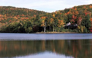
Weather in this IP's area
clear sky
20 Celsius
20 Celsius
18 Celsius
21 Celsius
1017 hPa
82 %
1017 hPa
1015 hPa
10000 meters
06:35:43
18:58:28