Country:
Region:
City:
Latitude and Longitude:
Time Zone:
Postal Code:
IP information under different IP Channel
ip-api
Country
Region
City
ASN
Time Zone
ISP
Blacklist
Proxy
Latitude
Longitude
Postal
Route
Luminati
Country
Region
on
City
whitby
ASN
Time Zone
America/Toronto
ISP
OXIO-ASN-01
Latitude
Longitude
Postal
IPinfo
Country
Region
City
ASN
Time Zone
ISP
Blacklist
Proxy
Latitude
Longitude
Postal
Route
db-ip
Country
Region
City
ASN
Time Zone
ISP
Blacklist
Proxy
Latitude
Longitude
Postal
Route
ipdata
Country
Region
City
ASN
Time Zone
ISP
Blacklist
Proxy
Latitude
Longitude
Postal
Route
Popular places and events near this IP address
Ajax, Ontario
Town in Ontario, Canada
Distance: Approx. 3469 meters
Latitude and longitude: 43.85833333,-79.03638889
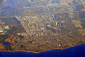
Ajax (; 2021 population: 126,666) is a waterfront town in Durham Region in Southern Ontario, Canada, located in the eastern part of the Greater Toronto Area. The town is named for HMS Ajax, a Royal Navy cruiser that served in the Second World War. It is approximately 11 kilometres (7 mi) east of Toronto on the shores of Lake Ontario and is bordered by the City of Pickering to the west and north, and the Town of Whitby to the east.
Ajax—Pickering
Former federal electoral district of Canada
Distance: Approx. 3762 meters
Latitude and longitude: 43.85055556,-79.055
Ajax—Pickering was a federal electoral district in Ontario, Canada, that had been represented in the House of Commons of Canada since 2011 by Conservative MP Chris Alexander. Its population in 2001 was 100,215. The district included the Town of Ajax and the northern part of the City of Pickering in the eastern suburbs of Toronto.

Ajax GO Station
Railway station in Ontario, Canada
Distance: Approx. 4330 meters
Latitude and longitude: 43.84777778,-79.04138889
Ajax GO Station is a train and bus station in the GO Transit network located in Ajax, Ontario, Canada. It is a stop on the Lakeshore East line and on the Oshawa/Finch Express bus route. The train platforms lie along the south side of Highway 401 with access to the station from Westney Road at Fairall Street.

Pickering High School, Ajax
Public secondary school in Ajax, Ontario, Canada
Distance: Approx. 2842 meters
Latitude and longitude: 43.85861111,-79.05861111
Pickering High School is a Canadian high school located in Ajax, Ontario, within the Durham District School Board serving the west Ajax and east Pickering area. Specifically, the school is found in historical Pickering Village, Ontario on Church Street. The school has students in grades 9 to 12, and offers gifted, co-op, and special education classes.
J. Clarke Richardson Collegiate
Public secondary school in Ajax, Ontario, Canada
Distance: Approx. 2687 meters
Latitude and longitude: 43.88361111,-79.02722222
J. Clarke Richardson Collegiate is a secondary school in Ajax, Ontario, Canada. J. Clarke Richardson is run under the Durham District School Board. Richardson offers a wide range of academic and co-curricular activities for students, such as the enriched specialist high skills major program, laptop program and other activities that aid student success.
Pickering Village
Neighbourhood in Durham, Ontario, Canada
Distance: Approx. 3631 meters
Latitude and longitude: 43.85222222,-79.05111111
Pickering Village is a former municipality and now a neighbourhood in the town of Ajax, within the Durham Region of Ontario, Canada. The Pickering Village derives its name from the former Pickering Township, which included the present-day town of Ajax and the city of Pickering. A small portion of the original settlement is now part of the Village East neighbourhood in the city of Pickering.

Ajax (federal electoral district)
Federal electoral district in Ontario, Canada
Distance: Approx. 3295 meters
Latitude and longitude: 43.854506,-79.059892
Ajax is a federal electoral district in the Durham Region of Ontario. Ajax was created by the 2012 riding redistribution from the portion of Ajax—Pickering consisting of the entire town of Ajax, Ontario, and was legally defined in the 2013 representation order. It came into effect in time for the 2015 Canadian federal election.
Manresa Jesuit Spiritual Renewal Centre
Church in Ontario, Canada
Distance: Approx. 4495 meters
Latitude and longitude: 43.854895,-79.099385
Manresa Jesuit Spiritual Renewal Centre is a centre for Ignatian spirituality run by the Society of Jesus in Pickering, Ontario. It was founded in 1924 and was built in 1945. It is situated next to Pine Ridge Secondary School just off Finch Avenue in north Pickering.
FaithWay Baptist College of Canada
Distance: Approx. 2819 meters
Latitude and longitude: 43.897625,-79.030993
FaithWay Baptist College of Canada is a private Baptist Bible college in Ajax, Ontario, Canada.

Notre Dame Catholic Secondary School (Ajax)
Catholic high school in Ajax, Ontario, Canada
Distance: Approx. 2640 meters
Latitude and longitude: 43.8847,-79.0278
Notre Dame Catholic Secondary School is a high school located in Ajax, Ontario, Canada. It was opened in 2001 along with its twin school J. Clarke Richardson Collegiate. Notre Dame and Richardson share the same building, with Notre Dame occupying the north wing and Richardson the south.

Ajax (provincial electoral district)
Provincial electoral district in Ontario, Canada
Distance: Approx. 3240 meters
Latitude and longitude: 43.855,-79.06
Ajax is a provincial electoral district in Ontario, Canada. It elects one member to the Legislative Assembly of Ontario. This riding was created in 2015.
Audley, Ontario
Village in Ontario, Canada
Distance: Approx. 4464 meters
Latitude and longitude: 43.90305556,-79.01166667
Audley, known as Brown's Corners until 1857, was an unincorporated village in the Pickering Township of Ontario, Canada. In the mid-19th century, it emerged as a stopover for farmers traveling to the Whitby port, and gradually evolved into a village. Audley was located around what is now the intersection of Audley Road and Taunton Road in Ajax.
Weather in this IP's area
few clouds
12 Celsius
10 Celsius
11 Celsius
12 Celsius
1014 hPa
65 %
1014 hPa
1002 hPa
10000 meters
8.54 m/s
13.14 m/s
295 degree
17 %
07:02:23
16:57:45


