Country:
 Canada
Region:
City:
Latitude and Longitude:
Time Zone:
Postal Code:
IP information under different IP Channel
ip-api
Country
Region
City
ASN
Time Zone
ISP
Blacklist
Proxy
Latitude
Longitude
Postal
Route
IPinfo
Country
Region
City
ASN
Time Zone
ISP
Blacklist
Proxy
Latitude
Longitude
Postal
Route
MaxMind
Country
Region
City
ASN
Time Zone
ISP
Blacklist
Proxy
Latitude
Longitude
Postal
Route
Luminati
Country
CARegion
on
City
toronto
ASN
Time Zone
America/Toronto
ISP
OXIO-ASN-01
Latitude
Longitude
Postal
db-ip
Country
Region
City
ASN
Time Zone
ISP
Blacklist
Proxy
Latitude
Longitude
Postal
Route
ipdata
Country
Region
City
ASN
Time Zone
ISP
Blacklist
Proxy
Latitude
Longitude
Postal
Route
Popular places and events near this IP address
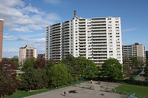
Swansea, Toronto
Neighbourhood in Toronto, Ontario, Canada
Distance: Approx. 796 meters
Latitude and longitude: 43.64388889,-79.47777778
Swansea is a neighbourhood in the city of Toronto, Ontario, Canada, bounded on the west by the Humber River, on the north by Bloor Street, on the east by High Park and on the south by Lake Ontario. The neighbourhood was originally a separate municipality, the Village of Swansea, which became part of Metropolitan Toronto in 1953.
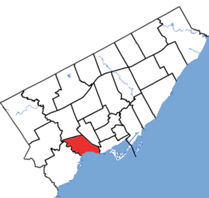
Parkdale—High Park (federal electoral district)
Federal electoral district in Ontario, Canada
Distance: Approx. 834 meters
Latitude and longitude: 43.65,-79.47
Parkdale—High Park is a federal electoral district in Ontario, Canada, that has been represented in the House of Commons of Canada since 1979. It was created during the 1976 electoral boundaries redistribution from parts of Parkdale, High Park—Humber Valley, Davenport and Spadina districts. As of the October 19, 2015, Canadian general election, the current Member of Parliament (MP) is Liberal member Arif Virani.
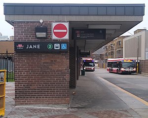
Jane station
Toronto subway station
Distance: Approx. 305 meters
Latitude and longitude: 43.64991667,-79.48388889
Jane is a subway station on Line 2 Bloor–Danforth of the Toronto subway in Toronto, Ontario, Canada. It is located just north of Bloor Street West, spanning the block east of Jane Street to Armadale Avenue, with entrances from all three streets. It opened in 1968 as part of the westerly extension from Keele to Islington Station.

Runnymede station
Toronto subway station
Distance: Approx. 372 meters
Latitude and longitude: 43.65166667,-79.47583333
Runnymede is a subway station on Line 2 Bloor–Danforth of the Toronto subway in Toronto, Ontario, Canada. It is located just north of Bloor Street West, spanning the block east of Runnymede Road to Kennedy Avenue, with bus platforms at the surface level and entrances at both ends. Wi-Fi service is available at this station.

Western Technical-Commercial School
Public high school in High Park North, Toronto, Ontario, Canada
Distance: Approx. 785 meters
Latitude and longitude: 43.656742,-79.47506
Western Technical-Commercial School is a high school in the High Park North neighbourhood of Toronto, Ontario, Canada oversighted by the Toronto District School Board. It shares the same building with Ursula Franklin Academy and The Student School. The school was founded in 1927 and was part of the Toronto Board of Education until 1998.
Westminster-Branson
Neighbourhood in Toronto, Ontario, Canada
Distance: Approx. 719 meters
Latitude and longitude: 43.656,-79.475
Westminster-Branson is a neighbourhood in the city of Toronto, Ontario, Canada. It is in the northernmost part of the city within the area of North York. Branson is located along Finch Avenue, west of Bathurst Street and east of the west branch of the Don River.

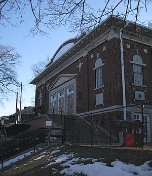
Runnymede Theatre
Former theater in Toronto, Canada
Distance: Approx. 304 meters
Latitude and longitude: 43.65073,-79.47653
The Runnymede Theatre is a historic building located in Bloor West Village, an affluent west end Toronto neighbourhood. The building has operated as a vaudeville theatre, a movie theatre, a bingo hall, and a Chapters bookstore. The building is now a Shoppers Drug Mart.

Old Mill, Toronto
Riverside neighbourhood of Toronto, Ontario, Canada
Distance: Approx. 739 meters
Latitude and longitude: 43.6521,-79.4893
Old Mill is a neighbourhood of Toronto, Ontario, Canada on the banks of the Humber River. It is located north and west of the intersection of Bloor Street and Jane Street. The area takes its name from the old grist mill ruins on the west bank of the river, now converted into a hotel (also named "Old Mill").
High Park North
Neighbourhood in Toronto, Ontario, Canada
Distance: Approx. 719 meters
Latitude and longitude: 43.656,-79.475
High Park North, or often simply High Park, after the park, is a neighbourhood in Toronto, Ontario, Canada. It is bounded on the south by Bloor Street, on the west by Runnymede Road, on the north by Annette Street, and on the east by the GO Transit Weston Subdivision rail tracks (formerly owned by Canadian National Railway). It is located in the Parkdale—High Park provincial and federal electoral districts.

Bloor West Village
Residential Neighbourhood and Shopping District in Toronto, Ontario, Canada
Distance: Approx. 226 meters
Latitude and longitude: 43.65083333,-79.4775
Bloor West Village is a residential neighbourhood and shopping district in Toronto, Ontario, Canada. Bordered on the south by Bloor Street, it encompasses all businesses along Bloor Street between South Kingsway and Ellis Park Road, consisting of more than 400 shops, restaurants and services, plus the residential neighbourhood to the north. The official City of Toronto name of the neighbourhood is Runneymede-Bloor West Village.
Parkdale—High Park (provincial electoral district)
Canadian provincial electoral district in the city of Toronto, Ontario
Distance: Approx. 834 meters
Latitude and longitude: 43.65,-79.47
Parkdale—High Park is a provincial electoral district in Toronto, Ontario, Canada, created in 1996 and represented in the Legislative Assembly of Ontario since 1999. It is located in the Toronto's west-end, bordering on the lakefront to the south, the Humber River to the west, and the Canadian Pacific Railway tracks essentially defining its northern and eastern borders. There are 107,035 residents in the district.

Jane Loop
Toronto Transit Commission (TTC) streetcar turning loop and bus station
Distance: Approx. 361 meters
Latitude and longitude: 43.64916667,-79.48416667
Jane Loop was an important Toronto Transit Commission (TTC) streetcar turning loop and bus station, prior to the completion of the Bloor Danforth Subway line. The Jane Loop opened on December 31, 1923; it was the western end of Bloor Streetcar line from 1925 to 1968. The loop was at a boundary between two zones in the TTC's zoned fare system.
Weather in this IP's area
clear sky
20 Celsius
20 Celsius
18 Celsius
21 Celsius
1017 hPa
81 %
1017 hPa
1004 hPa
10000 meters
4.12 m/s
50 degree
07:01:11
19:22:43